


81
While tilting the scanner at angles greater than 45 degrees, ensure there is structure in front of
and behind the scanner and that the feature tracker is pointed towards the ground and not the
sky.
For scanning higher up on buildings or trees, first build a solid base map with Stencil horizontal
and then tilt and repeat the base scan, once at about 30 degrees, then 60. Finally, you can fully
paint the buildings or trees by doing an up and down paint brush approach. (Do not rotate while
scanning at these high angles.)
V E H I C L E M O U N T E D S C A N N I N G
Mount LIDAR horizontally. Tilting up to 15 degrees works pretty well. The steeper the angle the
more vertical drift you will get.
Do not occlude the front or back of the sensor. Adjust the blindRadius to eliminate any portion of
the support structure or vehicle from the scan.
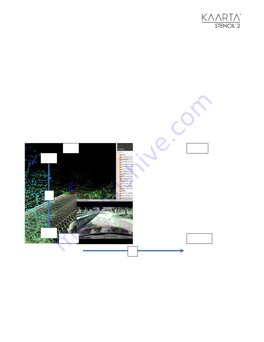
Use the ignorePolygon parameters in Stencil Settings to remove any portion of the image that is
not moving. In this image a polygon has been defined in red. The top left corner of the image is
0,0. The bottom right corner is 320, 320. This image has the five polygon points [10, 160] [20,140]
[150, 135] [ 300, 140] [ 310, 160]. No feature points will be tracked within this closed polygon.
Use the exclusionZone parameters in Stencil Settings to remove any portion of the lidar scan that
is not moving. You can keep a shorter blindRadius by using the exclusion parameters to exclude a
portion of the vehicle instead of increasing the blind radius all around the vehicle. You can select
0, 0
320, 180
320, 0
0, 180
X
Y
0
0
320
180


