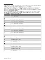


Chart Menu
NOTE: Not all settings apply to all charts. Some options require premium maps or connected accessories, such
as radar.
NOTE: The menus may contain some settings that are not supported by your installed charts or your present
location. If you make changes to those settings, the changes will not impact the chart view.
From a chart, select MENU.
Layers: Adjusts the appearance of the different items on the charts (
).
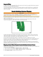
Quickdraw Contours: Turns on bottom contour drawing, and allows you to create fishing map labels (
Quickdraw Contours Mapping, page 42
).
Settings: Adjusts the chart settings (
).
Edit Overlays: Adjusts the data shown on the screen (
Customizing the Data Overlays, page 11
).
Chart Layers
You can turn on and off chart layers and customize features of the charts. Each setting is specific to the chart
or chart view being used.
NOTE: Not all settings apply to all charts and chartplotter models. Some options require premium maps or
connected accessories.
NOTE: The menus may contain some settings that are not supported by your installed charts or your present
location. If you make changes to those settings, the changes will not impact the chart view.
From a chart, select MENU > Layers.
Chart: Shows and hides chart-related items (
).
My Vessel: Shows and hides items relating to the boat (
My Vessel Layer Settings, page 38
).
Manage User Data: Shows and hides user data, such as waypoints, boundaries, and tracks, and opens user data
lists (
User Data Layer Settings, page 39
).
Other Vessels: Adjusts how other vessels are shown (
Other Vessels Layer Settings, page 39
).
Water: Shows and hides depth items (
).
Quickdraw Contours: Shows and hides Garmin Quickdraw Contours data (
Garmin Quickdraw Contours Settings,
).
Weather: Shows and hides weather-related items (
Weather Layer Settings, page 40
).
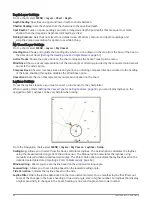
Chart Layer Settings
From a chart, select MENU > Layers > Chart.
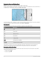
Satellite Photos: Shows high-resolution satellite images on the land or on both land and sea portions of the
Navigation chart, when certain premium maps are used (
Showing Satellite Imagery on the Navigation Chart,
).
NOTE: This setting must be enabled to view Standard Mapping charts.
Tides & Currents: Shows current station indicators and tide station indicators on the chart (
) and enables the tides and current slider, which sets the time for which tides and
currents are reported on the map.
Land POIs: Shows points of interest on land.
Navaid: Shows navigational aids, such as ATONs and flashing lights, on the chart. Allows you to select NOAA or
IALA navaid type.
Service Points: Shows locations for marine services.
Depth: Adjusts the items on the depth layer (
).
Restricted Areas: Shows information about restricted areas on the chart.
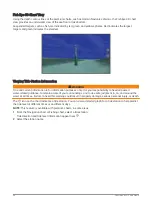
Photo Points: Shows camera icons for aerial photos (
Viewing Aerial Photos of Landmarks, page 32
).
Charts and 3D Chart Views
37
Summary of Contents for GPSMAP1222
Page 1: ...GPSMAP 10X2 12X2SERIES Owner sManual...
Page 14: ......
Page 213: ......
Page 214: ...support garmin com GUID C3CEA164 A1CB 4B15 92F2 5C04944CC6F3 v21 January 2024...