Navigation Chart and Fishing Chart
NOTE: The Fishing chart is available with premium charts, in some areas.
The Nav. Chart is optimized for navigation. You can plan a course, view map information, and use the chart as a
navigational aid. To open the Nav. Chart, select Charts > Nav. Chart.
The Fishing Chart provides a detailed view with more bottom detail and fishing content. This chart is optimized
for use when fishing. To open the Fishing Chart, select Charts > Fishing Chart.
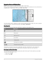
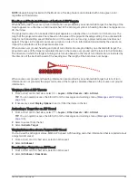
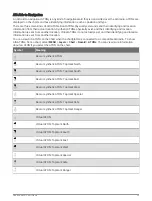
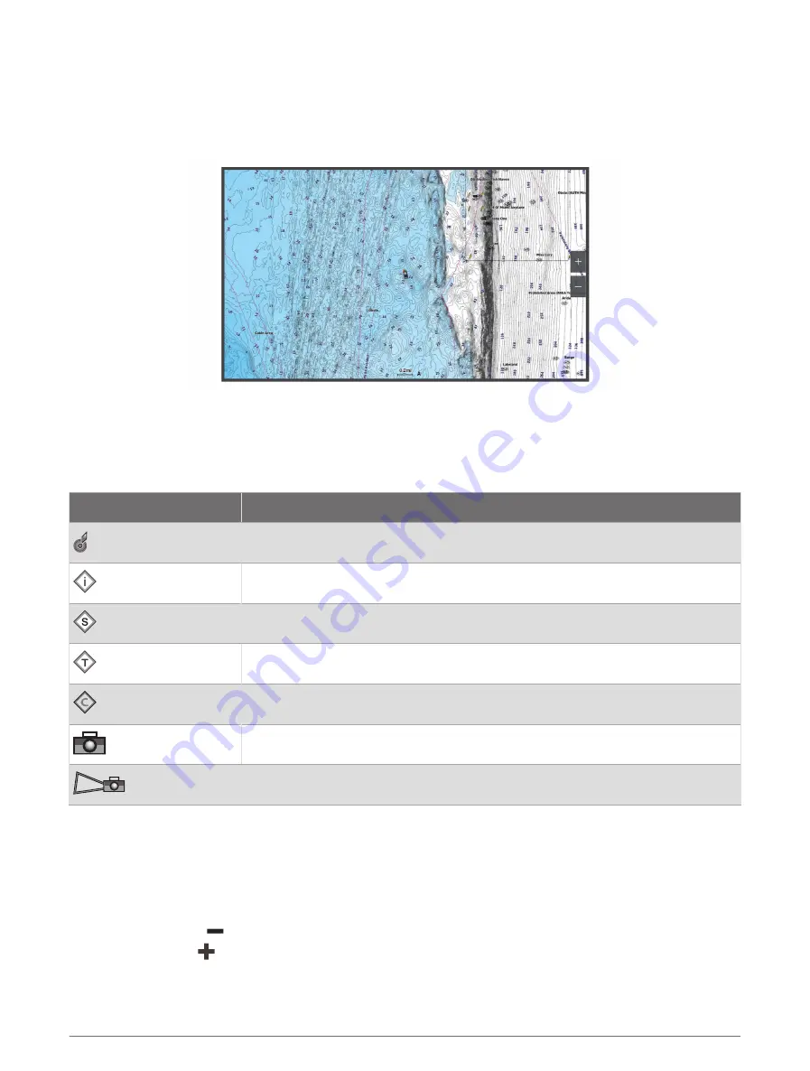
Chart Symbols
This table contains some of the common symbols you might see on the detailed charts.
Icon
Description
Buoy
Information
Marine services
Tide station
Current station
Overhead photo available
Perspective photo available
Other features common to most charts include depth contour lines, intertidal zones, spot soundings (as
depicted on the original paper chart), navigational aids and symbols, obstructions, and cable areas.
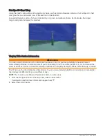
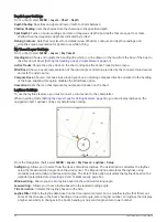
Zooming In and Out of the Chart
The zoom level is indicated by the scale number at the bottom of the chart. The bar under the scale number
represents that distance on the chart.
• To zoom out, select
.
• To zoom in, select
.
26
Charts and 3D Chart Views
Summary of Contents for GPSMAP1222
Page 1: ...GPSMAP 10X2 12X2SERIES Owner sManual...
Page 14: ......
Page 213: ......
Page 214: ...support garmin com GUID C3CEA164 A1CB 4B15 92F2 5C04944CC6F3 v21 January 2024...