


Connecting a Wireless Sensor to the
Chartplotter........................................ 23
Adjusting the Wind Sensor
Orientation......................................... 23
Watch..................................................... 23
Viewing Boat Data on a Garmin Nautix™
Device.................................................... 24
Charts and 3D Chart Views............. 24
Detailed Charts...................................... 24
Subscription....................................... 25
Purchasing a Chart Subscription with
ActiveCaptain.................................... 25
Renewing Your Subscription............ 25
Navigation Chart and Fishing Chart..... 26
Chart Symbols................................... 26
Zooming In and Out of the Chart...... 26
Panning the Chart with the Keys...... 27
Selecting an Item on the Map Using
the Device Keys................................. 27
Measuring a Distance on the
Information on a Chart...................... 27
Viewing Details about Navaids.........27
Navigating to a Point on the Chart... 28
Premium Chart Features...................... 29
Fish Eye 3D Chart View..................... 30
Viewing Tide Station Information.....30
Indicators....................................... 31
Showing Tides and Current
Indicators....................................... 31
Showing Satellite Imagery on the
Navigation Chart................................31
Viewing Aerial Photos of
Landmarks......................................... 32
Automatic Identification System......... 32
AIS Targeting Symbols..................... 32
Heading and Projected Course of
Vessel.................................................33
Targeted AIS Vessel...................... 33
Deactivating a Target for an AIS
Vessel............................................. 33
Showing AIS Vessels on a Chart or
3D Chart View................................ 34
Setting the Safe-Zone Collision
Alarm.................................................. 34
AIS Aids to Navigation...................... 35
AIS Distress Signals...................... 36
Turning Off AIS Reception................ 36
Chart Menu............................................ 37
Chart Layers.......................................37
Chart Layer Settings...................... 37
Depth Layer Settings..................... 38
My Vessel Layer Settings.............. 38
Laylines Settings........................... 38
User Data Layer Settings...............39
Other Vessels Layer Settings........ 39
Water Layer Settings..................... 39
Depth Range Shading.................... 40
Weather Layer Settings................. 40
Radar Overlay Settings.................. 41
Supported Maps.................................... 42
Mapping......................................... 42
Mapping a Body of Water Using the
Garmin Quickdraw Contours Feature.. 42
Adding a Label to a Garmin Quickdraw
Contours Map........................................ 43
Garmin Quickdraw Community............ 43
Connecting to the Garmin Quickdraw
Community with ActiveCaptain........ 43
ActiveCaptain.................................43
Sharing Your Garmin Quickdraw
ActiveCaptain.................................43
Connecting to the Garmin Quickdraw
Community with Garmin Connect.... 44
ii
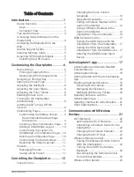
Table of Contents
Summary of Contents for GPSMAP1222
Page 1: ...GPSMAP 10X2 12X2SERIES Owner sManual...
Page 14: ......
Page 213: ......
Page 214: ...support garmin com GUID C3CEA164 A1CB 4B15 92F2 5C04944CC6F3 v21 January 2024...