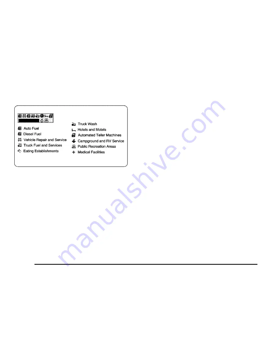
Once you have a route planned and begin to
travel on an interstate, a box with a series of icons
will appear in the upper left corner of the screen.
These icons indicate what services are available at
the next exit. A smaller Interstate America icon
will appear on the map next to the referenced exit.
Tracking
Select this option to leave a trail showing where
you have been on the map. Your path will be
represented by bubbles that appear
three-dimensional on the screen.
Tracking can be useful for the following reasons:
•
When tracking is activated, you can see
where you have already traveled.
•
When you wish to return to your point of origin
without planning another route, you can follow
the tracking bubbles back to where you
started.
•
When you drive into an area with few digitized
roads listed on the DVD map disc, you can
follow the tracking bubbles back to a
digitized area.
To clear the trail left by tracking, turn off Tracking
by pressing the TUNE/SEL knob. This will
erase the bubbles. You may then choose to turn
Tracking back on again, in which case your
trail will begin from your current location.
The maximum length of a tracking trail is 50 miles
(80 km). Once you exceed this distance, the
bubbles marking the beginning of your route begin
to disappear as new ones are created at the
end of your trail.
38
Summary of Contents for CTS 2007
Page 4: ...Overview Navigation System Overview 4 ...
Page 20: ... NOTES 20 ...
Page 62: ... NOTES 62 ...
Page 63: ...Navigation Audio System 64 CD DVD Player 84 Section 3 Navigation Audio System 63 ...
Page 83: ...Road work Construction Alert Road condition Road visibility Other 83 ...
Page 92: ... NOTES 92 ...
Page 93: ...Voice Recognition 94 Voice Recognition CTS 94 Section 4 Voice Recognition 93 ...


