


23
3.4 Mission Information
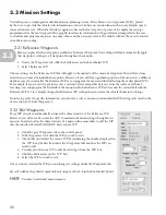
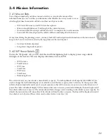
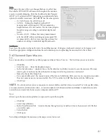
3.41 Mission Stats
VectorMap automatically calculates mission statistics as you plan the mission. This
information may be very useful as you determine what distance the survey needs to cover,
what length of time the mission will take, and how much power is left.
• WP Count: How many total WPs have been placed.
• Mission Length (distance): Total length of the current mission.
• Duration (time): How long it will take the AUV to complete the current mission.
• Power Left: How much power the vehicle will have remaining after the mission.
At any time during the planning process, you may check GPS and navigational information on the mission and
map in the ‘Location’ section located in the top portion of the control panel.
• Lat: Exact latitude of pointer
• Long: Exact longitude of pointer
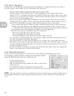
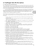
3.42 WP Power Details
Under the ‘Waypoints’ tab, you can click the small blue lightning bolt to display power usage details
throughout the mission. The icon displays information for each WP.
• WP Distance
• Total Distance
• WP Time
• Total Time
• WP Power
• Total Power
• Remaining Power
These statistics rely on your vehicle’s current battery capacity. VectorMap default is full capacity (600 WHr). If you
wish to change the field which displays your vehicle’s current battery capacity, refer to Section 3.6.
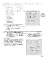
This power table
will also help automatically notify you if you plan a mission that will run on reserve power or run the vehicle out of
power. The table will default display WPs in maroon that run on reserve power and will display them in bright red if
the vehicle will run out of power. The mission line will also change color according to the vehicle’s power capacity. By
default, the mission line will turn yellow if the vehicle will run the line on reserve. The line will be displayed in red if
the vehicle is out of power. (These colors can be altered, refer to Section 3.6)
3.4