

27
Horizon GPS Chart400 User Manual
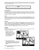
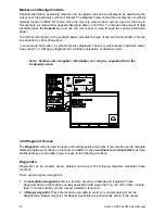
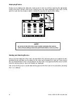
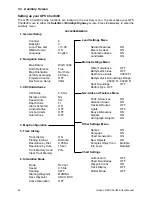
Navigating the Menus
The GPS Chart400 uses the cursor keys to scroll, enter or leave the various setup menus. The up
and down arrows on the cursor key scroll the highlight bar through the menus. The right arrow on the
cursor key enters the highlighted menu title. In most menus an Enter softkey will become available.
The Enter key must be pressed to save the changes to memory. The Page key is used to escape
from the menus without making permanent changes.
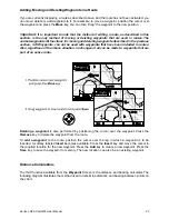
1. General Setup
Contrast
Display contrast (16 levels)
Backlight
Backlight Intensity (16 Levels)
Local Time ofst
Time zone offset from UTC (GMT) for your local region.
NMEA Output
Enable/Disable the autopilot NMEA0183 output
Language
The available languages are: English, Italian, French, German and
Spanish.
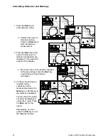
2. Navigation Setup
Map Datum
128 chart datums are provided. The satellite derived positions displayed
on the GPS Chart400 can be adjusted to match your local paper charts
by selecting the appropriate datum for your region.
North Reference
This option applies if charts are displayed North up. See Map Orientation
below. The North Reference options are true and magnetic.
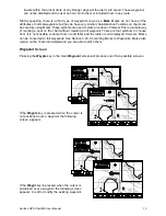
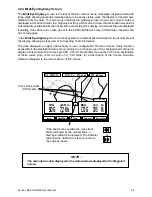
Map Orientation
Charts can be displayed either North up, so that North is always at the
top of the display, or Projected Track up. Projected Track up maintains
the boat direction toward the top of the screen. The chart is automatically
rotated to achieve this affect. In this mode a small square appears in the
upper right corner of the LCD, indicating the direction of North. This a
mode of operation is particularly useful for navigating narrow harbors or
rivers.
Velocity Averaging
The GPS Chart400 is able to show instantaneous velocity or velocity
averaged over a selected period. The available averaging options are
OFF, 20 seconds and 60 seconds. The COG damping is also derived
from this setting.
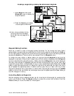
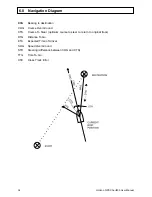
Projected Course
The GPS Chart400 can plot your likely course using current speed and
heading. The projected course is displayed as a solid line originating
from the boat position. The projected course is also displayed in the
Satellite Screen. There are six options for the historical period from
which the projected course is calculated. The options are OFF, 2
minutes, 10 minutes, 30 minutes, 1 hour and 2 hours.
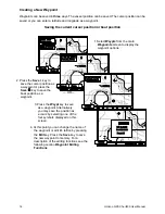
Nav Screen Setup
The Waypoint Screen and the BirdsEye Highway screens have a data
window that displays a user definable data field. In the Waypoint screen
the window is located immediately below the COG/SOG window. In the
BirdsEye Highway screen the data window is located in the center of
the display. Four data choices are available: XTE, CTS, STR and VMG.