9
Horizon GPS Chart400 User Manual
3.0
GPS CHART400 Operation
3.1 Overview
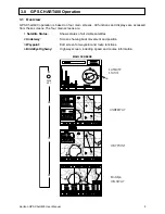
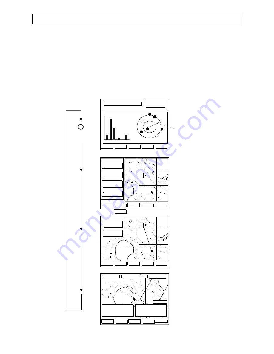
GPS Chart400 operation is based on four main screens. All functions and displays are accessed
from these screens. The four main screens are:
1. Satellite Status:
Shows status of all visible satellites
2. Underway:
Screen showing boat movement and position
3. Waypoint:
Edit screen for waypoint and route functions
4. BirdsEye Highway:
Highway screen, including speed and course information.
MAIN SCREENS
Zoom In
Zoom In
Zoom Out
Zoom Out
3 6 4 8 . 1 7 3 S
3 6 4 8 . 1 7 3 S
1 7 4 4 2 . 9 9 6 E
1 7 4 4 2 . 9 9 6 E
!
!
Waypts
Routes
Dist
B R G
D I S T 0.86m
3 4 5
Scale :
WAYPOINT
SATELLITE
STATUS
GPS Fix
GPS Fix
29 May 97
29 May 97
07:05:34am
01 14 15 20 21 25 29
01 14 15 20 21 25 29
9
8
7
6
5
4
3
2
1
0
9
8
7
6
5
4
3
2
1
0
25
14
29
15
20
21
01
MapShft
Aux
HDOP: 1.1
HDOP: 1.1
COG
BirdsEye
HIGHWAY
CTR
Zoom In
Zoom In
Zoom Out
Zoom Out
GoTo
To Cursor, Wpt #, Route
To Cursor, Wpt #, Route
B R G
D T G
1 2 3
2 3 4 . 5 n
COG
S O G
0 0 0
2 3 . 4 k t
U S R
F i x
3.6nm
3 6 4 8 . 1 7 3 S
3 6 4 8 . 1 7 3 S
1 7 4 4 2 . 9 9 6 E
1 7 4 4 2 . 9 9 6 E
!
!
or
UNDERWAY
Hide
Hide All
Hide All
PAGE
KEY
!
!
SOG 7.2Kts
SOG 7.2Kts
DTG
4.5 Nm
DTG
4.5 Nm
COG 205 M
COG 205 M
BRG
234 M
BRG
234 M
XTE 0.07nm
XTE 0.07nm
TTG 2:34 ETA 15:56
TTG 2:34 ETA 15:56
TO: WPT003
TO: WPT003
UndrWay
Nav
Aux
Zoom In
Zoom In
Zoom Out
Zoom Out
+/- 0.1 nm
+/- 0.1 nm

