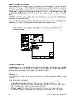
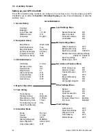

25
Horizon GPS Chart400 User Manual
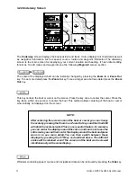
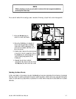
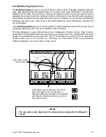
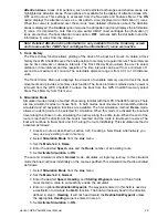
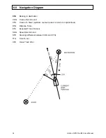
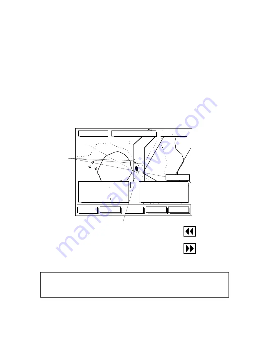
3.24 BirdsEye Highway Screen
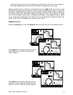
The BirdsEye Highway screen is the last of the four main screens. It displays navigation data with
large digits allowing essential navigation data to be easily visible when the display is located some
distance from the helm. This screen also features the highway screen, where your current course is
displayed in a manner similar to a highway, but from a bird’s point of view the destination waypoint is
automatically positioned directly ahead, at the center top of the display. Two vertical lines are displayed
indicating cross track error limits, as set in the CDI/Units/Alarms screen (CDI Scale), located in the
Aux setup pages.
In the BirdsEye Highway screen the boat position is automatically maintained in the central area of
the display, allowing a clear view of surrounding chart information.
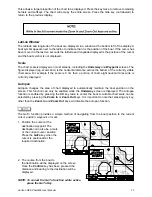
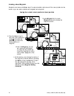
The data displayed in upper right window is user configurable. The Nav Screen Setup function,
accessible in the Navigation Setup menu, allows you to choose one of four navigational functions to
display in this window. The choices are XTE, CTS, STR and VMG. See section 6.0 for an explanation
of these terms. Also, refer to section 3.3, CDI scale, for a description of the Course Deviation
Indicator displayed in the lower section of this screen.
or
If the boat moves outside the cross track
limits, indicated by the vertical lines, a
steerage indicator is displayed. The indicator
will show the direction to steer, to return to
the original course.
Cross Track Limits
(CDI Scale)
!
!
SOG 7.2Kts
DTG
4.5 Nm
COG 205 M
BRG
234 M
XTE 0.07nm
TTG 2:34 ETA 15:56
TO: WPT003
UndrWay
Nav
Aux
Zoom In
Zoom Out
+/- 0.1 nm
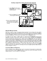
NOTE:
The same data is also displayed in the data windows displayed in the Waypoint
screen.