


RT1003 Manual
Revision:
190628
71
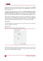
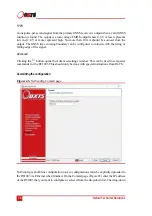
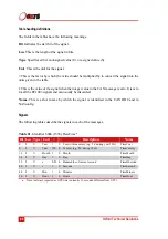
Coordinate system
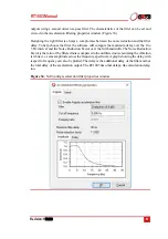
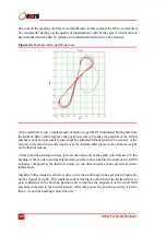
Figure 42.
NAVconfig coordinate system properties window
The RT1003 can output position relative to different coordinate frames. Click the
button
to open the properties window, shown in Figure 42.
From the Coordinate datum section you can choose which reference datum to output latitude
and longitude relative to. The default system and the standard for GPS is the WGS 84 datum.
Note:
Currently outputs will only reference datums other than WGS 84 in post-processing.
Real-time outputs will still be referenced to WGS 84 even if another option is selected.
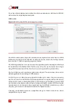
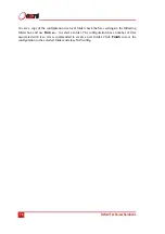
The Altitude reference can be compared to either ellipsoidal or geoidal height. If Ellipsoid is
selected, the altitude will be output with respect to the reference ellipsoid selected in the
coordinate datum section. If Geoid (receiver default) is selected, the altitude will be relative
to the geoid used in the GNSS receivers. A Custom geoid file can be used for local variations.
To download supported geoid files, go to
http://support.oxts.com/local-geoid-files/
. The UGF
file must be saved in
C:\Users\username\Documents\OXTS\Shared\Custom geoid files
. Once
the file is downloaded and saved in this location, it can be selected from the drop down box.
A constant offset to the specified altitude reference can be applied by checking the Set offset
box typing in a value into the cell
Содержание RT1003
Страница 1: ...Confidently Accurately User Manual RT1003 GNSS aided inertial navigation system ...
Страница 108: ...Confidential Information Oxford Technical Solutions ...
Страница 110: ......


