background image

Chapter 8 - Creating Routes

Page 8-22

961/962 Operations and Reference Manual, Rev. A 

4. Press the 

CURSOR 

menu


key. 

5. At the 

SELECTED ROUTE POINT

 dialog box, press the 

EDIT

 key. 

6. Press the 

CURSOR PAD

 to move the waypoint to the 

desired location, then press the 

DONE

 key (or press 

CANCEL

 to leave the waypoint unchanged). 

The location of the moved route waypoint is displayed. 

Graphically adding waypoints to a route leg 

1. On the 

ROUTES

 screen, press the 

CURSOR PAD

 up or 

down to select the desired route.

2. To display the route on the 

CHART

 screen, press the 

ON 

CHART

 key, then press the 

CHART

 key.

3. At the 

CHART

 screen, press the 

CURSOR PAD

 to select 

the desired leg of the route. 

The name of the selected route and the particular leg 

must appear in the 

CURSOR INFO BAR

 at the bottom of 

the screen; to highlight the route leg, you may have to 

press the 

LEFT ARROW

 and 

RIGHT ARROW

 keys. 

4. Press the 

CURSOR 

menu key, then press the 

EDIT

 key.

5. Press the 

CURSOR


PAD

 to move the cursor to the desired 

location. If desired, you may select a named waypoint. 

As you move the cursor, a light gray line indicates the 

location of the new legs to and from the new waypoint. 

6. To insert the new waypoint at the cursor position, press 

the 

DONE

 key.

The 

CHART

 screen appears, showing the route leg’s new 

unnamed point

 (

called 

POINT X

 in the 

CURSOR


INFO 

BAR)

.

7. To add waypoints to the same route leg or different route 

legs, repeat steps #3 through #6. 

Graphically adding waypoints to the end of a route

1. On the 

ROUTES

 screen, press the 

CURSOR PAD

 up or 

down to select the desired route. 

Содержание 961

Страница 1: ... Using the chart view screens 1 17 Navigating to a point 1 24 Reading and clearing alarm messages 1 30 Chapter 2 Introducing the 961 962 2 1 System overview 2 2 Introducing the controls 2 6 Entering data 2 7 Caring for the system 2 8 About interfacing the system 2 10 Introducing GPS and DGPS 2 11 Chapter 3 Using the Controls 3 1 More navigation terminology 3 2 Highlight Two More navigation terms 3...

Страница 2: ...ng waypoints 6 2 Displaying waypoints 6 3 Sorting the list of waypoints 6 6 Searching for a waypoint 6 7 Creating a new waypoint 6 8 Editing a waypoint 6 14 Erasing a waypoint 6 16 Changing the display of coordinates 6 16 Chapter 7 Creating Avoidance Points 7 1 Introducing avoidance points 7 2 Displaying avoidance points 7 3 Sorting the list of avoidance points 7 7 Searching for an avoidance point...

Страница 3: ...playing the trip 11 3 Changing the trip 11 5 Saving the trip as a route 11 11 Erasing the trip 11 12 Restarting the track at the trip screen 11 14 Stopping navigation 11 15 Chapter 12 Alarms TideTrack Currents and Echo Sounding 12 1 Understanding alarms 12 2 Understanding the TideTrack function 12 11 Understanding the currents function 12 15 Adding the echo sounder overlay 12 19 Chapter 13 Customi...

Страница 4: ...A 2 Steer screens A 2 Waypoint and route management A 2 Waypoint navigation A 3 Trip functions A 3 Echo sounder A 4 Miscellaneous functions A 4 GPS receiver A 4 DGPS receiver 961XD 962XD A 5 Interfacing A 6 Physical features A 6 Options A 7 Warranty A 8 GPS Antenna A 8 GPS DGPS Combination Antenna A 8 Glossary G 1 Index I 1 ...

Страница 5: ...3 GPS satellites communicating with vessel 2 12 Figure 4 Position variances with uncorrected GPS 5 9 Figure 5 Restarting the desired track 10 20 Figure 6 Passing a waypoint 13 21 Figure 7 North up orientation vessel on northerly leg 13 31 Figure 8 North up orientation vessel on southeasterly leg 13 31 Figure 9 Course up chart orientation 13 32 ...

Страница 6: ...Page viii 961 962 Operations and Reference Manual Rev A ...

Страница 7: ...tus messages 5 6 Table 4 Displaying waypoints 6 3 Table 5 Displaying avoidance points 7 3 Table 6 Displaying routes 8 3 Table 7 Displaying tracks 9 3 Table 8 961 962 alarms 12 5 Table 9 Cross track scale options 13 4 Table 10 Datum list 13 12 Table 11 Reference ellipsoid constants 13 19 Table 12 HCRF chart errors 13 55 Table 13 Service checklist 14 18 ...

Страница 8: ...Page x 961 962 Operations and Reference Manual Rev A ...

Страница 9: ...29 Initial startup screen 3 3 Power off dialog box 3 5 Chart screen with menu keys 3 7 Echo sounder screen 3 9 Alarms screen 3 10 Chart screen alarm message 3 11 Setup menu screen 3 12 Service menu screen 3 14 Traditional steer screen 3 16 3 D steer screen 3 17 Trip screen 3 18 Waypoints screen 3 20 Routes screen 3 22 Tracks screen 3 24 Avoidance points screen 3 26 Man overboard dialog box 3 29 Ch...

Страница 10: ...ox 4 31 Selected trip leg dialog box 4 32 Selected route leg dialog box 4 33 Selected waypoint dialog box 4 35 Edit selected waypoint dialog box 4 35 Use selected waypoint dialog box 4 36 Selected route point dialog box 4 37 GPS satellite status screen 5 3 Chart screen with waypoints 6 4 Waypoints screen 6 5 Selected cursor position dialog box 6 9 Store as a waypoint dialog box 6 10 Vessel positio...

Страница 11: ...Steer screen 10 3 3 D steer screen 10 4 Routes screen 10 7 Follow route screen 10 7 Join leg dialog box 10 9 Selected route point dialog box 10 11 Selected route leg dialog box 10 12 Selected waypoint dialog box 10 14 Selected cursor position dialog box 10 16 Selected cursor position dialog box 10 17 Go to waypoint dialog box 10 18 Go to waypoint dialog box 10 19 Trip screen 11 3 Active trip point...

Страница 12: ... Chart setup screen waypoints 13 26 Chart inventory screen 13 36 HCRF summary dialog box 13 47 HCRF summary dialog box 13 49 Charts on disk screen 13 51 Enter navigator permit dialog box 13 52 Deleting all HCRF dialog box 13 54 HCRF charts screen 13 58 HCRF charts in database screen 13 59 HCRF permits screen Skipper version 13 60 HCRF permits screen Navigator version 13 61 HCRF user permit screen ...

Страница 13: ...961 962 Operations and Reference Manual Rev A Page xv Select database to restore dialog box 14 14 Select a restored database to undo dialog box 14 15 Save log data dialog box 14 16 ...

Страница 14: ...Page xvi 961 962 Operations and Reference Manual Rev A ...

Страница 15: ...unction keys 1 16 Using the chart view screens 1 17 Navigating to a point 1 24 Reading and clearing alarm messages 1 30 This chapter introduces the 961 962 Operations and Reference Manual describes initial startup and basic installation procedures and briefly discusses the function keys and CHART screens After reading this chapter you ll know how to turn on the 961 962 and start basic navigation o...

Страница 16: ...For enhanced accuracy the Northstar 961XD 962XD combines GPS navigation with DGPS capability using an internal fully automatic differential receiver The Northstar 961 962 also can be interfaced with other equipment for details about interfacing see the Northstar 961 962 GPS Chart Navigator Installation Manual Both the 961X 962X and the 962XD 962XD have an internal hard drive inside their processor...

Страница 17: ...trip Welcome to the world of Northstar 961 962 color chart navigation CAUTION Although Northstar products are designed to be very useful navigation tools they are not substitutes for good seamanship The prudent navigator should never rely on any single device as the sole source of navigation guidance Exercise caution and good judgment whenever underway CAUTION Proper installation of your Northstar...

Страница 18: ...chapters of this manual extremely helpful As you learn more about the system later chapters will help you understand many of its advanced yet still easy to use capabilities see Organization starting on page 1 5 Certain terms that either have a special meaning in this manual or that are important to understand clearly are defined in the margin In addition readers who are new to marine navigation ma...

Страница 19: ...ncepts of GPS and DGPS Chapters 3 4 and 5 detail the controls chart display screens and position coordinates respectively before moving to more advanced waypoint and route navigation operations comprising Chapters 6 through 12 Chapters 13 and 14 describe customizing the setup of your system including the loading of charts and the maintenance and service procedures respectively A glossary is found ...

Страница 20: ...al row on the right side of the control head These keys are discussed further in Introducing the 961 962 starting on page 2 1 and in Using the Controls starting on page 3 1 DISPLAY TEXT is the type style representing text that appears on the display screens Sample 961 962 screen is the type style used for captions of display screens Figure 1 is the type style used for captions of figures such as p...

Страница 21: ...f an operating problem you may contact your dealer or return the system to the Northstar factory for diagnosis and repair You may want to back up any user defined waypoints and routes before returning the system for repair for details see Maintenance functions starting on page 14 17 When describing an operating problem be as complete and accurate as possible Be sure to have your serial number and ...

Страница 22: ...s returned to the Northstar factory by the owner or dealer during the warranty period Northstar will repair or replace free of charge any part found to be defective due to faulty materials or workmanship if the system has been properly installed and hasn t been abused The only cost to the owner will be the one way shipping charges and any associated charges that may be imposed by the dealer Shipme...

Страница 23: ...e PWR power key in the upper left hand corner pressing the PWR key activates the control head and the processor After several minutes the INITIAL STARTUP screen appears which is displayed for about five to ten seconds Initial startup screen After the INITIAL STARTUP screen the 961 962 automatically displays the SYSTEM TEST screen for about 10 seconds ...

Страница 24: ...atically displayed for about 10 seconds To create a personal owner s message such as the owner s name and the name of the vessel see System security starting on page 13 7 If inconsistencies are found in the system test the CONFIRM menu key will appear in the upper right of the screen Press this key to acknowledge that you are aware of the problem and accept it ...

Страница 25: ...erence Manual Rev A Page 1 11 Owner s message screen After the OWNER S MESSAGE screen the ADVISORY MESSAGE screen is automatically displayed warning you not to rely solely on the 961 962 s chart cartography for safe navigation Advisory message screen ...

Страница 26: ...the center of the chart represented as a small circle A 961 962 that recently has been used either at or near that same position will usually be ready to navigate within several minutes If GPS signals aren t acquired soon enough however your last position fix from the last time the 961 962 ran will be represented by a small position fix circle you ll see an alarm message in the upper portion of th...

Страница 27: ...l low when you don t actually need it for more details see Controlling LCD screen brightness starting on page 3 27 Turning the system off The procedure for turning off a system with two control heads is slightly different than turning off a system with one head To turn off an entire system both the head and the processor with one control head 1 Press and hold the PWR key for approximately three se...

Страница 28: ...operation Menu keys with a red mark cancel an operation and return you to the screen you were previously viewing Basic navigation terminology If you re new to navigation before proceeding you may want to review the basic navigation terms on the following page in Highlight One It is suggested that you review these terms carefully because many of them are used in a very specific way in this manual S...

Страница 29: ...rth s surface running east west expressed as the number of degrees 0 to 90 north or south of the Equator Leg The line or path between any two waypoints in a route or a trip Longitude Imaginary lines on the earth s surface running north south expressed as the number of degrees 0 to 180 east or west of the Prime Meridian a line running from the North Pole to the South Pole Nautical mile nm One nm eq...

Страница 30: ...on keys are briefly described below CHART displays two independent CHART screens views A and B showing your position on the chart information about the chart in use all the data you need to navigate tides using Northstar s exclusive TideTrack feature and currents overlay You can create and store new waypoints avoidance points and routes at these screens and view existing waypoints avoidance points...

Страница 31: ...ncluding port setup options and saving restoring the waypoint and route databases NOTE Pressing the STAR key only accesses the ECHO SOUNDER screen if the 490 is enabled on NMEA Port 3 For more information see the Northstar 490 Echo Sounder Installation Manual GM491 TRIP displays one screen showing the progress of today s navigation plan called today s trip This trip can easily be modified For deta...

Страница 32: ...t view B offers the same chart view functions as chart view A Using the second view you can select a different zoom level a different location on the chart different navigation information or even a different chart You can switch between the two views by pressing the CHART key Both CHART views display electronic versions of actual paper charts This means that everything that you re already familia...

Страница 33: ... 961 962 provides you with truly worldwide chart coverage If your vessel ever moves into an area that isn t covered by the charts installed the 961 962 will automatically display a plotter grid For information on obtaining BSB or HCRF ARCS charts see Purchasing charts starting on page 13 37 For further details about using these charts see Navigational chart CDs starting on page 2 5 NOTE If you re ...

Страница 34: ... refer to the sample display screen on page 1 22 On the DISPLAY SETUP screen you can set the distance units to statute miles mi nautical miles nm or kilometers km Water depths The small box in the lower left hand corner shows how water depths spot soundings are shown on the currently displayed chart in feet meters or fathoms These are the numbers from the paper version of the chart accordingly you...

Страница 35: ...re located in a vertical row to the right of the display screen Each of these keys controls a function to its left GO TO provides several options to select and navigate to new position coordinates For details see Navigating to a point starting on page 1 24 NEW CHART lets you select a different chart for your vessel s location from the chart database or display a basic plotter grid For details see ...

Страница 36: ...Showing position coordinates below and see Displaying information about your position starting on page 4 15 For more about the CHART screen s menu keys see Chart view menu keys starting on page 3 6 Showing position coordinates You can display position coordinates on the CHART screen as lat lon coordinates from the GPS receiver Phantom loran TDs that are calculated from the GPS coordinates for when...

Страница 37: ...isplay position coordinates as loran TDs at the CHART SETUP screen 4 active waypoint if any distance and bearing to the active waypoint cross track error XTE estimated time of arrival ETA estimated time enroute ETE and placement of your vessel relative to the desired track 5 the name and number of the chart in use its originator and manufacturer source date and chart datum 6 if you re displaying a...

Страница 38: ... Option 1 Using the cursor to designate a chart position You can use the cursor to point to a spot on the chart and navigate there as follows 1 To display the cursor represented by a red square symbol with crosshairs and move it to the desired spot on the chart press the large CURSOR PAD located in the lower right hand corner of the control head The CURSOR PAD is multidirectional so you can move i...

Страница 39: ...1 25 Chart screen with cursor location info bar To return to showing your vessel in the center of the chart press the bottom right VESSEL key at any time 2 Press the CURSOR key The SELECTED CURSOR POSITION dialog box appears displaying the coordinates of the cursor position ...

Страница 40: ...ion dialog box 3 To navigate directly to the coordinates press the GO NOW key or press the CANCEL key to cancel The CHART screen displays a dashed green line the desired track from your vessel to the new waypoint automatically named COORD This waypoint is represented by a green X on the CHART screen ...

Страница 41: ...bout these options see Using the cursor on the chart screen starting on page 4 17 Option 2 Entering coordinates Your second option for navigating to a point is to enter numeric coordinates as lat lon Loran C TDs or distance and bearing as follows 1 From the CHART screen press the GO TO key The GO TO COORDINATES dialog box appears The coordinates of your active waypoint if any or else the coordinat...

Страница 42: ... enter new coordinates Press the CURSOR PAD right to move the flashing cursor to the longitude field or press down to move to the distance and bearing fields then use the KEYPAD to enter new coordinates For details about using the KEYPAD to enter data see Entering data starting on page 2 7 To display the coordinates as lat lon or TDs press the LL TDS key ...

Страница 43: ...gate directly to the new coordinates press the GO NOW key or press the CANCEL key to cancel The CHART screen displays a green line the desired track to the new waypoint automatically named COORD This waypoint is represented by a green X on the CHART screen Chart screen with COORD waypoint ...

Страница 44: ... the message hasn t self cleared 2 To acknowledge an alarm message press the CLEAR ALARM key at the upper right side of the screen 3 To return to the CHART screen press the CHART key Some alarms can t be manually cleared for complete details about alarms see Alarms TideTrack Currents and Echo Sounding starting on page 12 1 NOTE During an alarm condition the alarm message always appears on whatever...

Страница 45: ...ring data 2 7 Caring for the system 2 8 About interfacing the system 2 10 Introducing GPS and DGPS 2 11 This chapter introduces the 961 962 s major features and controls discusses basic maintenance and provides an introduction to GPS and DGPS Read this chapter to learn the broader concepts of 961 962 operations and marine navigation ...

Страница 46: ...s 961XD 962XD only For the best in GPS accuracy the Northstar 961XD 962XD features an internal two channel DGPS receiver that accepts DGPS signal corrections from shore based transmitters called beacons These transmitting beacons emit radio signals which may be affected by lightning The 961XD 962XD uses these DGPS signal corrections to display your position a position fix as accurately as one to t...

Страница 47: ...e currents for the 24 hour period of any chosen date Waypoint avoidance point and route features The waypoint avoidance point and route features include storing up to 2 000 waypoints and 1 000 routes storing up to 200 avoidance points and displaying them on the CHART screen and the 3 D STEER screen storing and displaying waypoints in several ways one of 23 different symbols can be assigned to each...

Страница 48: ...lly keeps the chart visible even as you move from one chart to the next Lighting The liquid crystal display LCD screen is easy to see in all kinds of light from full direct sunlight to total darkness Anti reflection treatment of the screen removes over 90 percent of the reflection and glare usually found in bright sunlight Moreover the screen is fully lit for nighttime use To adjust the screen s b...

Страница 49: ...ge for most of the world Each CD contains about 75 to 200 different charts covering a specific area of coastline ChartPak CDs also supplied by Maptech These charts are similar to those supplied on ChartKit CDs as above Hydrographic Chart Raster Format HCRF navigational charts such as ARCS chart CDs supplied by the United Kingdom Hydrographic Office UKHO ARCS charts Admiralty Raster Chart Format ar...

Страница 50: ...page 4 10 for full details about TideTrack see Understanding the TideTrack function starting on page 12 11 Currents The currents feature displays a 24 hour current speed direction graph for any date to choose For more about viewing currents see see Understanding the currents function starting on page 12 15 Introducing the controls Collectively the controls refer to the soft rubber buttons or keys ...

Страница 51: ...essing the CURSOR PAD to move the flashing cursor to that item The cursor appears as a flashing red box that represents the place where the next typed character is to appear The flashing cursor indicates which character position will be written into Use the LEFT ARROW and RIGHT ARROW keys on the KEYPAD to move the flashing cursor to the next character you want to enter In some fields numbers will ...

Страница 52: ...ess a third and fourth time to show the letter C and the number 1 respectively A fifth keypress returns you to the letter A The other nine keys use this same method for data entry To enter data 1 Find the key containing the desired letter number or character 2 To display the letter number or character press that key one to four times 3 To move the cursor to the next position press the RIGHT ARROW ...

Страница 53: ... your 961 962 Saltwater spray If left disconnected the rear connectors behind the control head may corrode slightly from exposure to saltwater spray Keep the plastic caps of the rear connectors in place at all times Protect the entire 961 962 from prolonged exposure to the elements by mounting it if possible in a relatively dry area At the end of a trip wipe the control head dry Cleaning the scree...

Страница 54: ...ay closed unless you re inserting or removing a CD Because the 961 962 copies and stores CD data onto its internal hard drive you ll only have to insert these CDs during their installation You shouldn t have to open or close the drive for any other reason Keep all of your CDs in a safe watertight place where they won t be damaged or exposed to sunlight and any other kind of heat About interfacing ...

Страница 55: ... GPS and DGPS navigation systems and describes how these systems relate to the Northstar 961 962 If you re new to navigation you may begin without understanding anything about these navigational concepts However Northstar recommends that you read this section at some point to become familiar with the concept of GPS and DGPS What is GPS The United States Global Positioning System GPS is now fully o...

Страница 56: ...evice to determine your actual lat lon coordinates on the surface of the earth as compared to position data determined from a paper chart or other reference Repeatable accuracy on the other hand refers to the ability of a particular navigation device to return to a position whose lat lon coordinates were previously recorded by this same navigation device Selective availability The Department of De...

Страница 57: ...e sources datum shifts latency of displayed position fix and so on all compound the error in the resulting displayed position fix For example imagine a chart plotter at full scale zoom showing a channel 200 feet wide 60 meters A vessel navigating through that channel may well appear to be on the rocks if it is 30 meters out of place Although this magnitude of error won t always be the case the pru...

Страница 58: ...navigating in such narrow or congested areas as ports and waterways or wherever you require extreme accuracy to locate a precise area retrieving lobster traps returning to a favorite diving spot and so on The 961 962 displays lat lon coordinates to thousandths of minutes approximately six feet When using a radar plotter or paper plotter DGPS corrections dramatically improve the steadiness of your ...

Страница 59: ...R key 3 3 Function keys 3 5 Brightness key 3 27 SAVE key 3 28 MOB key 3 28 IN and OUT keys 3 31 Cursor pad 3 31 Arrow keys 3 32 Menu keys 3 33 This chapter describes all of the Northstar 961 962 s controls in detail except for the alphanumeric KEYPAD for this information see Entering data starting on page 2 7 ...

Страница 60: ... DGPS starting on page 2 11 Hydrographic Chart Raster Format HCRF A chart format designed by the United Kingdom Hydrographic Office and used by ARCS see ARCS definition above Leg The line or path between any two waypoints in a route or a trip Nav aid Aids to navigation often used on coastal and inland waters Nav aids primarily comprise buoys lighthouses and daymarkers and their purpose is to warn ...

Страница 61: ...rs which is displayed for about five to ten seconds Initial startup screen After the INITIAL STARTUP screen the SYSTEM TEST screen is displayed for about 10 seconds After the SYSTEM TEST screen the OWNER S MESSAGE screen is displayed for about 10 seconds To create a personal owner s message such as the name of the vessel and its owner see System security starting on page 13 7 After the OWNER S MES...

Страница 62: ...er up and thereafter if GPS data is unavailable for more than three seconds GPS position is considered unknown and a non clearable GPS alarm is activated You ll receive the alarm message GPS ACQUIRING at power up or NO GPS FIX The displays of speed over ground SOG and course over ground COG lat lon and TDs and GRI are replaced by dashed lines Turning the system off The procedure for turning off a ...

Страница 63: ...setting lets you save power by turning off the control head while the processor is running and lets you separately test the functioning of the head and processor if necessary Unless the 961 962 is being tested make sure the TEST POWER switch is set to AUTO Function keys The five function keys located across on the lower left part of the control head CHART STEER WAYPTS ROUTES STAR and TRIP control ...

Страница 64: ... called chart views A and B You can preset each view to a useful zoom level a particular chart or an INFO BAR display and you can instantly select one view or the other Using this feature you can view one screen with your present position and a second screen with your destination position all with just a single keypress Chart view menu keys The menu keys are the six round keys to the right of the ...

Страница 65: ...to view charts of your present position in increasingly better scales press briefly view a list of all charts that cover the vessel s location press and hold the NEW CHART key or the cursor s location first press the CURSOR PAD then press the NEW CHART key view a list of all charts in the chart database press and hold change the usage of any chart press and hold select a lat lon grid instead of a ...

Страница 66: ...display Loran C GRI and TDs if specified at the CHART SETUP screen display your active waypoint if any distance and bearing to the waypoint numerical and graphical cross track error XTE estimated time of arrival ETA and estimated time enroute ETE display details about the chart in use including its name number source and revision date If you re displaying an HCRF chart such as ARCS the INFO BAR di...

Страница 67: ...tions if installed 5 Service functions Echo Sounder The ECHO SOUNDER screen indicates the depth of the water under the vessel the position and depth of fish and the contours of the seabed From this screen you access all echo sounder operations For details about using the echo sounder see the Northstar 490 Echo Sounder Operations Manual GM490 Echo sounder screen Alarms The ALARMS screen shows any n...

Страница 68: ...OR KEY BEEP OFF ON LOUDER and SOFTER to control the alarm functions Use the CLEAR ALARM key to clear the newest alarm after you ve viewed the alarm message and move the alarm message to the old alarms list Most alarms automatically self clear when the alarm condition is no longer present but you can use the CLEAR ALARM key to manually clear most alarms if desired This key only appears if there are...

Страница 69: ...s soon as possible including such information as a dragging anchor lost GPS signals or the upcoming arrival at a particular waypoint Alarms are displayed at the top of the CHART screen and at the bottom of other screens including the echo sounder screens They are accompanied by sound unless the audio is turned off Exceptions to this are the anchor drag and avoidance points alarms which are accompa...

Страница 70: ...e and view time information Setup menu screen The SETUP MENU screen uses six menu keys DISPLAY SETUP NAVIGATION SETUP CHART SCREEN SETUP CHART INVENTORY DEMO SETUP and TIME INFORMATION to control setup customization Use the DISPLAY SETUP key to change the time zone and the time display format XTE scale on both steering screens distance and speed units tide height units maximum number of SAVEDXX wa...

Страница 71: ...tor line show loran TDs on the CHART screen INFO BARs and the CURSOR INFO BAR and turn on or off the display of range rings the distance scale bar past trip legs and a chart update region on the CHART screen For more about all of these options see Changing the chart setup starting on page 13 24 Use the CHART INVENTORY key to load update charts delete charts from the database and access all HCRF sp...

Страница 72: ... control service functions Service menu screen Use the PRODUCT INFORMATION key to view such information as the serial number and software revision of the control head s and processor the self test status and software revision of the GPS and beacon receivers and the amount of memory in the processor For more about viewing product information see Viewing product information starting on page 14 2 Use...

Страница 73: ...racy as well as the frequency baud rate and status of DGPS transmitters 961XD 962XD only For more about viewing GPS and DGPS information see Viewing GPS status starting on page 14 9 Use the DATABASES AND LOG key to save or restore the waypoints routes and the user preferences display navigation chart receiver and port setup options and to save log data when troubleshooting the system For details s...

Страница 74: ...ation starting on page 11 15 Use the RESTART HERE key to restart the track line to the active waypoint XTE becomes zero so that your present position becomes the initial track point your vessel will subsequently follow any remaining waypoints in the trip For details about restarting the track see Restarting the track starting on page 10 19 Traditional steer screen The traditional STEER screen show...

Страница 75: ...s red circles all in relation to your desired track the dashed center line and distance and bearing from your present position to the active waypoint SOG COG ETA and ETE are shown numerically If you re navigating to a waypoint the 3D STEER screen displays your vessel on or near your desired track line according to your XTE If you aren t navigating to a waypoint the 3D STEER screen still shows a co...

Страница 76: ...d future waypoints with their lat lon coordinates and for past waypoints the actual time of arrival as day and date or day and time as well as distance and bearing between points and the total trip distance and for active and future waypoints ETA as day and date or day and time Trip screen By pressing the CURSOR PAD up and down you can see all past and future waypoints The TRIP screen has six menu...

Страница 77: ... the ARRIVAL column of the trip list between day and time of arrival day and date of arrival and distance and bearing between trip points along with the total trip distance For in depth information about the trip function see Using the Trip Function starting on page 11 1 WAYPTS ROUTES key Pressing the WAYPTS ROUTES key lets you create new waypoints routes tracks and avoidance points access sort an...

Страница 78: ...arrows of the CURSOR PAD the currently selected waypoint route track or avoidance point is indicated by a horizontal stripe Waypoints screen The WAYPOINTS screen lists all your stored named waypoints by symbol name distance and bearing and lat lon or TDs the distance and bearing fields are completely blank if there s no position fix Until you store user defined waypoints in the database the WAYPOI...

Страница 79: ...few characters of the category you re sorting by The WAYPOINTS screen has five menu keys GO TO TDS LT LN NEW WAYPT COPY and EDIT that control waypoint functions Use the GO TO key to go directly to the selected waypoint erases the future part of your trip add the selected waypoints to the end of your current trip if you re already past the last waypoint you ll start navigating along the newly enter...

Страница 80: ...screen By pressing the CURSOR PAD left or right you can sort the route list by each column selected columns are highlighted with a vertical stripe a sort by the CHT column means the route is marked for display on the CHART screen places that route at the top a sort by the SAVE column places that route at the top a sort by the NAME column lists routes alphabetically a sort by the MODIFIED column da...

Страница 81: ...dd the selected route starting with a selected waypoint to the end of your trip in a forward or reverse direction Use the ERASE key to delete the selected route Use the ON CHART key to mark a route for display on the CHART screen you can display only one route on the CHART screen at a time Use the NEW ROUTE key to create a new route from the list of waypoints stored in the database and graphically...

Страница 82: ...cted track is also displayed Until you store user defined tracks in the database the TRACKS screen will be blank Tracks screen By pressing the CURSOR PAD left or right you can sort the track list by each column selected columns are highlighted with a vertical stripe a sort by the CHT column marked for display on the CHART screen places that track at the top a sort by the COL column color groups sa...

Страница 83: ...TRACK key to define a new track by picking a start time and end time Use the START SAVING key to start saving a new track immediately then stop saving at any time Use the EDIT key to change the description or name of an existing track permanently erase a track For information about tracks see Introducing tracks starting on page 9 2 Avoidance points screen The AVOIDANCE POINTS screen lists all your...

Страница 84: ...radius a sort by the NAME column yields an alphabetical list a sort by the DISTANCE or BRG bearing columns lists avoidance points in order of distance or bearing from your present position You can also search the list for a particular avoidance point by entering the first few characters of the category you re sorting by The AVOIDANCE POINTS screen has four menu keys TDS LT LN NEW AVOID COPY and ED...

Страница 85: ...luminating the screen slowly dim after several thousand hours of use If you use the 961 962 for several hours each day try to keep the lighting level low when you don t actually need it for example during twilight or nighttime hours Occasional users once a week or less don t need to worry about keeping the lighting level low Producing the high brightness needed for sunlight visibility creates heat...

Страница 86: ...e waypoint or as multiple waypoints in a route or add your vessel s position to the end of the previously designated route For details about using the SAVE key to save your vessel s position as a waypoint see Creating a new waypoint at the vessel s position starting on page 6 11 For details about using the SAVE key to save your vessel s position as part of a new route see Creating a route as you t...

Страница 87: ... overboard dialog box Your position is saved and displayed on the CHART screen as a waypoint with a symbol called MOBXX The MOB position has immediately become your active waypoint When navigating to an MOBXX waypoint the chart s zoom level will automatically be set to its native level 1 1 ...

Страница 88: ...int If you press the WAYPTS ROUTES key you ll see the MOBXX waypoint in the list and MOBXX waypoints are also displayed on the 3 D STEER STEER and TRIP screens If you press the MOB key a second time before you arrive at this first MOBXX waypoint you ll have to press the YES GO NOW key to confirm because a second MOB keypress would save your latest position and make this your active waypoint instea...

Страница 89: ...ons of data Using the cursor pad on the chart screen On the CHART screen you can move the CURSOR PAD in an up to down left to right or diagonal direction You can move the cursor diagonally by pressing between any two of its arrow indicators The longer you hold the CURSOR PAD the faster the cursor moves To carefully move the cursor small distances on the CHART screen the easiest way is to place you...

Страница 90: ... contains a LEFT ARROW key and a RIGHT ARROW key which are used while entering data to move the flashing cursor to the character you want to change For example if you make a mistake when entering lat lon coordinates or waypoint and route names press the LEFT ARROW key to move the cursor a flashing red box that represents the place at which the next typed character will appear back to a previous ch...

Страница 91: ...l Rev A Page 3 33 Menu keys Use the six MENU keys located in a vertical row on the right of the display screen for a variety of functions Each key s function depends specifically on which screen you re displaying each key s current function is shown right on the screen ...

Страница 92: ...Chapter 3 Using the Controls Page 3 34 961 962 Operations and Reference Manual Rev A ...

Страница 93: ...ronic charts 4 2 Understanding the chart screen 4 2 Displaying your vessel s position on a chart 4 4 Functions performed at the chart screen 4 4 Using the cursor on the chart screen 4 17 This chapter explains the 961 962 s electronic chart the chart views and their menu keys and vessel and cursor functions ...

Страница 94: ...ou ll probably see a sudden change in the detail shown on the screen just as if you d changed from one paper chart to another Chart scale At the lower left hand side of the CHART screen is the chart scale box which shows the chart magnification A display of 1 1 indicates the largest magnification at which you can display the current chart As you zoom out this number changes to 1 2 1 4 1 8 and so o...

Страница 95: ...nge of chart navigation functions For a complete description of these keys see Chart view menu keys starting on page 3 6 Zooming in and out on the chart screen Zoom levels Press the IN key to zoom in for a closer look at the area either around your vessel or around the cursor when the cursor is on the screen Press the OUT key to zoom out for a wider look at the area either around your vessel or ar...

Страница 96: ...sel centered on the CHART screen You can immediately find your present position as it relates to your desired track and any nearby waypoints nav aids land masses and so on Your vessel remains centered on the chart while the chart moves underneath your vessel When the vessel moves near the edge of a chart the 961 962 automatically switches to another available chart If more than one is available th...

Страница 97: ... SAVE key to save your vessel s position as a waypoint or as part of a route this can be done from any screen as well as the CHART screen NOTE You also can easily create a new route right from the CHART screen To make a new route see Making a new route starting on page 4 24 Going to new coordinates To specify new coordinates from the CHART screen press the GO TO key and the GO TO COORDINATES dialo...

Страница 98: ... 1 From the CHART screen press the GO TO key 2 At the GO TO COORDINATES dialog box use the KEYPAD to enter the desired position coordinates or distance and bearing 3 Press the GO NOW key or press the CANCEL key to cancel On the CHART screen a waypoint is automatically created named COORD to which you re now going and appears as a track line to this new waypoint The 961 962 automatically removes an...

Страница 99: ... past the last waypoint adding to the end of the trip will restart navigation To queue a waypoint 1 From the CHART screen press the GO TO key 2 At the GO TO COORDINATES dialog box use the KEYPAD to enter the desired position coordinates 3 Press the ADD TO END OF TRIP key or press the CANCEL key to cancel A waypoint is created called COORD to which you ll navigate at the end of your current trip an...

Страница 100: ...ART key With each brief keypress you ll cycle through all the available charts for your specific location right on the CHART screen When you see the desired chart stop pressing the NEW CHART key As you cycle through the available charts the 961 962 selects a chart of the same scale being viewed until there s a better scale to choose from When there aren t any better charts to choose from you ll se...

Страница 101: ...ons and Reference Manual Rev A Page 4 9 Vessel position charts screen Cursor position charts screen You can view a list of all the charts in the database by pressing the ALL CHARTS key then return to the list of local charts by pressing the POSITION LIST key ...

Страница 102: ...selected chart by pressing the INFO key several times You can also change the charts usage mark charts as PREFER NORMAL or AVOID for details about this function see Common chart functions starting on page 13 63 You can select a north up plotter grid by pressing the GRID key A grid is automatically displayed if you navigate into an area for which there isn t a chart The grid displays the lat lon co...

Страница 103: ...NFO BAR at the bottom of the screen shows today s date and the number of stations in the coverage area If the STATION COVERAGE bar says there aren t any stations in the coverage area press the OUT key to zoom out to a wider coverage area the GRAPH ON key will appear if there are too many stations zoom in To select the tide station nearest to your vessel or to the cursor if you ve already pressed t...

Страница 104: ...ss the LEFT ARROW key To view future days press the RIGHT ARROW key Use the CURSOR PAD to choose the day hour or minute selection for the LEFT ARROW and RIGHT ARROW keys To cancel the tides view at any time press the OVERLAY key then press the HIDE TIDES key For more about the TideTrack function including how to view tides anywhere on the CHART screen see Understanding the TideTrack function start...

Страница 105: ...O BAR at the bottom of the screen shows today s date and the number of stations in the coverage area If the STATION COVERAGE bar indicates there aren t any stations in the coverage area press the OUT key to zoom out to a wider coverage area the GRAPH ON key will appear if there are too many stations zoom in To select the current station nearest to your vessel or to the cursor if you ve already pre...

Страница 106: ...ss the OVERLAY key then press the HIDE CURRENTS key For more about the currents function including how to view currents anywhere on the CHART screen see Understanding the currents function starting on page 12 15 Clearing chart screen menu keys You may want to clear the CHART screen s menu keys to help reduce on screen clutter and show more of the area around your vessel To remove all the menu keys...

Страница 107: ...Ds at the CHART SETUP screen 4 active waypoint if any distance and bearing to the active waypoint a graphic and numeric display of your XTE how far off you are from your intended course line estimated time of arrival ETA estimated time enroute ETE and the placement of your vessel relative to the desired track 5 the name and number of the chart in use its originator and manufacturer source date and...

Страница 108: ...hart Screen Page 4 16 961 962 Operations and Reference Manual Rev A function lets you see two INFO BARs with different navigation data on your screen at the same time Chart view A with two info bars Chart view B with two info bars ...

Страница 109: ...ssel s position as a waypoint see Creating a new waypoint at the vessel s position starting on page 6 11 For details about using the SAVE key to save your vessel s position as part of a new route see Creating a route as you travel starting on page 8 10 Using the cursor on the chart screen On the CHART screen pressing the CURSOR PAD displays a cursor shown as a square red window that lets you view ...

Страница 110: ...chart press and hold the NEW CHART key to display the CURSOR POSITION CHARTS screen and select the desired chart see Selecting new charts starting on page 4 8 To move the cursor a long distance on the chart it s often quicker to zoom out move the cursor and then zoom in Once you ve pressed the CURSOR PAD you can now select objects on the CHART screen or else use the CURSOR key to perform a variety...

Страница 111: ...f the object lat lon and loran TDs if specified at the CHART SETUP screen Note that you can t select items that are actually printed on the chart such as buoys or other navaids NOTE At any given time the CHART screen may display multiple objects at the same location When you move the cursor onto these multiple objects a set of arrows is displayed at the lower left of the CURSOR INFO BAR By pressin...

Страница 112: ...oint store the cursor position as the first point of a new route and display it add the cursor position to the currently displayed route if any Additional functions are available when you press the CURSOR PAD then select a route or future trip leg a route or trip point or a single waypoint then press the CURSOR key go to the selected route or future trip point and continue in a forward or reverse ...

Страница 113: ...OR POSITION dialog box appears Selected cursor position dialog box 2 If desired you can use the KEYPAD to change the cursor s coordinates if not press the GO NOW key or press the CANCEL key to cancel A new temporary waypoint is created called COORD which isn t stored in the waypoint database instead it s placed into the trip where it replaces any future trip points Your present vessel position and...

Страница 114: ...dded to the end of the trip and the CHART screen is displayed The future trip leg is displayed in light blue on the CHART screen Nothing is erased from the trip If you were already past the end of your trip you ll immediately begin navigating to this new position as the active waypoint Making a new waypoint To store a new named waypoint at the chart location designated by the cursor 1 Press the CU...

Страница 115: ...To erase the entire NAME field press the CLEAR ENTRY key 4 Press the MAKE NEW WAYPOINT key or press the RETURN key to cancel The new waypoint is stored and the CHART screen is displayed showing the navigation information about this new waypoint in the CURSOR INFO BAR Making a new avoidance point You can create avoidance points with a user defined name and radius that are displayed on the CHART scr...

Страница 116: ...n have up to nine characters or use the default avoidance point name which is the letter W followed by four digits If you use the default avoidance point name you can always change the name later on the AVOIDANCE POINTS screen To erase the entire NAME field press the CLEAR ENTRY key 4 Press the MAKE NEW AVOID key or press the RETURN key to cancel The new avoidance point is stored and the CHART scr...

Страница 117: ...te use the KEYPAD to enter a name in the WAYPOINT NAME field or use the default waypoint name Waypoint names can have up to nine characters To clear the entire NAME field during data entry press the CLEAR ENTRY key 4 To name the route press the CURSOR PAD up to move the cursor to the ROUTE NAME field then use the KEYPAD to enter a route name route names can have up to 15 characters If you use the ...

Страница 118: ... appears supplying a default waypoint name and also showing the name of the currently displayed route Store as a waypoint for on chart route dialog box 3 If desired use the KEYPAD to change the default waypoint name if not press the ADD TO END OF ROUTE key The CHART screen appears showing the added route waypoint To continue adding route waypoints keep moving the cursor to each desired location on...

Страница 119: ...he LEFT ARROW and RIGHT ARROW keys to highlight a route point not a named waypoint Why If you select for example POINT 3 from the route you ll follow the remainder of the route after POINT 3 Instead if you select a named waypoint from the route for example WAYPT D you ll navigate only to that named waypoint To go directly to an existing route point and continue along the displayed route remember t...

Страница 120: ... CANCEL key to cancel The CHART screen appears showing the track line to the selected route point and the future trip as copied from the displayed route Your vessel s present position and time have been inserted as a past trip point and any previously existing future trip points have been deleted Going to a selected trip point Selecting a past trip point takes you only to that point you won t foll...

Страница 121: ...AD to select the desired point then press the CURSOR menu key The SELECTED TRIP POINT dialog box appears If you chose a past trip point this dialog box is named SELECTED COORDINATE Selected trip point dialog box 2 To go directly from your present position to this point press the GO NOW key or press the CANCEL key to cancel The CHART screen appears showing a track line to the selected point ...

Страница 122: ...he route not the named first waypoint of the route To add only part of the route press the CURSOR PAD to move the cursor to the desired route point and the route is added starting at the selected point including all subsequent points This procedure also applies to selecting a route leg Press the CURSOR PAD to move the cursor to the desired route leg and the route is added starting at the beginning...

Страница 123: ...D TO END OF TRIP key or press the CANCEL key to cancel The CHART screen appears showing the route added to your trip If you were already past the end of the existing trip you ll immediately begin navigating to the new route Joining a route leg or trip leg You can join a leg of a displayed route or join a future leg of the trip To join a future trip leg 1 On the CHART screen press the CURSOR PAD to...

Страница 124: ... vessel position and time are inserted as a past trip point The JOIN LEG dialog box appears reminding you to press the SAVE key when you reach the point where you join the trip leg pressing the SAVE key there ensures that the system saves the position in the trip where you ll join the leg 4 Press the OK key To join a route leg 1 On the CHART screen press the CURSOR PAD to select the desired route ...

Страница 125: ...OIN LEG dialog box appears reminding you to press the SAVE key when you reach the point where you join the route leg pressing the SAVE key there ensures that the system saves the position in the trip where you ll join the leg 4 Press the OK key Editing a route or the trip You can edit a route or a trip by adding waypoints to the middle of a route leg or a trip leg This function splits a leg into t...

Страница 126: ...point or press the CANCEL key to cancel The CHART screen appears showing the new point inserted into the selected route leg or trip leg Editing a waypoint You can select an existing waypoint route point or trip point on the CHART screen and move it to another location 1 On the CHART screen press the CURSOR PAD to select a waypoint If necessary to select a named waypoint or a waypoint that s part o...

Страница 127: ...anding the Chart Screen 961 962 Operations and Reference Manual Rev A Page 4 35 Selected waypoint dialog box 3 Press the EDIT key The CHART screen appears showing the selected waypoint Edit selected waypoint dialog box ...

Страница 128: ...s or the trip you ll always be asked whether you want to use the new location of this waypoint in all routes and the trip or keep the original coordinates as unnamed points in the trip or routes This USE SELECTED DIALOG box won t appear if you selected a route point or a trip point Use selected waypoint dialog box To use the new coordinates press the USE NEW COORD IN ROUTES key to leave routes and...

Страница 129: ...eted because the past can t be changed unless you first save the trip as a route and then delete the past trip points To delete waypoints from a route or the trip but not from the database of waypoints 1 On the CHART screen press the CURSOR PAD to select the point you want to delete You must use the LEFT ARROW and RIGHT ARROW keys to select for example ROUTE POINT 6 not WAYPOINT XX to be able to d...

Страница 130: ... 38 961 962 Operations and Reference Manual Rev A 2 Press the DELETE POINT key The CHART screen is displayed If you deleted a route point this point is removed from the displayed route If you deleted a trip point this point is removed from the trip ...

Страница 131: ...ing Position Coordinates Using GPS to determine position 5 2 Using DGPS to determine position 5 4 Understanding Loran C 5 7 Using Phantom loran to determine position 5 10 This chapter describes the 961 962 s most important navigation function determining your position ...

Страница 132: ...eric STEER screen To display SOG and COG on either the STEER or 3 D STEER screens press the STEER key once or twice SOG and COG readings result from ongoing measurements derived from the satellite signals GPS speed is updated every second You can set the 961 962 to display its SOG and COG readings more smoothly by setting the GPS speed averaging value up to 10 seconds Increasing this averaging tim...

Страница 133: ...view is looking down from above with East to your right and West to your left Also displayed on the screen is the following GPS data ACCURACY HDOP horizontal dilution of precision Accuracy is the estimated accuracy of the GPS system to be expected at the current time Your position readings should be more accurate than this estimate 95 percent of the time HDOP is a technical measure of how good the...

Страница 134: ...nd COG measurements accurate to about 0 5 degree For more information about GPS see Using GPS to determine position starting on page 5 2 NOTE When using DGPS as your navigation source your position coordinates may actually exceed the accuracy of some charts DGPS in use indicator The DGPS indicator appears as the word DGPS in the upper left hand corner of the CHART screen When this indicator is dis...

Страница 135: ...eceived signal and should be as high as possible Signal strength varies with the distance from the differential transmitter NOISE is the level of static caused by lightning and other atmospheric effects and should be low for best results The range of noise level meanings are outlined in Table 2 Noise level meanings below For information on optimizing these numbers see the Northstar 961 962 GPS Cha...

Страница 136: ...transmitter reports technical problems UNHEALTHY SATELLITES Data received from the satellites is unreliable BAD UDRE IODE Data received from the satellites is unreliable ACQUIRING SATELLITES Either the GPS receiver can t operate until it has received ephemeris data from the satellites or else the receiver isn t tracking enough satellites yet for a fix DGPS NOT IN USE BUT AVAILABLE DGPS was turned ...

Страница 137: ... have relied on its ability to repeatedly return them to previously saved locations with extreme accuracy This capability has been especially appreciated by captains of commercial fishing vessels since each subsequent visit to a lobster trap or buoy would be virtually on the mark saving valuable time and money During that time loran s repeatable accuracy was superior to anything else commercially ...

Страница 138: ...lute accuracy GPS provides an absolute accuracy of better than 100 feet almost everywhere in the world under virtually all conditions far surpassing the 600 foot absolute accuracy of a good loran receiver under ideal conditions If you re used to relying on a loran receiver s repeatable accuracy to return you to within one vessel s length of a lobster trap or buoy time after time you won t necessar...

Страница 139: ...ived from the secondary loran stations These signals provide a basis for a navigational system that s totally independent of the GPS system The 961 962 automatically converts GPS coordinates to loran TDs which can be viewed on the CHART screen at any time as well as other screens This conversion is known as Northstar s Phantom loran feature With Phantom loran you can display your position as TDs o...

Страница 140: ...an signals Remember however that these calculated TDs won t exactly match the positions of previously recorded TD coordinates that you obtained from actual loran signals In most areas TD errors shouldn t exceed one microsecond on the best pair selected However larger errors are possible in areas for which the 961 962 doesn t contain accurate factory programmed ASF correction points Selecting Phant...

Страница 141: ...ying GPS only coordinates repeat the above steps but turn the setting of LORAN INFO BARs to OFF Setting Phantom loran GRI You can choose the preferred four digit loran GRI to use when converting lat lon coordinates to Phantom loran TDs For details about setting the loran GRI see Preferred loran GRI starting on page 13 20 ...

Страница 142: ...Chapter 5 Understanding Position Coordinates Page 5 12 961 962 Operations and Reference Manual Rev A ...

Страница 143: ...3 Sorting the list of waypoints 6 6 Searching for a waypoint 6 7 Creating a new waypoint 6 8 Editing a waypoint 6 14 Erasing a waypoint 6 16 Changing the display of coordinates 6 16 This chapter describes how to display and edit waypoints already in the database create user defined waypoints and manage the waypoint database ...

Страница 144: ...n t create nav aids they originate on the chart CDs which are installed and stored on the hard disk as part of the electronic chart Although you can t create nav aids you can navigate to them Many of the waypoint functions can also be performed for nav aids Why use waypoints Here are some of the functions you can perform with waypoints quickly navigate to any waypoint connect individual waypoints ...

Страница 145: ... screen by using their symbols and optionally their names You control the appearance of waypoints on the CHART screen by specifying whether to display them by name by name and symbol or not at all see Changing the chart setup starting on page 13 24 To see waypoints on the CHART screen press the CHART key Table 4 Displaying waypoints Display type Display location Graphical on the CHART screen Listi...

Страница 146: ...n have the option whether to display the name directly below the symbol To turn on or off the display of waypoint names on the CHART screen see Displaying waypoint symbols and names starting on page 13 26 If you change the CHART screen s orientation waypoint symbols and waypoint names remain right side up NOTE Some waypoints don t have an actual name and don t appear on the waypoint list because t...

Страница 147: ...d by the horizontal stripe press the CURSOR PAD up or down To the right of the LONGITUDE column is a red vertical slide bar which is relative to the size of the list of waypoints The smaller the slider the larger the list the larger the slider the smaller the list The slider also indicates your relative position in the list Other displays of waypoints In addition to the WAYPOINTS and CHART screens...

Страница 148: ...ymbol with similar symbols listed together press the CURSOR PAD left to highlight the SYMBOL column shown at the far left without a heading This makes it easy for example to see all waypoints using the fish symbol To choose the desired symbol press the LEFT ARROW and RIGHT ARROW keys below the KEYPAD Note that waypoints with the same symbol are also sorted alphabetically Sorting by name To show wa...

Страница 149: ...ou want to see all the waypoints to the east for example look at the part of the list containing bearings near 090 Searching for a waypoint If you ve stored hundreds of waypoints scrolling through the entire list to find the one you want may be tedious At the WAYPOINTS screen you can search for waypoints by the same categories as the sorting process that is you can search by symbol name distance a...

Страница 150: ...s present position as a waypoint numerically by entering the coordinates at the WAYPOINTS screen You can also save waypoints that are specifically associated with the echo sounder function for details refer to the Northstar 490 Operations Manual GM490 NOTE Pressing the MOB key will also save a waypoint however this option is reserved for situations that require an instantaneous press of the MOB ke...

Страница 151: ...A Page 6 9 2 Press the CURSOR menu key The SELECTED CURSOR POSITION dialog box appears If desired you can change the coordinates before moving to the next step Selected cursor position dialog box 3 Press the STORE AS WAYPT ROUTE key The STORE AS A WAYPOINT dialog box appears ...

Страница 152: ...characters on the KEYPAD The name can be from one to nine characters long and must be unique To select a symbol for this waypoint after you ve finished storing its coordinates here on the CHART screen go to the WAYPOINTS screen and edit the waypoint 5 Press the MAKE NEW WAYPOINT key or press the RETURN key to cancel The new waypoint is stored and the CURSOR INFO BAR appears showing the navigation ...

Страница 153: ...DXX You can use any characters on the KEYPAD The name can be from one to nine characters long and must be unique 3 Press the SAVE AS WAYPOINT key or press the CANCEL key to cancel As long as the VESSEL POSITION dialog box is still on the screen pressing the SAVE key again instead of the SAVE AS WAYPOINT key has the same effect as pressing the SAVE AS WAYPOINT key The coordinates you just saved are...

Страница 154: ... and then press the SAVE key the point is automatically saved in this route the timed VESSEL POSITION dialog box automatically disappears after nine seconds unless you press any menu key With this feature you can save a sequence of waypoints in a route with only one keypress for each new waypoint As long as the VESSEL POSITION dialog box is up you can press the SAVE key again and again to save poi...

Страница 155: ...e waypoint description can be up to 32 characters long 4 To store the new waypoint press the DONE key or press CANCEL to cancel and return to the WAYPOINTS screen The new waypoint is now permanently stored however you can edit or erase it any time Copying and changing an existing waypoint If a new waypoint will be similar to an existing one you can copy the existing waypoint then change its charac...

Страница 156: ...er To select and edit a waypoint 1 At the WAYPOINTS screen press the CURSOR PAD up or down to select the desired waypoint 2 After you ve selected a waypoint press the EDIT key Press the CURSOR PAD left or right to move from field to field changing the data in any of those fields including the comment line as desired 3 When finished press the DONE key to store the changes to the database and return...

Страница 157: ...trip or one or more routes you ll always be asked if you want to keep the original coordinates as unnamed points in the trip or routes if so press the KEEP OLD COORDS key or use the new coordinates instead press the USE NEW COORDS key The CHART screen appears showing the new location of the waypoint and its position data in the CURSOR INFO BAR To update a waypoint s coordinates to be the same as y...

Страница 158: ...roceed by pressing the YES key to cancel the erasure press the NO key Changing the display of coordinates When you re viewing the WAYPOINTS screen you can view the position of waypoints in three different ways distance and bearing lat lon loran time differences TDs Distance and bearing DISTANCE BRG is always shown often the most useful way since it may be easier to visualize three miles north than...

Страница 159: ...Chapter 6 Creating Waypoints 961 962 Operations and Reference Manual Rev A Page 6 17 13 20 Not all positions have corresponding TDs In these cases dashes are shown in the TD field ...

Страница 160: ...Chapter 6 Creating Waypoints Page 6 18 961 962 Operations and Reference Manual Rev A ...

Страница 161: ...of avoidance points 7 7 Searching for an avoidance point 7 8 Creating a new avoidance point 7 9 Editing an avoidance point 7 13 Erasing an avoidance point 7 14 Changing the display of coordinates 7 15 This chapter describes how to display and edit avoidance points already in the database create user defined avoidance points and manage the avoidance point database ...

Страница 162: ...ce point to create a new one edit or erase avoidance points How are avoidance points used The 961 962 always checks your vessel s position relative to nearby avoidance points and alerts you whenever you re near them As soon as your vessel is on a course line with an avoidance point the yellow avoidance point alarm appears on all screens to alert you that an avoidance point is in your trip the avoi...

Страница 163: ...ible red circle Unlike waypoints you can t control the appearance of avoidance points on the CHART screen All avoidance points are displayed with this symbol and their user defined names To see avoidance points on the CHART screen press the CHART key CAUTION The 961 962 s avoidance point alarm is only an extra safety feature that helps inform you of possible hazards It doesn t replace the person o...

Страница 164: ... your area are displayed on the CHART screen As you press the CURSOR PAD to move around the CHART screen the chart view displays all the avoidance points in a particular area Displaying avoidance points on the 3 D steer screen On the 3 D STEER screen avoidance points are displayed as the red circle whose size is defined by the user selectable radius ...

Страница 165: ... Reference Manual Rev A Page 7 5 3 D steer screen with avoidance points List display Displaying avoidance points on the avoidance points screen To display a list of named avoidance points press the WAYPTS ROUTES key until you reach the AVOIDANCE POINTS screen ...

Страница 166: ... of avoidance points The smaller the slider the larger the list the larger the slider the smaller the list The slider also indicates your relative position in the list The radii of the avoidance points can be displayed in meters or yards depending upon which distance and speed units you ve selected on the DISPLAY SETUP screen The radii of avoidance points can range from 1 to 999 yards or meters To...

Страница 167: ...far left Note that avoidance points with the same radius are also sorted alphabetically Sorting by name To show avoidance points in alphabetical order press the CURSOR PAD left or right to highlight the NAME column Avoidance points with a special character or a number as the first character appear at the top of the list Sorting by distance To show the avoidance points near your present position pr...

Страница 168: ...splaying the list you must either change columns or leave and return to viewing the AVOIDANCE POINTS screen to update the sorting order Searching for an avoidance point If you ve stored hundreds of avoidance points scrolling through the entire list to find the one you want may be tedious At the AVOIDANCE POINTS screen you can search for avoidance points by the same categories as the sorting proces...

Страница 169: ...n by moving the cursor to any position and storing it numerically by entering the coordinates at the AVOIDANCE POINTS screen Creating a new avoidance point graphically You can create a new avoidance point right on the CHART screen To store the cursor location as an avoidance point 1 On the CHART screen press the CURSOR PAD to move the cursor to the desired location to establish a precise position ...

Страница 170: ... Avoidance Points Page 7 10 961 962 Operations and Reference Manual Rev A Selected cursor position dialog box 3 Press the STORE AS WAYPT ROUTE key The STORE AS A WAYPOINT dialog box appears Store as a waypoint dialog box ...

Страница 171: ...ting a new avoidance point at the avoidance points screen entering coordinates To add a new avoidance point at the AVOIDANCE POINTS screen 1 At the AVOIDANCE POINTS screen press the NEW AVOID key A blank line is created just above the currently selected avoidance point and the flashing cursor goes to the NAME field Your present position if known is already inserted into the LATITUDE and LONGITUDE ...

Страница 172: ...to an existing one you can copy the existing avoidance point then change its characteristics to create a new avoidance point To copy and change an existing avoidance point 1 At the AVOIDANCE POINTS screen press the CURSOR PAD up or down to highlight the avoidance point you want to copy then press the COPY key A duplicate avoidance point is created just above the highlighted avoidance point and the...

Страница 173: ...ter you ve selected an avoidance point press the EDIT key Press the CURSOR PAD left or right to move from field to field changing the data in any of those fields including the comment line as desired 3 When finished press the DONE key to store the changes to the database and return to the AVOIDANCE POINTS screen or press CANCEL to return to the AVOIDANCE POINTS screen Editing an avoidance point at...

Страница 174: ...n appears showing the selected avoidance point radius 3 Press the CURSOR PAD to move the cursor and the radius to the desired location 4 Press the DONE key to store the new avoidance point radius to the avoidance point database or press the CANCEL key to cancel The CHART screen appears showing the avoidance point s new radius and its position data in the CURSOR INFO BAR Erasing an avoidance point ...

Страница 175: ... and bearing DISTANCE BRG is always shown often the most useful way since it may be easier to visualize three miles north than the digits of lat lon or TDs These two columns are completely empty if the 961 962 has no position fix You can switch between lat lon and TDs by pressing the TDS LT LN key When you use TDs three fields appear on the screen GRI TD 1 and TD 2 GRI defines the particular geogr...

Страница 176: ...Chapter 7 Creating Avoidance Points Page 7 16 961 962 Operations and Reference Manual Rev A ...
Страница 177: ... 8 2 Displaying routes 8 3 Sorting the list of routes 8 6 Searching for a route 8 7 Creating a new route 8 8 Editing a route 8 17 Erasing a route 8 24 This chapter describes how to display and edit routes already stored in the database create user defined routes and manage the route database ...

Страница 178: ...ass such as an island guidance on a single long trip with various legs see below to food and fuel stops or other temporary destinations along the way How are routes used You can follow an entire route or just one or more of its legs in a forward or reverse direction Whether you follow an entire route or one or more route legs the route is copied into the trip function Then you can always modify th...

Страница 179: ...moved To display a route on the CHART screen you must first mark the route for display 1 Press the WAYPTS ROUTES key to access the ROUTES screen 2 Press the CURSOR PAD up or down to select the desired route 3 To mark the route for display press the ON CHART key to unmark the route for display press the OFF CHART key 4 Press the CHART key Table 6 Displaying routes Display type Display location Grap...

Страница 180: ...hart screen You assign each route a name when you create it see Creating a new route starting on page 8 8 To see the name of the route on the CHART screen press the CURSOR PAD to select any part of the route either a leg or a point and its name appears in the CURSOR INFO BAR if necessary press the LEFT ARROW key or RIGHT ARROW key If you change the CHART screen s orientation route names remain rig...

Страница 181: ...imity If a route is empty the length and proximity fields will contain dashes To select a route indicated by the horizontal stripe press the CURSOR PAD up or down To the right of the PROXIMITY column is a red vertical slide bar which is relative to the size of the list of routes The smaller the slider the larger the list the larger the slider the smaller the list The slider also indicates your rel...

Страница 182: ... it Conversely displaying a route on the CHART screen doesn t mean that you re saving waypoints into it The two functions work independently If desired however you can display a route and have it marked to accept SAVE keypresses 1 At the ROUTES screen press the CURSOR PAD up or down to select the desired route then press the ON CHART key 2 Press the EDIT key then press the START SAVING ROUTE key T...

Страница 183: ... Sorting by date To show routes sorted by date of modification press the CURSOR PAD left or right to highlight the MODIFIED column and the most recently modified routes will appear at the top of the list Sorting by length To show the routes sorted by length press the CURSOR PAD left or right to highlight the LENGTH column and the shorter routes will appear at the top of the list Sorting by proximi...

Страница 184: ...w waypoints on any screen from existing waypoints on the ROUTES screen by editing a copy of an existing route from the trip log Creating a new route graphically One way to create a route is to make a new route right at the CHART screen To start creating a route on the chart using the cursor 1 On the CHART screen press the CURSOR PAD to move the cursor to the desired location then press the CURSOR ...

Страница 185: ... a name in the NAME field or use the default waypoint name Waypoint names can have up to nine characters If you make a mistake during data entry press the CLEAR ENTRY key 4 To name the route press the CURSOR PAD up to move the cursor to the ROUTE NAME field then use the KEYPAD to enter a route name Route names can have up to 15 characters and must be unique If you use the default route name you ca...

Страница 186: ...rently displayed route Store as a waypoint with on chart route dialog box 3 If desired use the KEYPAD to change the default waypoint name if not press the ADD TO END OF ROUTE key The CHART screen appears showing the dark blue route line with each newly added route waypoint Creating a route as you travel Another way to create a route is simply to travel the length of the desired route pressing the ...

Страница 187: ...ter a name for the first waypoint or use the default name SAVEDXX 3 If desired press the CURSOR PAD down to select the ROUTE NAME field and use the KEYPAD to enter the name of the new route you want to start saving or you can use the default route name 4 Press the START SAVING ROUTE key The CHART screen appears 5 As you reach the location of each new desired waypoint press the SAVE key A timed ver...

Страница 188: ...n go to the ROUTES screen and mark the new route for display by selected it and pressing the ON CHART key Repeat step 5 at each point where you want to add a waypoint to the route To stop saving waypoints to this route at any time press the SAVE key then within the nine second period press the STOP SAVING ROUTE key You can perform these same functions while you re displaying the ROUTES screen Pres...

Страница 189: ...mit you had set using the SAVE WPTS function at the DISPLAY SETUP screen At this limit the old waypoint with this same name will be overwritten This wrap around feature keeps the waypoint list from getting filled with SAVEDXX waypoints If the old waypoint was in the trip or in a route its coordinates will be kept there as an unnamed waypoint To choose how many SAVEDXX waypoints are retained before...

Страница 190: ...ew route s waypoints and legs as you add them to the new route the left side will show a graphical representation of this route as you add points to it To the right of the NEXT LEG column is a red vertical slide bar which is relative to the size of the list of waypoints in the route as you create it The smaller the slider the larger the list the larger the slider the smaller the list The slider al...

Страница 191: ...gle keypresses You can also press the DELETE key to remove the selected waypoint When you ve finished adding waypoints press the DONE key to return to the ROUTES screen The route is displayed in the list To change this route see Editing a route at the routes screen starting on page 8 17 NOTE You may want to make your dock the first waypoint of a route This ensures that when you reverse the route y...

Страница 192: ...iting a route at the routes screen on page 17 17 starting from the EDIT ROUTE screen Saving the trip as a route If at any time you decide to save the sequence of waypoints in the trip you can save and store your entire current trip as a route Before saving the trip however you may want to erase unwanted waypoints from it see Erasing the trip starting on page 11 12 1 At the TRIP screen press the SA...

Страница 193: ... by using the route editing function You can edit a route at the ROUTES screen or at the CHART screen Editing a route at the routes screen At the EDIT ROUTE screen you can change a route in the following ways change its name insert waypoints at the beginning insert waypoints at the end insert waypoints within a route leg delete waypoints To edit a route on the ROUTES screen 1 Press the CURSOR PAD ...

Страница 194: ... Creating Routes Page 8 18 961 962 Operations and Reference Manual Rev A Edit the route dialog box 2 If desired change the route name then press the EDIT ROUTE key The EDIT ROUTE screen appears Edit route screen ...

Страница 195: ...ey auto repeat which moves you up and down the list more quickly than single keypresses You can either delete individual waypoints or insert additional waypoints in each leg You can insert waypoints at the beginning middle or end of a route You select waypoints to insert into the route from the list at the bottom of the screen To select these waypoints from the database press the CURSOR PAD up or ...

Страница 196: ...OR PAD up or down to select the waypoint that you want to add to the route or search for the desired waypoint as described above 2 If the end of the route isn t already selected press the MOVE DOWN key to highlight the end of the route remember don t highlight the last waypoint at the bottom half of the screen press the MOVE DOWN key to highlight the end of the route displayed at the top half of t...

Страница 197: ...eturn to the ROUTES screen Editing a route at the chart screen At the CHART screen you can change a route in the following ways graphically move waypoints anywhere in a route graphically add waypoints to a route leg graphically add waypoints to the end of a route delete waypoints from the route Graphically moving a route s waypoints 1 On the ROUTES screen press the CURSOR PAD up or down to select ...

Страница 198: ... name of the selected route and the particular leg must appear in the CURSOR INFO BAR at the bottom of the screen to highlight the route leg you may have to press the LEFT ARROW and RIGHT ARROW keys 4 Press the CURSOR menu key then press the EDIT key 5 Press the CURSOR PAD to move the cursor to the desired location If desired you may select a named waypoint As you move the cursor a light gray line...

Страница 199: ...epeat step 3 through step 6 Adding named waypoints to the end of a displayed route First on the ROUTES screen remember to press the CURSOR PAD up or down to select the desired route To display the route on the CHART screen press the ON CHART key then press the CHART key 1 At the CHART screen press the CURSOR PAD to select the named waypoint you want to add to the route Note that you may have to us...

Страница 200: ...6 not just WAYPOINT X otherwise you won t be able to delete the waypoint from the route 4 Press the CURSOR menu key The SELECTED ROUTE POINT dialog box appears Selected route point dialog box 5 Press the DELETE POINT key The CHART screen appears showing the route with the point deleted Erasing a route At the ROUTES screen you can permanently erase an entire route from the database 1 At the ROUTES ...

Страница 201: ...962 Operations and Reference Manual Rev A Page 8 25 2 Press the ERASE key The ERASE ROUTE FROM SYSTEM dialog box appears 3 To erase the route press the YES key or press NO to cancel The route is deleted and the ROUTES screen appears ...

Страница 202: ...Chapter 8 Creating Routes Page 8 26 961 962 Operations and Reference Manual Rev A ...

Страница 203: ...ating Tracks Introducing tracks 9 2 Displaying tracks 9 3 Sorting the list of tracks 9 6 Creating a new track 9 7 Editing a track 9 10 Erasing a track 9 12 This chapter introduces the track function and describes how to display create and edit individual tracks ...

Страница 204: ...this portion is also known as a track Note that the master track isn t the same as the trip which is a record of the specific waypoints coordinates and saved points to which you have navigated Track data is saved whenever power is on and GPS position is being calculated and even when your vessel isn t moving When you re in demo mode your vessel s true positions are recorded not the demo positions ...

Страница 205: ...tem doesn t affect its speed To display a track on the CHART screen 1 Press the WAYPTS ROUTES key to access the TRACKS screen 2 Press the CURSOR PAD up or down to select the desired track then press the ON CHART key to mark the chart for graphical display if you change your mind press the OFF CHART key 3 Press the CHART key The CHART screen appears Table 7 Displaying tracks Display type Display lo...

Страница 206: ... track on your CHART screen you may have to press the OUT key or the IN key or press the CURSOR PAD to move into the track s area or even press the NEW CHART key to choose another chart You identify a track by its designated color Unlike a route a track can t be selected on the CHART screen List display Displaying a track on the tracks screen To display a list of tracks on the TRACKS screen press ...

Страница 207: ...g tracks showing whether a track is marked for display on the CHART screen and its color name start date and time and end date and time If entered a description of the selected track appears in the description field near the bottom of the screen and details about the extent of the track appear at the bottom of the screen To select a track indicated by the horizontal stripe press the CURSOR PAD up ...

Страница 208: ...RSOR PAD left or right to highlight the CHT column and those tracks will appear at the top of the list Sorting by color To show tracks sorted by color press the CURSOR PAD left or right to highlight the COL column and similar colors will be listed together Sorting by name To show tracks in alphabetical order press the CURSOR PAD left or right to highlight the NAME column Tracks with a special char...

Страница 209: ...w track now Creating a track by defining start and end date time To create a new track by start and end date time 1 Press the WAYPTS ROUTES key to access the TRACKS screen then press the NEW TRACK key A field for the new track appears on the screen and the cursor goes to the NAME field The END field is set to the present date and time and the START field is set to 24 hours earlier than now New tra...

Страница 210: ... end date and time press the CURSOR PAD to highlight the END field which defaults to the date To change the end date which can t be past the present press the LEFT ARROW key to select a desired date To change the end hour press the DATE key then press the ARROW keys to select a desired hour To change the minute press the HOUR key then press the ARROW keys to select a desired minute You can t set t...

Страница 211: ... at a time To create a new track at the TRACKS screen 1 At the TRACKS screen press the START SAVING key A field for the new track appears on the screen Start saving track screen The START field is set to the present and the END field is dashed out which means that position data is now being saved to this track In the DESCRIPTION field not labelled at the bottom of the screen the system tells you t...

Страница 212: ...mark the track for display on the CHART screen press the ON CHART key Track data is updated on the CHART screen every 10 seconds Editing a track You can change an existing track at the TRACKS screen Editing a track at the tracks screen At the EDIT TRACK screen you can change a track in the following ways change its name change its color change its description You can t change the start or end date...

Страница 213: ...ess the NEXT COLOR key at any time To change the user entered description press the CURSOR PAD left or right until the red cursor flashes in the DESCRIPTION field not labelled at the bottom of the screen then use the KEYPAD to change the description if you make a mistake while changing the description you can press the CLEAR ENTRY key to clear the field or use the LEFT ARROW and RIGHT ARROW keys t...

Страница 214: ...ntly erase a track from the database 1 At the TRACKS screen press the CURSOR PAD up or down to select the desired track 2 Press the EDIT key 3 Press the ERASE key 4 At the ERASE TRACK FROM SYSTEM dialog box press the YES key to erase the track or press NO to cancel the erase operation The track is erased and the TRACKS screen appears ...

Страница 215: ...points screen 10 17 Restarting the track 10 19 This chapter describes how to navigate from the various screens including how to use the steering screens to steer to a waypoint and around an avoidance point designating a route to follow from the ROUTES screen or the CHART screen using point and shoot navigation on the CHART screen navigating from the WAYPOINTS screen and restarting the track if you...

Страница 216: ...d time enroute ETE numerical and graphical XTE In addition the 3D STEER screen using a panoramic perspective view graphically displays your vessel in relation to nearby waypoints as well as avoidance points Both screens help guide you precisely along a course line for example following a harbor channel or a line between shoals and sandbars to an active waypoint You can choose whichever screen you ...

Страница 217: ...ditional STEER screen press the STEER key twice if necessary Steer screen The standard STEER screen is a simplified version of the 3 D STEER screen displaying the same numeric information but without the perspective view of the course line and nearby waypoints and avoidance points Displaying the 3 D steer screen To display the 3 D STEER screen press the STEER key twice if necessary ...

Страница 218: ...nd for precision steering your position and COG relative to the desired track The 3 D STEER screen graphically displays nearby waypoints including any unnamed waypoints in the trip and in whatever route is currently displayed on the CHART screen as well as your active waypoint shown with a green flag or red if an MOB waypoint if any Only waypoints within a certain number of miles are shown on the ...

Страница 219: ...ines on either side of the black course line represent the maximum distance your vessel can travel from the course line before the cross track alarm sounds To set the distance for this alarm see Changing alarm settings starting on page 12 9 In addition the orientation of your black vessel symbol indicates the direction you re actually travelling which may not be the same as your heading if any cur...

Страница 220: ...rs will activate the day hour display Navigating from the routes screen Following a route from the routes screen You can start following a route directly from the ROUTES screen First select the route to follow You can then follow the route in either a forward or reverse direction in three different ways follow the selected route now you choose a starting waypoint join any leg of the route then fol...

Страница 221: ...Route Navigation 961 962 Operations and Reference Manual Rev A Page 10 7 Routes screen 2 Press the CURSOR PAD up or down to select the desired route then press the FOLLOW key The FOLLOW ROUTE screen appears Follow route screen ...

Страница 222: ...oute you chose when you select a starting waypoint to go directly to the graphic shows how you ll navigate to it when you select a starting leg to join with the graphic shows how you ll join the leg The length of the route and the number of waypoints comprising it are also displayed at the bottom of the screen From this screen you can select any of the three options described below or press the CA...

Страница 223: ...have to press the CURSOR PAD down to scroll through the future waypoints Joining a leg of a route You can join a route leg and follow the rest of the route rather than go directly to a waypoint 1 At the FOLLOW ROUTE screen press the CURSOR PAD up or down to select the route leg you want to join Note that you can reverse the direction of the selected route by pressing the REVERSE DIR key 2 Press th...

Страница 224: ...e route in the trip press the TRIP key you may have to press the CURSOR PAD down to scroll the list of future waypoints Navigating from the chart screen Following a route from the chart screen You can follow a route right from the CHART screen To do so you must first mark the route for display but then you simply select it on the CHART screen and choose from the following three options follow the ...

Страница 225: ...UTES screen press the CURSOR PAD up or down to select the desired route 2 To display the route on the CHART screen press the ON CHART key then press the CHART key 3 On the CHART screen press the CURSOR PAD to select the starting waypoint of the route The name of the selected route point must appear in the CURSOR INFO BAR at the bottom of the screen if necessary press the LEFT ARROW and RIGHT ARROW...

Страница 226: ...URSOR PAD up or down to select the desired route 2 To display the route on the CHART screen press the ON CHART key then press the CHART menu key 3 On the CHART screen press the CURSOR PAD to select the starting leg of the route The name of the selected route leg must appear in the CURSOR INFO BAR at the bottom of the screen if necessary press the LEFT ARROW and RIGHT ARROW keys 4 Press the CURSOR ...

Страница 227: ... screen press the CURSOR PAD to select the starting point or starting leg of the route The name of the selected route must appear in the CURSOR INFO BAR at the bottom of the screen if necessary press the LEFT ARROW and RIGHT ARROW keys To add the entire route select POINT 1 of the desired route to add only part of the route select the desired POINT and the route will be added starting at this poin...

Страница 228: ...do any of the following select existing waypoints on the CHART screen and navigate to them one at a time or add them to the end of your trip create and navigate to entirely new waypoints the cursor locations or add them to the end of your trip Going to an existing waypoint 1 Press the CURSOR PAD to select a waypoint on the CHART screen then press the CURSOR menu key The SELECTED WAYPOINT dialog bo...

Страница 229: ... were already past the end of the trip you ll immediately begin navigating along the leg to the new waypoint Going directly to any location on the chart Using the cursor on the CHART screen you can go to an entirely new waypoint 1 Press the CURSOR PAD to move the cursor to the desired location on the CHART screen to establish a precise position press the IN or OUT keys to zoom the chart view in or...

Страница 230: ...ed in the waypoint database and that all unnamed waypoints are labelled as COORD Adding a location on the chart to the end of the trip 1 Press the CURSOR PAD to move the cursor to the desired location on the CHART screen to establish a precise position for this new waypoint press the IN or OUT keys to zoom the chart view in or out 2 Press the CURSOR menu key The SELECTED CURSOR POSITION dialog box...

Страница 231: ...oint Navigating from the waypoints screen Instead of selecting a waypoint at the CHART screen you may prefer to select one from a list of existing waypoints displayed on the WAYPOINTS screen After you select a waypoint you can go to it now or add it to the end of your trip Going to a selected waypoint now 1 Press the WAYPTS ROUTES key to access the WAYPOINTS screen Because the waypoints you naviga...

Страница 232: ...LT LN key to view waypoint coordinates as loran TDs 3 Press the GO TO key Go to waypoint dialog box 4 Press the GO NOW key The STEER screen appears and guides you to this selected waypoint Adding a selected waypoint to the end of the trip 1 Press the WAYPTS ROUTES key to access the WAYPOINTS screen 2 Press the CURSOR PAD up or down to highlight the desired waypoint 3 Press the GO TO key ...

Страница 233: ...ack Perhaps you steered to avoid an obstacle or simply drifted slightly off course Whenever you re off course for any reason there are two tracks you can take to the waypoint after passing the obstacle you can steer your vessel back to the original desired track using the XTE display see track 1 in Figure 5 below and continue to the waypoint if you don t need to return to the original desired trac...

Страница 234: ...e 3 D STEER screen or the traditional STEER screen press the RESTART HERE key then press the CONFIRM key Your present position becomes your new from point XTE becomes zero and the STEER screen appears Restarting from the chart screen At the CHART screen first press the GO TO key At the GO TO COORDINATES dialog box press the RESTART HERE key Your present position becomes your new from point XTE bec...

Страница 235: ...11 3 Changing the trip 11 5 Saving the trip as a route 11 11 Erasing the trip 11 12 Restarting the track at the trip screen 11 14 Stopping navigation 11 15 This chapter describes the trip function a series of waypoints that are saved in real time as you travel providing a quick and easy way to check on your progress and make any changes ...

Страница 236: ... the trip function provides a quick and easy way to check on your progress as well as make changes while you travel Of course you can navigate while ignoring the trip function You may want to ignore trip functions while learning to use the system You might consider erasing the trip at the beginning of each day The trip can t fill up unless there are 250 future points in it Even when full the trip ...

Страница 237: ...he TRIP key at any time to display the TRIP screen which sequentially lists all your past active and future waypoints Trip screen The TRIP screen shows a list of these waypoints with name position coordinates day date time of arrival and distance and bearing between trip points for past waypoints and day date and estimated time of arrival for active and future waypoints By pressing the DATE DIST B...

Страница 238: ... active waypoint if any is displayed in the middle and is always highlighted in yellow and any future waypoints are listed below the active one Waypoint names The TRIP screen displays all waypoints involved with your current trip which can be any of the following waypoints selected from the database user defined names unnamed waypoints entered and saved as numeric coordinates labelled COORD unname...

Страница 239: ...nge either intentionally or due to varying magnitudes of wind and current Displaying the trip on the chart screen On the CHART screen past legs of the trip are displayed in yellow future trip legs are displayed in light blue and the current track to the active waypoint is displayed in green You have the option of turning off the display of past trip legs on the CHART screen For details see Changin...

Страница 240: ...n starting on page 11 14 NOTE You can perform most of the functions listed above at the CHART screen since the trip is automatically displayed on that same screen However those functions aren t described here for details about modifying your trip on the CHART screen see Using the cursor key starting on page 4 20 Adding and going directly to a new waypoint To add a new waypoint and go directly to i...

Страница 241: ...uture trip points and begins navigating directly to the new active waypoint Inserting a new waypoint to the trip This option lets you insert a new waypoint into the trip You must select the active or a future trip point since you can t ever add a trip point to the past part of the trip 1 At the TRIP screen press the CURSOR PAD up or down to select the waypoint right after the one where you want to...

Страница 242: ...s the new active waypoint If you selected a future waypoint the TRIP screen appears In either case the TRIP screen displays the new COORD waypoint Adding a new waypoint to the end of the trip To add a new waypoint to the end of your trip 1 At the TRIP screen press the GO TO NEW COORDS key You don t have to select any particular waypoint since the waypoint will be added to the end the resulting dia...

Страница 243: ...he trip didn t have an active waypoint you ll begin navigating to this new waypoint and the STEER screen appears Going directly to a future waypoint and continuing To go directly to a future waypoint 1 At the TRIP screen select the desired future waypoint 2 Press the GO TO SELECTION key Go to selection dialog box 3 Press the GO DIRECT key or press the CANCEL key to cancel The STEER screen appears ...

Страница 244: ... 3 Press the JOIN LEG key or press the CANCEL key to cancel The STEER screen appears and you re travelling along the leg to your active waypoint The intermediate points have been removed from the trip but your desired track is the previously defined leg Going directly to a past waypoint and continuing To go to a past waypoint then follow all points from that point back to the beginning of the trip...

Страница 245: ...ent position to the selected waypoint All the earlier trip points are added in reverse order to the future trip Saving the trip as a route If at any time you decide to save the sequence of waypoints in the trip you can save and store your entire current trip as a route Before saving the trip however you may want to erase unwanted waypoints from it see Erasing the trip starting on page 11 12 1 At t...

Страница 246: ...key or press CANCEL to cancel The TRIP screen appears Current navigation if any isn t affected Erasing the trip At the TRIP screen you have the following options for erasing your trip erasing the entire trip erasing all the points up to or after a selected one erasing a single point It is recommended that you erase an old trip before you start a new one To access the ERASURES dialog box at the TRI...

Страница 247: ...E TRIP The entire trip is erased and the TRIP screen appears Your last known position is placed into the trip Any current waypoint navigation will cease Erasing selected waypoints To permanently erase all the trip points before the selected one but not the selected one 1 At the TRIP screen select the point at which all other points before it will be erased then press the ERASURES key 2 Press the E...

Страница 248: ...s the ERASE AFTER key All the selected trip points are erased and the TRIP screen appears Erasing a single waypoint To erase a single trip point 1 At the TRIP screen select the desired point 2 Press the ERASURES key 3 Press the ERASE CURRENT key The trip point is erased and the TRIP screen appears Restarting the track at the trip screen To restart the track from your present position to the active...

Страница 249: ...onscreen navigation messages appearing and without unwanted waypoint sequencing In addition autopilot commands cease when stopped Why stop navigation If you purposely want to go off course for example simply stop navigation When you re done you can resume navigation right where you left off To stop waypoint navigation calculations at the TRIP screen press the STOP NAV key this key isn t displayed ...

Страница 250: ...Chapter 11 Using the Trip Function Page 11 16 961 962 Operations and Reference Manual Rev A Note that if there s an active waypoint in the trip when you turn on the system navigation will be stopped ...

Страница 251: ...the currents function 12 15 Adding the echo sounder overlay 12 19 This chapter describes four important navigation functions setting and clearing the alarms using Northstar s unique TideTrack and currents features and placing the echo sounder screen as an overlay on the CHART screen For complete details about using the echo sounder see the Northstar 490 Echo Sounder Operations Manual ...

Страница 252: ...n four different ways at the bottom of any screen you re displaying at the top of the CHART screen this lets you still see the INFO BARs at the bottom of the screen on the ALARMS screen on this screen you can manually clear or stop new alarms although some are auto clearing and you can view old alarms which are alarms that already have cleared on the ECHO SOUNDER screen if you re using the echo so...

Страница 253: ...larm will sound unless you ve turned off the alarm audio Before turning off the alarm audio however remember that the audio beep is necessary when you re not looking at the display screen For details about the alarm audio see Understanding the alarm audio starting on page 12 10 Most of the alarms automatically clear when the alarm condition stops although some alarms require manual clearing on the...

Страница 254: ...y until you reach the ALARMS screen The new alarm is displayed in the NEW ALARMS box 2 To clear the alarm message from the screen and stop the alarm audio if on press the CLEAR ALARM key The new alarm is moved to the OLD ALARMS box For a description of auto clearing alarms and ones that require manual clearing see Table 8 961 962 alarms below NOTE The following abbreviations are used in Table 8 Fo...

Страница 255: ...T NAME G vessel has entered active waypoint s arrival radius autoclears after vessel leaves waypoint s arrival radius or when vessel passes waypoint or when waypoint changes Can be completely disabled Y M AVOID NAME IN TRIP Y vessel s current trip leg pierces an avoidance circle must be manually cleared Y H AVOID NAME R vessel has entered avoid ance circle must be manually cleared Y H BOTTOM COLLI...

Страница 256: ...RCS chart is viewed N L CHART NOT CURRENT HCRF10 R ARCS chart isn t current autoclears when a new cur rent chart is loaded or when a new chart is viewed N L CHART PERMIT EXPIRED HCRF09 Y ARCS license has expired autoclears when license is updated or when chart with valid license or non ARCS chart is viewed N L CLOSE TO NAME Y vessel is within 900 feet of entering active waypoint s arrival radius a...

Страница 257: ...lower depths you ve set autoclears after 20 seconds Y L GPS ACQUIRING appears only after power up during initial GPS acquisition G GPS position signals are temporarily unavailable autoclears when GPS sig nals are received Y H GPS RECEIVER FAILURE A2 R the 961 962 and its internal GPS receiver aren t com municating autoclears when condition clears N VH NO BEACON STATUS DATA Y the 961 962 and its in...

Страница 258: ...N L OVERZOOM ALLOWED R viewing an ARCS chart autoclears when non ARCS chart is viewed N L PASSING NAME G vessel has passed abeam of the active waypoint only appears if there are NO future waypoints autoclears after 5 seconds Y M TEMPERATURE G 490 detects water tempera ture is either above or below the upper or lower limits autoclear after 20 seconds Y L TOO HOT LIGHT LOWERED R excessive heat is ca...

Страница 259: ...isplayed in the equivalent yards feet or meters if you set distance precision to HIGH the ARRIVAL RADIUS ALARM can be set to on or off and the alarm radius can be set to nautical miles miles or kilometers and displayed in the equivalent yards feet or meters if you set distance precision to HIGH the DGPS ALARM can be set to on or off the ANCHOR DRAG ALARM can be set to on or off and the alarm radiu...

Страница 260: ...desired alarm setting then use the KEYPAD to enter the distance at which you want to be alerted If necessary press the LEFT ARROW and RIGHT ARROW to move the cursor into the desired decimal place When done press the ACCEPT key or press CANCEL to leave the value unchanged Understanding the alarm audio The alarm audio for most of the alarms can be turned off which means the alarms won t beep for any...

Страница 261: ...vide a sample of the new volume setting To turn off the alarm audio press the SOFTER key until you reach the OFF setting Understanding the TideTrack function What is TideTrack The TideTrack function calculates and selects tide information for any of over 3 000 NOS NOAA tide stations TideTrack covers the entire U S coastline including Alaska and Hawaii plus many Caribbean islands and western Canada...

Страница 262: ...nd a STATION COVERAGE bar replacing an INFO BAR shows today s date and the number of stations within the coverage area If the STATION COVERAGE bar says there aren t any stations in the coverage area press the OUT key to zoom out to a wider coverage area the GRAPH ON key will appear If the STATION COVERAGE bar says there are too many stations press the IN key to zoom in to a smaller coverage area t...

Страница 263: ...hen press the SHOW TIDES key 2 Press the GRAPH ON key The nearest station is automatically selected Chart screen with tide graph and tide station bar Understanding the tides overlay The tide graph and TIDE STATION bar displays the following information name of the tide station present tide level for today s date tide level at flashing red cursor can be changed today s day and date can be changed p...

Страница 264: ...minutes press the CURSOR PAD to highlight the minutes e g 46 then press the LEFT or RIGHT ARROW keys to view past or future minutes in 5 minute increments only respectively For a selected a tide station the TIDE STATION bar at the bottom displays the distance and bearing to the selected tide station as well as its lat lon coordinates and TDs For a selected a tide station the scale range reading ca...

Страница 265: ...e overlay To turn any tide graph off press the GRAPH OFF key To remove all tide stations from the CHART screen press the OVERLAY key then press the HIDE TIDES key To return to vessel functions press the VESSEL key Changing tide height units You can change the height display units for the tides at the DISPLAY SETUP screen You can display tide heights using the same units as depths on the chart or s...

Страница 266: ...thin the coverage area If the STATION COVERAGE bar says there aren t any stations in the coverage area press the OUT key to zoom out to a wider coverage area the GRAPH ON key will appear If the STATION COVERAGE bar says there are too many stations press the IN key to zoom in to a smaller coverage area the GRAPH ON key will appear In either case you can also press the CURSOR PAD to change the cover...

Страница 267: ...est station is automatically selected Chart screen with current graph and current station bar The current graph and CURRENT STATION bar displays the following information name of the current station current speed and direction for today s date current speed and direction at the flashing red cursor can be changed in hourly and five minute increments time of sunrise and sunset current speed and dire...

Страница 268: ...xample 46 then press the LEFT ARROW or RIGHT ARROW keys to view past or future minutes in five minute increments only respectively For a selected currents station the CURRENTS STATION bar at the bottom displays the distance and bearing to the selected current station as well as its lat lon coordinates and TDs To select current stations other than the one nearest your vessel see below Choosing curs...

Страница 269: ...hanging current graph units You can change the units for the currents at the DISPLAY SETUP screen You can display current speed to be in kilometers or miles per hour or in knots For details on changing these units see Distance and speed units starting on page 13 4 Adding the echo sounder overlay To add the live echo sounder data to the CHART screen 1 At the CHART screen press the OVERLAY key then ...

Страница 270: ... Page 12 20 961 962 Operations and Reference Manual Rev A 2 To remove the echo sounder overlay at any time press the OVERLAY key then press the HIDE 490 key For details about using the echo sounder see the Northstar 490 Echo Sounder Operations Manual GM490 ...

Страница 271: ...sing demo mode 13 69 Viewing the time information screen 13 72 This chapter describes how to tailor the CHART screen to suit your particular needs The setup functions include specifying how to compute certain navigation data and display this data on the CHART screen Also described are how to manage your BSB ChartPack and HCRF chart files including loading updating and deleting them and using demo ...

Страница 272: ...ETUP MENU screen then press the DISPLAY SETUP key Display setup screen At the DISPLAY SETUP screen you can view or edit any of the following options time zone time format cross track error XTE scale distance and speed units distance precision height units for a tide graph s tides maximum number of saved waypoints You can also press the SECURITY key to enter a user defined password for your system ...

Страница 273: ...CURSOR PAD up or down or press the ARROW keys to select the desired zone 3 When done press the ACCEPT key or CANCEL to leave the option unchanged 4 Press RETURN to go back to the SETUP MENU screen Display of time To change the display of time to either a 12 or 24 hour clock 1 Press the CURSOR PAD to highlight the TIME FORMAT field then press the EDIT key 2 Press the CURSOR PAD left or right or pre...

Страница 274: ...lected see the DIST SPEED field on this same screen 3 When done press the ACCEPT key or CANCEL to leave the option unchanged 4 Press RETURN to go back to the SETUP MENU screen Distance and speed units You can set the display of distance and speed units to any of the following measurements nautical miles and knots NM KTS statute miles and miles per hour MI MPH kilometers and kilometers per hour KM ...

Страница 275: ... distances not only in nautical miles miles or kilometers but also smaller distances in their equivalent of yards feet or meters by selecting a HIGH distance precision To set the precision 1 Press the CURSOR PAD to highlight the DIST PRECISION field then press the EDIT key 2 Press the CURSOR PAD left or right or press the ARROW keys to select either NORMAL or HIGH NOTE Remember To display distance...

Страница 276: ...aypoint previously designated as number 00 You can set the maximum number of SAVEDXX waypoints to 10 20 or 100 waypoints For many applications you may want to set this maximum number to 10 provided you promptly rename any SAVEDXX waypoints you want to retain before they re overwritten The factory default setting is 100 SAVEDXX waypoints To change the maximum number of SAVEDXX waypoints 1 At the DI...

Страница 277: ...return the registration card included with your system Once Northstar receives this card you ll then receive the Northstar defined password for your system Until you receive this password the message on the OWNER S MESSAGE screen which appears as part of the startup process will read SPECIFY YOUR OWNER S MESSAGE HERE After you ve received the password for your system you can now specify an individ...

Страница 278: ... 13 8 961 962 Operations and Reference Manual Rev A Password dialog box 2 Enter the Northstar defined password or if you already have a user defined password enter it instead then press the CONFIRM key The OWNER S MESSAGE DISPLAY screen appears ...

Страница 279: ...ANCEL to leave the owner s message blank or the same as before Turning on the security system 1 At the OWNER S MESSAGE DISPLAY screen press the CURSOR PAD to highlight the SECURITY field 2 Press the EDIT key 3 Press the CURSOR PAD left to highlight the ON field then press the ACCEPT key or press CANCEL to leave the option unchanged By turning on the security system you ll always have to use the KE...

Страница 280: ...PAD to enter a new password 4 When done press the ACCEPT key Once accepted if the security system is on you ll always have to use the KEYPAD to enter your user defined password or you can still enter the Northstar password at the OWNER S MESSAGE screen Changing navigation setup There are several different options for navigation setup To access these options press the STAR key until you reach the S...

Страница 281: ...CEL key Geodetic datum Different regions of the world have various models for lat lon coordinates on their charts each model is called a datum The datum used on the CHART screen always matches that of the chart in use The non chart screens and the serial data input and output use the same datum as chart view A unless you change the GEO DATUM setting from auto to manual Once in manual you then sele...

Страница 282: ...ress the SELECT key or CANCEL to leave the option unchanged 6 Press the RETURN key to go back to the SETUP MENU screen The list of datums is organized alphabetically in Table 10 Datum list below Note that the deltas are the three dimensional offset at the center of the earth Table 10 Datum list Datum name Ellipsoid delta x meters delta y meters delta z meters 0 0 0 8 7 HTKEC FKPFCPō VJKQRKC FKPFCP...

Страница 283: ...CYCKKCP UNCPFU 06 UVTQ QU VNCPVKE UN 06 UVTQPQOKE 5VCVKQP 06 WUVTCNKCP GQFGVKE 7564 WUVTCNKCP GQFGVKE 7564 GNNGXWG 0 06 GTOWFC QIQVC 1DUGTXCVQT QNQODKC 06 CORQ PEJCWURG 06 CPVQP UVTQ 06 CRG 5QWVJ HTKEC CRG CPCXGTCN OGCP XCNWG CTVJCIG 6WPKUKC JCVJCO 5 9 2CE UN 06 JWC UVTQ 2CTCIWC 06 QTTGIQ NNGITG TC KN 06 LCMCTVC CVCXKC Table 10 Datum list continued Datum name Ellipsoid delta x meters delta y meter...

Страница 284: ... TCP 06 WTQRGCP ō0QTYC CPF KPNCPF 06 WTQRGCP ō2QTVWICN CPF 5RCKP 06 WTQRGCP ō5CTFKPKC 06 WTQRGCP ō5KEKN 06 WTQRGCP 9GUVGTP WTQRG 06 WTQRGCP OGCP XCNWG 06 CPFCLKMC CUG PFKCP 1EGCP 06 GQFGVKE CVWO 06 WCO WZ UVTQ WCFCNECPCN UN 06 LQTUG EGNCPF 06 QPI QPI 06 PFKCP CPINCFGUJ PFKC 0GRCN 8456 PFKCP 6JCKNCPF 8KGVPCO 8456 TGNCPF 4 565 UVTQ 06 Table 10 Datum list continued Datum name Ellipsoid delta x meters...

Страница 285: ...F W QPō2JKNKRRKPGU CJG PFKCP 1EGCP CTEQ UVTQ 5CNXCIG UNCPFU 06 CUUCYC VJKQRKC GTEJKEJ QTQEEQ KFYC UVTQ 06 KPPC 0KIGTKC 0CJTYCPō CUKTCJ UNCPF 1OCP 0CJTYCPō5CWFK TCDKC 0CJTYCPō7PKVGF TCD OKTCVGU 0CRCTKOC 9 6TKPKFCF CPF 6QDCIQ 06 0146 4 0 1075 0 8 7 0QTVJ OGTKECP ō NCUMC 0QTVJ OGTKECP ō NDGTVC CPF 0QTVJ OGTKECP ō CJCOCU 0QTVJ OGTKECP ō CPCFC Table 10 Datum list continued Datum name Ellipsoid delta x ...

Страница 286: ...PNCPF 0QTVJ OGTKECP ō CPKVQDC CPF 1PVCTKQ 0QTVJ OGTKECP ō GZKEQ 0QTVJ OGTKECP ō0 9 6GTTU 5CUM 0QTVJ OGTKECP ō5CP 5CNXCFQT UNCPF 0QTVJ OGTKECP ō9GUVGTP 7 5 0QTVJ OGTKECP ō WMQP 0QTVJ OGTKECP 45 1DUGTXCVQTKQ VNCPVKE UN 06 1NF I RVKCP 1 9 0 0 8 7 1NF CYCKKCPō CYCKK 1NF CYCKKCPō CWCK 1NF CYCKKCPō CWK 1NF CYCKKCPō1CJW 1OCP 14 5748 QH 6 4 6 0 8 7 4 1TF 5WTX QH V TKV ō PINCPF 4 Table 10 Datum list contin...

Страница 287: ...QPCN 5 OGTKECP ō QNQODKC 06 2TQXKUKQPCN 5 OGTKECP ō EWCFQT 06 2TQXKUKQPCN 5 OGTKECP ō W CPC 06 2TQXKUKQPCN 5 OGTKECP ō0 JKNG 06 2TQXKUKQPCN 5 OGTKECP ō2GTW 06 2TQXKUKQPCN 5 OGTKECP ō5 JKNG 06 2TQXKUKQPCN 5 OGTKECP ō8GPG WGNC 06 2TQXKUKQPCN 5 JKNGCP 06 2WGTVQ 4KEQ 3CVCT 0CVKQPCN 06 3QTPQS TGGPNCPF 06 4GWPKQP PFKCP 1EGCP 06 4QOG 5CTFKPKC UN 06 5CPVQ 15 5 9 2CEKHKE UN 06 5CQ TC VNCPVKE UN 06 5CRRGT K...

Страница 288: ...P ō EWCFQT 5 5QWVJ OGTKECP ō W CPC 5 5QWVJ OGTKECP ō2CTCIWC 5 5QWVJ OGTKECP ō2GTW 5 5QWVJ OGTKECP ō6TKPKFCF CPF 6QDCIQ 5 5QWVJ OGTKECP ō8GPG WGNC 5 5QWVJ UKC 5KPICRQTG 5 5QWVJGCUV CUG 06 5QWVJYGUV CUG 06 6KODCNCK CNC UKC 8456 61 1 0 8 7 6QM Qō CRCP 6QM Qō QTGC 6QM Qō1MKPCYC 6TKUVCP UVTQNQIKECN 5 VNCPVKE 06 8KVK GXW 5 9 2CEKHKE UN 9CMG PKYGVQM 17 9 5 9 5 Table 10 Datum list continued Datum name Ell...

Страница 289: ...inued Datum name Ellipsoid delta x meters delta y meters delta z meters Table 11 Reference ellipsoid constants Reference ellipsoids a meters f flattening Airy AIRY Modified Airy AIRYM 6377563 396 6377340 189 1 299 3249646 1 299 3249646 Australian National AUSTR 6378160 1 298 25 Bessel 1841 B1841 6377397 155 1 299 1528128 Clarke 1866 CL1866 6378206 4 1 294 9786982 Clarke 1880 CL1880 6378249 145 1 2...

Страница 290: ...ress the EDIT key 2 Press the CURSOR PAD up or down or press the LEFT ARROW or RIGHT ARROW keys to scroll the list of available GRIs 3 When done press the SELECT key or CANCEL to leave the option unchanged 4 Press RETURN to go back to the SETUP MENU screen Advancing waypoints As you pass each waypoint you can either manually switch to the next waypoint or automatically advance to the next one Pass...

Страница 291: ...efore calculations to the next waypoint begin Each time you arrive at an active waypoint however you must manually change to the next waypoint Advancing to the next waypoint however is as simple as pressing the TRIP key selecting the future waypoint pressing the GO TO SELECTION key and pressing the GO DIRECT key When set to automatic switching however new distance and bearing information for the n...

Страница 292: ...netic variation or true north True north setting If you select true north no corrections will be applied to your course and bearings True north usually is required if you re using a gyrocompass Automatic setting If you select automatic variation magnetic variation is calculated automatically according to your position to coincide with a magnetic compass Manual setting If you select the manual sett...

Страница 293: ...bearing and steering calculations The shortest distance between any two points on the surface of a sphere appearing as a curved line on a Mercator grid is known as the great circle By comparison a constant direction to your destination is known as a rhumb line which appears as a straight line on a Mercator grid Over long distances a rhumb line provides a somewhat longer route of travel than a grea...

Страница 294: ... go back to the SETUP MENU screen Changing the chart setup Several different options are available for the CHART screen s setup To access these options press the STAR key until you reach the SETUP MENU screen then press the CHART SCREEN SETUP key to display the CHART SETUP screen Chart setup screen At the CHART SETUP screen you can view or edit any of the following options enable disable individua...

Страница 295: ...ted by your function keypress To resume editing at the CHART SETUP screen you must return to that screen and re enter the data that you lost when you pressed the function key To purposely cancel an edit in progress you d usually press the CANCEL key Enabling disabling individual waypoint symbols You can enable or disable the display of waypoint symbols on the CHART screen After you enable certain ...

Страница 296: ...all waypoint symbols on or off press the ALL NONE key To use the default waypoint symbols press the DEFAULTS ON key 4 When done press the ACCEPT key or CANCEL to leave the option unchanged 5 Press RETURN twice to go back to the SETUP MENU screen Displaying waypoint symbols and names After enabling either individual or all waypoint symbols you must ensure that the WAYPT DISPLAY field is set to ON O...

Страница 297: ...e CHART screen display of waypoint names 1 At the CHART SETUP screen press the WAYPTS key 2 At the second CHART SETUP screen press the CURSOR PAD to highlight the WAYPT DISPLAY field then press the EDIT key 3 Press the CURSOR PAD left or right or press the LEFT ARROW or RIGHT ARROW keys to select either NAME SYMBOL or SYMBOL no names 4 When done press the ACCEPT key or CANCEL to leave the option u...

Страница 298: ... ClearZoom You can choose the ClearZoom feature to improve the quality of the displayed chart when you ve zoomed out to a smaller scale than the 1 1 original chart ClearZoom is a feature that restores full brilliance and clarity to a chart when it is zoomed out To set the CLEARZOOM feature 1 At the CHART SETUP screen press the CURSOR PAD to highlight the CLEARZOOM option then press the EDIT key 2 ...

Страница 299: ...ientation change This doesn t mean the chart orientation feature isn t working It is only temporarily inhibited so that precision positioning is retained with the CURSOR PAD To enable the changes in orientation press the VESSEL key to remove the cursor from the CHART screen When you rotate a chart by changing its orientation the following items also rotate original paper chart information such as ...

Страница 300: ...Figure 7 below the chart s orientation is set to north up as shown by the north pointing arrow in the upper right hand corner The vessel is on a northerly course line to the MOUNTPNT waypoint In Figure 8 below the chart s orientation is still north up but the vessel is now on a southeasterly leg from MOUNTPNT to GREATVIEW The vessel has changed direction but the chart hasn t Figure 7 North up orie...

Страница 301: ...Chapter 13 Customizing Setup Functions 961 962 Operations and Reference Manual Rev A Page 13 31 Figure 8 North up orientation vessel on southeasterly leg ...

Страница 302: ...on to leg up while on this southeasterly leg the orientation of the chart is similar to course up However in leg up mode if you enter yet another leg going in yet another direction the chart is automatically rotated immediately upon sequencing to that next leg even if you haven t turned the vessel yet To set the chart orientation option 1 At the CHART SETUP screen press the CURSOR PAD to highlight...

Страница 303: ...T key 2 Press the CURSOR PAD left or right or press the LEFT ARROW or RIGHT ARROW keys to select 1 MIN 2 3 5 30 or OFF 3 When done press the ACCEPT key or CANCEL to leave the option unchanged Display of position coordinates loran You can choose whether to display loran coordinates in the CHART screen INFO BARs including the CURSOR INFO BAR Choosing Phantom loran simply will display not only lat lo...

Страница 304: ...ETUP screen in the DIST SPEED field The default setting is ON To change the RANGE RINGS setting 1 At the CHART SETUP screen press the CURSOR PAD to highlight the RANGE RINGS option then press the EDIT key 2 Press the CURSOR PAD left or right or press the LEFT ARROW or RIGHT ARROW keys to select either ON or OFF 3 Press the ACCEPT key or CANCEL to leave the option unchanged 4 Press RETURN to go bac...

Страница 305: ...ons on ARCS charts You can turn on or off the display of regions on the CHART screen showing where the chart has been updated To change the SHOW UPDATE REGION setting 1 At the CHART SETUP screen press the CURSOR PAD to highlight the SHOW UPDATE REGION option then press the EDIT key 2 Press the CURSOR PAD left or right or press the LEFT ARROW or RIGHT ARROW keys to select either ON or OFF 3 Press t...

Страница 306: ...NTORY key Chart inventory screen From the CHART INVENTORY screen you can perform any of the following chart management functions load any chart delete any chart update HCRF charts delete individual HCRF chart permits and charts or all HCRF specific information view your HCRF user permit and license view a list of installed HCRF charts along with the Chart CDs and Update CDs used to load these char...

Страница 307: ...mit and license starting on page 13 58 Loading BSB and ChartPack charts From the BSB or ChartPack source CD you can load all the charts or only the ones you want When installing BSB format charts be sure to use Maptech Chartkit s Second Edition or higher If you try to install one of the First Edition CDs you ll receive an error message and will be unable to complete the installation NOTE Before yo...

Страница 308: ...ialog box appears If a chart you re loading is already in the database you ll have three options to choose from if none of the charts is already in the database these options won t be shown To ensure that the chart database contains the chart s with the most recent file date press the NEWEST VERSION key To always replace chart s already in the database press the ALWAYS OVERWRITE key To never repla...

Страница 309: ... CHARTS key and the LOADING CHARTS dialog box appears To load charts marked LOAD into the database press the LOAD MARKED CHARTS key or to cancel press the CANCEL key If the CD and the chart database have duplicate file names you ll have three options to choose from To ensure that the chart database contains the chart s with the most recent file date press the NEWEST VERSION key To always replace c...

Страница 310: ...vice This section introduces ARCS charts as well as key points to remember when loading and updating them Technical support For technical support with ARCS charts you should first call your ARCS agent distributor You can also email the UKHO at helpdesk busdev hydro gov uk or call the UKHO s ARCS Customer Service offices at 44 0 1823 723366 For troubleshooting HCRF chart loading and updating see Tr...

Страница 311: ...e your charts regularly your chart information should never be more than a week or two old at any given time Automatic weekly Update CDs are cumulative so all corrections from earlier weeks are included on the Update CD just in case you didn t install the Update CD from a previous week With the 12 month Navigator license first the 961 962 warns you one month before your license will expire Next th...

Страница 312: ...le table that lists all your charts and that Chart 01 and name was loaded from Chart CD RC1 24 June 1999 and Update CD Wk50 99 16 December 1999 If this information changes just make a note of it in your log Another option is to either enclose a list inside the cases or a sticker on the outside of the the Chart CD and Update CD cases where the Chart CDs would list for example Chart 01 and name and ...

Страница 313: ...D contains approximately 300 charts For regional coverage of ARCS visit the UKHO s website at www ukho gov uk Navigator users can reference their ARCS Navigator User Guide On the various charts lists for example the CHARTS IN DATABASE screen one chart may appear as if it s several charts even though you know you ve installed only one chart This occurs because a single chart may include the base ch...

Страница 314: ... all the Skipper charts and permits before you load Navigator charts and permits conversely if you re using the Navigator series and want to switch to Skipper you must delete all the Navigator charts and permits before you load Skipper charts and permits Both of these procedures are performed the same way see Deleting all HCRF specific information starting on page 13 53 Your ARCS license is valid ...

Страница 315: ...lways begins with the Update CD into the CD ROM drive and insert the Permit Disk into the appropriate drive 4 Press the LOAD CHARTS key 5 At the SELECT CHART SOURCE screen press the LIST CHARTS key The CD is scanned for the charts and a list appears on the CHARTS ON DISK screen Each chart for which you have a permit is pre marked as LOAD in the OPTION column If you want to load a chart that doesn ...

Страница 316: ...g this CD nearby since you ll need it again and insert the Chart CD 8 Press the OK key The charts are loaded At the INSERT HCRF CD dialog box you are then prompted to insert the same Update CD back into the drive 9 Remove the Chart CD from the drive and insert the same Update CD 10 Press the OK key The charts are updated The LOADING CHARTS dialog box is displayed followed by the HCRF SUMMARY dialo...

Страница 317: ... 13 Customizing Setup Functions 961 962 Operations and Reference Manual Rev A Page 13 47 HCRF summary dialog box 11 Press the OK key to display the LOADING CHARTS SUM MARY dialog box then press the CONFIRM key ...

Страница 318: ...At the CHART INVENTORY screen press the LOAD UPDATE CHARTS key 3 Insert the Update CD into the CD ROM drive 4 Press the UPDATE CHARTS key All HCRF charts are updated 5 At the UPDATING CHARTS dialog box press the CONFIRM key The charts are updated and the HCRF SUMMARY dialog box appears Each chart updated is represented by a different horizontal line with updating details for the highlighted line d...

Страница 319: ... 13 Customizing Setup Functions 961 962 Operations and Reference Manual Rev A Page 13 49 HCRF summary dialog box 6 Press the OK key to display the UPDATING CHARTS SUMMARY dialog box then press the CONFIRM key ...

Страница 320: ...UP MENU screen then press the CHART INVENTORY key 2 At the CHART INVENTORY screen press the LOAD UPDATE CHARTS key 3 Insert the Update CD into the CD ROM drive 4 Press the LOAD CHARTS key 5 At the SELECT CHART SOURCE screen press the LIST CHARTS key The CD is scanned for the charts and the CHARTS ON DISK screen is displayed Each chart for which you have a permit is marked LOAD in the OPTION column...

Страница 321: ...OR PAD to highlight the desired chart then press the OPTION key to mark it load the chart won t actually be loaded until you first enter the chart permit Instead of proceeding to mark the chart load the ENTER NAVIGATOR PERMIT dialog box or the ENTER SKIPPER PERMIT dialog box appears and you re prompted to manually enter a chart permit ...

Страница 322: ... signs are required you can scroll across them with the ARROW keys or use the SIGN key to enter them 8 Press the OK key if you made a mistake or entered an incorrect permit you will hear a beep and be prompted to try again The CHARTS ON DISK screen is now displayed with this chart marked load 9 To load charts see Loading HCRF charts starting on page 13 45 beginning with step 6 pressing the LOAD CH...

Страница 323: ...ORY key 2 At the CHART INVENTORY screen press the HCRF SPECIFIC key 3 At the HCRF CHARTS screen press the CHART PERMITS key 4 At the HCRF PERMITS screen press the CURSOR PAD to highlight the permit s that you want to delete then press the USAGE key to mark the permit delete in the USAGE field 5 Press the DELETE PERMITS key 6 At the DELETE PERMITS dialog box press the CONFIRM key After deleting a c...

Страница 324: ... At the DELETE ALL HCRF CHARTS PERMITS dialog box press the YES key Caution Before proceeding remember that this step deletes all HCRF information including all charts and permits 5 At the ARE YOU SURE dialog box press the YES key once you press the YES key you ll only have a very brief opportunity to stop the deletion process by pressing the STOP key if you don t the deletion of all charts and pe...

Страница 325: ...reference bridge card that s available from Northstar Table 12 HCRF chart errors Error number Service type What s wrong What can be done HCRF01 Either The contents of the license file are either altered or corrupt The probable cause is a bad floppy disk zip disk during license delivery Obtain a new license from your ARCS agent distributor HCRF02 Either Either the chart permit is corrupt or it s no...

Страница 326: ... ARCS agent distributor to get a chart permit for the newer chart HCRF08 Navigator Your Navigator license expires this month after which you won t be able to update your charts Contact your ARCS agent distributor to renew your license HCRF09 Navigator Your Navigator license has expired You have until the end of the month to renew your license Until then you can view but not update your charts Afte...

Страница 327: ...t CD Update CD to load a newer version of the chart HCRF15 Skipper You re trying to load a chart that s newer than your permit allows Either use older an Chart CD Update CD to view this chart or contact your ARCS agent distributor for a new chart permit HCRF16 Skipper You re trying to use an Update CD that s newer than your chart permit allows Either use an older Update CD or contact your ARCS age...

Страница 328: ...2 At the CHART INVENTORY screen press the HCRF SPECIFIC key to display the HCRF CHARTS screen note that this screen doesn t display a list of charts Your user permit is the series of 16 letters and numbers in the box at the bottom of the screen HCRF charts screen From the HCRF CHARTS screen you can access other HCRF specific functions which are explained in the following sections Viewing a list of...

Страница 329: ...hart and name and date of the Update CD used to update the chart NOTE It is highly recommended that you record the source of each HCRF chart If you haven t already recorded which Chart CDs and Update CDs comprise a chart you can get this information right from the HCRF CHARTS IN DATABASE screen as shown in the sample above For further details about keeping a log of your source CDs please see Under...

Страница 330: ...o view a list of charts for which you have permits 1 Press the STAR key until you reach the SETUP MENU screen then press the CHART INVENTORY key 2 At the CHART INVENTORY screen press the HCRF SPECIFIC key 3 At the HCRF CHARTS screen press the CHART PERMITS key to display the HCRF PERMITS screen HCRF permits screen Skipper version ...

Страница 331: ...e chart is installed usage normal or delete for Skipper permits the date of last correction in the NTOM column Notice to Mariners for Navigator permits expiration date in the EXPIRES column On this screen you can sort or search the permit list display detailed chart information by pressing the INFO key or mark a permit for deletion which will also delete the chart For details about deleting permit...

Страница 332: ...It is highly recommended that you enter this information with the assistance of the Northstar Service Department To enter your NOC and user permit 1 Press the STAR key until you reach the SETUP MENU screen then press the CHART INVENTORY key 2 At the CHART INVENTORY screen press the HCRF SPECIFIC key to display the HCRF CHARTS screen 3 At the HCRF CHARTS screen press the USER PERMIT key The HCRF US...

Страница 333: ...the fields unchanged Common chart functions There are several functions that help you manage your charts more effectively including deleting charts sorting and searching a chart list displaying detailed chart information changing a chart s usage displaying a list of charts on a CD To access these functions 1 Press the STAR key until you reach the SETUP MENU screen then press the CHART INVENTORY ke...

Страница 334: ...the list of charts in the database The smaller the slider the larger the list the larger the slider the smaller the list The slider also indicates your relative position in the list Deleting charts To delete one or more charts first you must mark each individual chart for deletion The chart deletion function is accessed from the CHART INVENTORY screen NOTE Whenever you delete HCRF charts the permi...

Страница 335: ... chart list You can sort or search the chart list at the following list screens CHARTS IN DATABASE screen HCRF CHARTS IN DATABASE screen HCRF PERMITS screen CHARTS ON DISK screen To sort a chart list press the CURSOR PAD left or right to highlight each screen s category by column To search on a column category first press the CURSOR PAD left or right to highlight the category for which you want to...

Страница 336: ... INFO BAR displays the chart series Navigator or Skipper expiration date Navigator series correction level this is the Notice to Mariners number to which the chart has been corrected name and date version of the corresponding Chart CD and name and date version of the corresponding Update CD Changing a chart s usage During navigation charts for your cruising area are automatically selected and disp...

Страница 337: ... not the HCRF CHARTS IN DATABASE screen Why The HCRF CHARTS IN DATABASE screen doesn t have the option to change chart usage this screen only lists the HCRF chart numbers names chart CD numbers and their dates and the update CD numbers and their dates Displaying a list of charts on a CD You can display a list of charts on either a BSB Chart CD ChartPack CD or an HCRF Update CD it isn t possible to...

Страница 338: ...Setup Functions Page 13 68 961 962 Operations and Reference Manual Rev A Select chart source screen 5 Press the LIST CHARTS key The selected CD is scanned for charts and the CHARTS ON DISK screen appears Charts on disk screen ...

Страница 339: ...avigation without actually being on your vessel or connecting the 961 962 with an antenna Demo mode is useful for training purposes or for looking ahead to a planned destination or for just practicing some of the functions In demo mode you can place your vessel anywhere in the world and can specify a course and speed Dead reckoned position information is generated as if it was coming from GPS fixe...

Страница 340: ...ger the list the larger the slider the smaller the list The slider also indicates your relative position in the list If there aren t any user defined waypoints in the database the SETUP DEMO MODE screen will be empty 2 To select a starting position for demo mode you can use any of the following the last position fix as lat lon outlined in a flashing red green box at the bottom of the SETUP DEMO MO...

Страница 341: ... desired lat lon course and speed or To enter new lat lon coordinates for your starting position press the CURSOR PAD left right up and down to separately highlight the LATITUDE and LONGITUDE fields the cursor defaults to the COURSE field then edit these fields as desired 3 To simulate motion enter course and speed in the COURSE and SPEED fields at the bottom of the screen 4 To start demo mode pre...

Страница 342: ...ettings Note that the RESTORE key appears on the SETUP DEMO MODE screen only after you ve pressed the SAVE key Using the resume key The RESUME key appears on the SETUP DEMO MODE screen only if you re already in demo mode and you ve returned to the SETUP DEMO MODE screen If you now make any changes in the demo setup such as changing speed for example you must press the RESUME key to accept the chan...

Страница 343: ... Rev A Page 13 73 To access the TIME INFORMATION screen press the STAR key until you reach the SETUP MENU screen then press the TIME INFORMATION key Time information screen You can t change the time and date shown because time and date are derived directly from the GPS satellites ...

Страница 344: ...Chapter 13 Customizing Setup Functions Page 13 74 961 962 Operations and Reference Manual Rev A ...

Страница 345: ...ctions 14 2 Maintenance functions 14 17 This chapter explains how to configure the receiver and backup and restore the waypoints routes and user preference database It also explains maintenance functions including how to install software updates and troubleshoot the system before returning it for service ...

Страница 346: ...h access to current information about the control head processor GPS receiver and DGPS receiver if installed To display these functions press the STAR key until you reach the SERVICE MENU screen then press the PRODUCT INFORMATION key to display the following screen Product information screen Viewing head 1 serial number and software revision The complete 961 962 comprises two or three serial numbe...

Страница 347: ...961 962 contains an internal DGPS differential receiver The processor s software version is displayed in the right hand box Beacon receiver self test and software revision The 961 962 automatically self tests the internal beacon receiver if installed each time you power up The box on the right of the BCN RCVR ST REV field displays the software version of the DGPS receiver if installed The self tes...

Страница 348: ...L is displayed on the left This box should read PASS not FAIL If the message FAIL is displayed return the 961 962 to Northstar for service Processor memory The MEMORY field displays the amount of memory currently installed and is used for diagnostic purposes only Configuring the receiver The RECEIVER INFORMATION screen provides you with access to several of the GPS and DGPS receiver if installed f...

Страница 349: ...he steadiness of these readings although you ll see a slightly longer display reaction time when the speed changes With GPS speed averaging you can select the time over which your speed is averaged with available values between one and ten seconds A longer averaging time is useful at lower speeds when you require the highest accuracy With this high degree of accuracy you ll see a steady display of...

Страница 350: ...urces of GPS position information and avoids potential errors You can adjust this option to 0 5 8 10 or 15 however Northstar recommends that you leave this option at the factory setting of 10 To change the satellite elevation 1 At the RECEIVER INFORMATION screen press the CURSOR PAD to highlight the MIN SAT ELEV field then press the EDIT key 2 Press the CURSOR PAD left or right to select either 0 ...

Страница 351: ...ceiver constantly evaluates available radio beacon signals for signal quality and selects only the best station The receiver is prepared to switch to another frequency automatically as you travel as conditions require The 961 962 maintains automatic operation by using its two independent receiver channels Channel 1 tracks the best available differential signal the one with the lowest data error ra...

Страница 352: ...uency and baud rate to tune in a particular differential transmitter In manual mode the differential receiver outputs DGPS corrections only from the selected station Although the need for manual operation is rare it is easily accessed at the RECEIVER INFORMATION screen Here you can set the differential frequency to any value between 283 5kHz and 325kHz You can set the baud rate to any of the four ...

Страница 353: ...PS status The GPS STATUS screen lets you see a display of all available satellites including their signal strength and your expected accuracy as well as the frequency baud rate and status of DGPS transmitters 961XD 962XD only To display this information press the STAR key until you reach the SERVICE MENU screen then press the GPS STATUS key GPS satellite status screen To go back to an overview of ...

Страница 354: ... Once configured the 961 962 will continuously send a stream of data to the device s For complete technical details about changing port setup options to interface your 961 962 with other equipment see the Northstar 961 962 GPS Chart Navigator Installation Manual Saving and restoring databases and logs The DATABASE FUNCTION screen provides access to several database maintenance options To display t...

Страница 355: ...py disk always has enough space to store your backed up databases a zip disk also has enough space If you receive the message Unable to copy data to the removable disk check if the disk is write protected To change the write protection status of a floppy disk use the tip of a pen to switch the position of the small square on the outer corner of the disk NOTE The save and restore function isn t des...

Страница 356: ...and Maintenance Functions Page 14 12 961 962 Operations and Reference Manual Rev A Database function screen 2 Press the SAVE DATABASES key The SELECT DATABASE TO SAVE dialog box appears Select database to save dialog box ...

Страница 357: ...r a zip disk then press the CONFIRM key The SAVING DATA dialog box appears defined as either user preference data waypoint and route data or all data asking you to wait while data is saved This dialog box is followed by the SUMMARY OF DATA SAVED dialog box showing the number of files saved 4 Press the CONFIRM key to return to the DATABASE FUNCTION screen Restoring a database Remember Restoring a d...

Страница 358: ...ss the ALL key The RESTORE DATA dialog box appears defined as either user preference data waypoint and route data or all data depending on which of the above options you chose 3 Insert the disk into the drive either a floppy disk or a zip disk then press the CONFIRM key The RESTORING DATA dialog box appears defined as either user preference data waypoint and route data or all data asking you to wa...

Страница 359: ... on you will permanently lose the option to undo the restore operation Be aware that an accidental loss of power to the system will also produce the same result 1 At the DATABASE FUNCTION screen press the UNDO RESTORE key This key only appears after you ve restored a database a database that hasn t been restored can t be undone The SELECT A RESTORED DATABASE TO UNDO dialog box appears Depending on...

Страница 360: ...ine the cause If this happens you ll be prompted to save the 961 962 s log files which should then be sent to the Northstar Service Department If you have any questions call Northstar and ask to speak with a marine service technician To save the log files 1 Press the STAR key until you reach the SERVICE MENU screen then press the DATABASES AND LOG key 2 At the DATABASE FUNCTION screen press the SA...

Страница 361: ...urrent software update on a CD ROM call the Northstar Service Department Installation instructions are provided with the CD be sure to read and follow these instructions carefully To ensure that you receive the correct CD ROM be sure to give the Northstar service technician your current software version To find the version of your software press the STAR key to display the SERVICE MENU screen then...

Страница 362: ...k the fuse and the power to the processor Check the coax cable between the head and the processor Set the TEST POWER switch on the processor to the test position If the processor doesn t power up then power to the processor is faulty or the processor s power supply may be defective The control head powers up but there isn t any video Verify that the power indicator at the back of the processor is ...

Страница 363: ...n the integrity of the display and reduce power consumption when power is on for many hours at a time Press any key to restore the previous brightness level The system may be running too hot based on its current environment In this case the display screen dims only about a notch or so which is normal The display screen dims and also displays the error message UNIT TOO HOT BACKLIGHTING DIMMED There...

Страница 364: ...ons Page 14 20 961 962 Operations and Reference Manual Rev A an RMA number if you don t have a dealer call the Northstar service department for an RMA number For details about how to contact Northstar see Technical support starting on page 1 7 ...

Страница 365: ...access and selection Scales from 4096 nm to 1 8 nm Displays chart data vessel waypoints routes avoidance points and multiple tracks Rotates chart orientation to chart up course up leg up or north up GO TO waypoint function point with cursor then go to Chart centers on vessel or follows cursor Range rings automatically adjust to chart scale User adjustable vessel position predictor line Small dista...

Страница 366: ...s and avoidance points 3D STEER screen offers zoom in out feature Waypoint name and position STEER screen Distance and bearing to waypoint STEER screen and 3D STEER screen XTE STEER screen and 3D STEER screen ETE and ETA STEER screen and 3D STEER screen Heading correction 3D STEER screen SOG and COG STEER screen and 3D STEER screen Automatic magnetic variation Waypoint and route management Sorts w...

Страница 367: ...ntry Create edit routes on CHART screen or by KEYPAD entry Waypoint navigation Navigate to coordinates and waypoints and along routes Save present position Steer to new point function go to any waypoint or coordinates at any time Multiple waypoint queuing Follow stored routes in forward or reverse direction Plot current trip on CHART screen Choice of rhumb line or great circle navigation Automatic...

Страница 368: ...feature for viewing past echoes Miscellaneous functions Alarm functions Dedicated brightness control key Dedicated zoom buttons IN and OUT keys Automatic or user selectable chart preferences Built in demo look ahead function Anchor drag alarm TideTrack Currents overlay Enhanced Man Over Board MOB function GPS clock Setup functions User preferences GPS receiver 12 parallel channels Type L1 frequenc...

Страница 369: ...104 message types including 1 and 9 DGPS receiver 961XD 962XD Signal processing Type 2 channel fully automatic Frequency range 283 5 325 0 kHz includes European frequencies Minimum signal 5µV m 100 bps Dynamic range 100 dB Adjacent channel rejection 50 dB at 1 kHz Acquisition time 5 seconds Noise Blanker Predictive variable length Signal Detection Acquisition via FLL tracking via PLL Tuning Resolu...

Страница 370: ...d output External alarm output External SAVE input External MOB input NMEA output sentences APB BOD BWC GGA GLC GLL GSA GSV HSC MSS RMA RMB RMC VTG WCV WPL XTE ZDA ZTG conforms to NMEA version 2 0 and later Supports 1 5 GLL BWC and RNN NMEA input sentences TLL rattle and others Physical features Control head Connects directly to processor with single RG 59 coaxial cable Display screen 640 x 480 pi...

Страница 371: ...ptional 100 MB Zip drive can replace floppy drive Environmental Head Waterproof meets IEC 529 IPX 6 EMI meets IEC 945 CE certified Temperature 0 to 50 C maximum 95 percent relative humidity non condensing Processor EMI meets IEC 945 CE certified Temperature 0 to 50 C maximum Power requirements Operating voltage 10 36 Volts DC Operating power 100 watts nominal single head Options Internal different...

Страница 372: ...10 DGPS Antenna Coupling Unit supplied with 25 foot cable and connectors 48 inch fiberglass whip antenna not supplied Height 11 inches Diameter 2 6 inches Weight 1 5 pounds GPS DGPS Combination Antenna Model AN205 P combination antenna supplied with 50 foot cable and connectors Mechanical enclosure ABS plastic Weight 0 60 kg 1 32 lbs Dimensions 152 mm W x 152 mm L x 67 mm H 6 00 W x 6 00 L x 2 63 ...

Страница 373: ...he receiver is turned on it requires about 15 minutes to collect almanac data Thereafter it usually can use the almanac data previously collected ARCS Admiralty Raster Chart Service autopilot An electronic compass related steering aid that automatically maintains a steady course avoidance point A specific position that you enter into the database and define by its radius and either its lat lon or ...

Страница 374: ...XTE The difference between your desired track and your actual track that is how far off you are from your intended course line course up An orientation of the CHART screen in which the viewing angle matches your true course during the last few seconds as determined by the GPS receiver coverage The extent ranging from poor to excellent to which usable GPS or loran signals encompass a geographical a...

Страница 375: ...next waypoint as calculated using your present speed and distance to the waypoint fathom A depth measurement that equals six feet of water GPS Global Positioning System Developed by the U S Department of Defense GPS is a satellite navigation system that computes your position by using signals from a system of 24 earth orbiting satellites Tracking the location of the satellites is a GPS receiver wh...

Страница 376: ...h South lines of longitude to determine position LCD Liquid Crystal Display leg The line or path between any two adjacent waypoints in a route or a trip Also known as a segment of a route or trip leg up An orientation of the CHART screen in which the viewing angle matches your desired track when navigating on a leg by leg basis leg up provides a more stable display than course up longitude Imagina...

Страница 377: ... slightly more than a standard yard mile A unit of measurement distance equal to 5 280 feet 1 609 3 meters nav aid Aids to navigation often used on coastal and inland waters Buoys lighthouses and daymarkers are nav aids nautical mile nm An international unit equal to 6 076 115 feet 1 852 meters used officially in the U S since 1959 A nautical mile is about 800 feet more than a statute mile NMEA Na...

Страница 378: ...n which appears as a straight line on a Mercator grid Compare with great circle route A group of two or more pre defined waypoints that form a connected path to and or from specific locations In its simplest form a route can be a straight line to a single waypoint SA Selective Availability The former intentional degradation of the GPS signal by the U S Department of Defense satellite An object orb...

Страница 379: ...a desired line of travel defined one second at a time that is defined by actually travelling from point A to point B Your track is a continuous record of everywhere your vessel has been transducer A device often mounted through the hull which sends and receives ultrasonic beams that determine seabed conditions and locate fish See also echo sounder trip A sequence of waypoints including past active...

Страница 380: ...Glossary Page G 8 961 962 Operations and Reference Manual Rev A ...
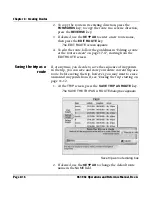
Страница 381: ...earing 1 30 12 3 cross track error 12 3 12 9 DGPS GPS 1 12 3 4 12 9 displaying 12 2 echo sounder 12 2 screen acknowledging messages on 1 30 functions available on 12 2 overview 3 9 symbols color coding See Symbols 12 3 waypoint 12 3 ARCS charts See HCRF charts Arrow keys See Keys Avoidance points alarms See Alarms changing 7 13 copying and changing an existing avoidance point 7 12 definition of 3 ...

Страница 382: ...ints 7 7 A 2 symbol See Symbols viewing position of 7 15 B Beacon receiver See DGPS receiver Bearing definition of 1 15 Brightness See Display and Keys BSB and ChartPack charts Also see Charts deleting 13 64 features 2 5 introduction to 1 19 loading 13 37 marking usage prefer normal avoid 13 67 purchasing 13 37 size of CD space available on 961 962 13 37 storing protecting 2 10 C Caution autopilot...

Страница 383: ...ates Position and Vessel rulers on See Distance scale bar selecting objects on 4 18 setting distances on 1 21 symbols on See Symbols understanding 1 17 2 4 4 4 update regions 13 35 views A and B 1 18 3 6 4 16 13 11 13 32 Charts automatic changing of 4 2 BSB and ChartPack charts See BSB and ChartPack charts cautions for using 1 4 changing orientation of a chart 4 2 11 5 13 28 13 32 changing usage o...

Страница 384: ...ng coordinates 1 27 specifying new 4 5 updating a waypoint s 6 15 Course line definition of 3 2 Course over ground COG accuracy of measurements 5 4 definition of 1 15 displaying 4 15 5 2 10 6 Cross track error XTE 3 D steer screen and 10 4 alarms See Alarms changing XTE scale setting 13 3 cross track scale options 13 4 definition of 1 15 displaying on the steer screens 10 5 using to restart track ...

Страница 385: ...able datums 13 12 Defaults avoidance point name W0000 4 24 7 11 chart orientation chart up 4 2 defaults on key See Keys definition of G 2 distance calculation rhumb line 13 23 end date and time 9 8 in demo mode 13 72 loran TDs setting on 5 10 magnetic variation of compass auto 13 22 route name R0000 4 25 saved waypoints 13 6 start date and time 9 8 track name T0000 9 7 waypoint name SAVEDXX 6 11 6...

Страница 386: ...display settings 13 2 Distance and bearing avoidance points and 7 15 calculating 13 23 displaying 6 16 8 14 10 5 11 3 entering data in field 2 8 searching for waypoints by 6 8 sorting avoidance points by 7 7 7 8 Distance and speed units changing measurements 13 4 changing precision 12 9 13 5 Distance scale bar 1 21 13 34 E Echo sounder alarms See Alarms definition of G 3 displaying on chart screen...

Страница 387: ...ections differential See DGPS definition of 1 15 G 3 features 2 2 receiver 5 2 adjusting satellite tracking 14 6 changing the speed averaging value 14 5 software version used by 14 6 specifications A 4 troubleshooting 14 4 viewing status 14 9 satellites 5 2 5 4 14 6 14 9 signal monitoring 1 12 2 14 software version serial number See Service time date and 13 73 understanding 2 11 Great circle 13 23...

Страница 388: ...4 13 48 13 61 nontransferrable 13 44 Skipper 4 15 13 41 13 44 13 45 13 61 switching from Skipper to Navigator or vice versa 13 53 loading and updating 13 40 13 43 13 45 logging 13 42 marking usage prefer normal avoid 13 67 Northstar operator code See NOC permit disk 13 40 13 43 13 45 13 50 purchasing 13 37 13 40 storing protecting 2 10 13 42 13 43 technical support 13 40 troubleshooting See Troubl...

Страница 389: ... key 10 10 ALARM ON OFF menu key 12 10 ALL CHARTS menu key 4 9 ALL menu key 14 14 ALWAYS OVERWRITE menu key 13 38 ARROW keys on keypad 3 32 4 19 beeping of 1 12 BOTH HEADS menu key 3 5 BRG TIME menu key 3 19 11 3 BRIGHTNESS key 2 4 3 27 CANCEL DEMO menu key 13 72 CANCEL menu key 3 28 CHANGE SETTINGS menu key 3 10 12 9 CHART function key 1 16 3 6 4 4 5 10 6 3 7 3 8 3 9 3 10 11 CHART INVENTORY menu ...

Страница 390: ...13 ERASE menu key 3 23 8 25 9 12 ERASE WAYPT menu key 6 16 ERASURES menu key 3 19 11 12 FOLLOW menu key 3 23 10 7 FOLLOW NOW menu key 10 9 FORWARDS menu key 8 16 function keys overview 1 16 3 5 13 11 GO BACKWARDS menu key 11 11 GO DIRECT menu key 11 9 13 21 GO NOW menu key 1 26 10 16 10 18 GO TO menu key 1 21 3 7 4 5 10 18 GO TO NEW COORDS menu key 3 19 11 6 GO TO SELECTION menu key 3 19 10 20 11 ...

Страница 391: ... menu key 8 15 NAVIGATION SETUP menu key 3 13 13 10 NEVER OVERWRITE menu key 13 38 NEW AVOID menu key 3 27 7 11 NEW CHART menu key 1 21 3 7 4 8 NEW ROUTE menu key 3 23 8 12 NEW TRACK menu key 3 25 9 5 NEW WAYPT menu key 3 21 6 12 NEWEST VERSION menu key 13 38 NEXT COLOR menu key 3 25 9 8 OFF CHART menu key 8 3 9 3 ON CHART menu key 3 23 8 3 9 3 10 11 OPTION menu key 13 39 OUT key 1 19 3 31 4 3 9 4...

Страница 392: ...SOFTER menu key 3 11 12 11 STAR function key 1 17 3 9 5 2 6 12 8 13 12 4 13 2 14 2 START DEMO menu key 13 72 START menu key 13 71 START SAVING menu key 3 25 9 5 START SAVING ROUTE menu key 8 6 STEER function key 1 16 3 15 5 2 10 3 STOP NAV menu key 3 16 11 15 STOP SAVING menu key 9 10 STOP SAVING ROUTE menu key 8 12 STORE AS WAYPT ROUTE menu key 4 22 6 9 8 9 TDS LAT LON menu key 4 5 10 15 13 71 TD...

Страница 393: ...efine waypoints 3 20 Latitude definition of 1 15 Leg adding waypoints to 8 20 8 22 definition of 1 15 3 2 3 22 8 2 G 4 joining leg as new desired track 4 31 joining leg to route 10 9 10 12 joining leg to trip 11 10 leg up orientation See Charts changing the orientation of a chart past trip leg 13 35 Licenses See HCRF charts licenses Local waypoints definition of 6 7 Log files creating for chart an...

Страница 394: ...sic terms 1 14 3 2 cautions 1 3 1 11 13 42 changing the navigation settings 13 10 coordinates and See Coordinates demo mode 13 69 DGPS and See DGPS displaying nav data 1 23 features 2 2 following a route from the chart screen 10 10 following a route from the routes screen 10 6 going to a point on the chart screen 10 14 going to a waypoint from the waypoints screen 10 17 going to coordinates on the...

Страница 395: ...word entering 13 10 obtaining 13 7 Permit disk See HCRF charts permit disk Phantom loran See Loran Plotter function definition of 2 4 Ports See NMEA and SC 104 Position accuracy of See Accuracy coordinates and See Coordinates DGPS GPS and See DGPS and GPS displaying on the chart screen 4 15 saving 3 28 6 11 specifications A 2 vessel s See Vessel Position fix definition of 2 2 PPNM definition of 13...

Страница 396: ...ing waypoints to 4 26 8 19 8 22 changing 4 33 4 34 8 17 8 21 copying and changing an existing route 8 15 definition of 1 15 3 22 8 2 G 6 deleting a route point on the chart screen 4 37 8 23 deleting waypoints from 8 23 displaying 8 3 8 4 8 6 8 12 erasing a route 8 24 following a route 10 6 10 10 10 11 going to a selected route point on the chart screen 4 27 joining a route leg from the chart scree...

Страница 397: ...avoidance points 7 8 for charts 4 10 13 65 13 69 for permits 13 66 for routes 8 7 for waypoints 6 7 6 8 A 2 Security system turning on 13 9 Selective availability definition of 2 12 G 6 Serial numbers See Service Service getting technical support 1 7 HCRF charts 13 40 log files for 961 962 14 16 receiver setup GPS DGPS 14 4 returning the 961 962 for repair 1 7 14 19 RMA number 1 8 14 19 screen 3 1...

Страница 398: ... sounder changing setup 3 14 legs past legs turning on or off display 13 35 loran GRI changing preferred 13 20 loran phantom loran turning on or off display 13 33 magnetic variation selecting auto or manual calculation 13 22 navigation setup changing 13 10 navigation changing setup 3 13 NOC entering 13 62 orientation changing 13 28 ports changing setup 3 15 range rings turning on or off display 13...

Страница 399: ...igation A 1 position specifications A 2 steer screens A 2 storing sorting avoidance points waypoints routes tracks A 2 trip A 3 waypoint and route storage A 2 waypoints A 3 Speed averaging value 5 2 Speed over ground SOG accuracy of 5 4 definition of 1 15 displaying 4 15 5 2 10 6 troubleshooting 14 5 Star function key See Keys Startup See Turning the 961 962 on Station coverage bar 4 11 4 13 12 15...

Страница 400: ...9 range rings 1 20 removing from chart screen 4 14 routes 13 29 time on tide graph 12 14 tracks 9 3 9 5 trip 13 29 vessel 1 19 1 25 vessel track predictor line 1 26 waypoints 6 4 6 7 6 11 10 4 13 25 13 26 13 29 System specifications See Specifications T TDs See Loran Technical support See Service Test power switch 3 5 Tide station bar 12 13 TideTrack changing tide height display units 13 5 definit...

Страница 401: ... 9 10 color selection for 9 8 9 10 9 11 definition of 1 15 3 24 9 2 displaying 9 3 9 4 entering description of 9 11 erasing 9 12 making a new track 9 7 9 9 master track 9 2 9 5 naming changing name 9 11 default 9 7 maximum length 9 7 sorting by name 9 6 restarting 4 7 10 19 11 14 screen overview 3 24 sorting 9 6 speed of system and 9 3 symbol See Symbols Transducer See Echo sounder Trip adding cur...

Страница 402: ... 14 3 control head and processor 3 5 DGPS 5 6 HCRF charts 13 46 13 48 13 55 SOG 14 5 Turning the 961 962 off 1 13 3 4 Turning the 961 962 on 1 9 1 12 3 3 U Update CD See HCRF update CD and Maintaining the 961 962 installing software updates User permit See HCRF charts user permit User preferences definition of 14 10 V Vessel centering on chart 1 25 orientation on steer screens 10 5 position on cha...

Страница 403: ...aypoints 10 8 10 15 10 17 11 6 11 9 11 10 list of displaying 6 5 11 3 11 4 sorting 6 6 local waypoints definition of 6 7 making a new waypoint on echo sounder screens 6 2 on the chart screen 4 22 6 8 on the waypoints screen 6 12 using the save key 6 11 13 6 maximum number of 2 3 6 8 13 6 moving on a route 8 21 naming default 4 25 displaying names 6 4 13 26 maximum length 4 25 procedure 8 9 unique ...

Страница 404: ...s function key See Keys Website address HCRF charts 13 37 13 43 Northstar 1 7 X XTE See Cross track error Z Zero mark definition of 12 14 Zoom chart scale and See Chart scale chart screen and 1 19 3 31 4 3 ClearZoom 3 13 13 28 moving cursor with 4 18 on currents overlay 12 16 ...

Отзывы: