UNCLASSIFIED
Code:
Date:
Issue:
Revision:
Page:
GMV-magicGNSS-MAN-0002
05 July 2018
1
2
29 of 44
magicGNSSUT
GMV 2018; all rights reserved
UNCLASSIFIED
magicGNSS User Terminal Manual
3.3.4.1.
Configuring an External Receiver
3.3.4.1.1.
TCP/IP
From the Add Receiver panel (Settings/My Receivers/Add receiver), select TCP, and a panel will expand
with the Host (IP or URL) and Port fields, to be filled by the user. Once filled, the user shall touch the
“Test” button, and the app will indicate whether the connection was successful or not. Once properly
filled and checked, the user shall name the receiver and click the Save button i.e. disk in the Top Bar.
3.3.4.2.
PPP Outputs
NMEA GPGGA definition:
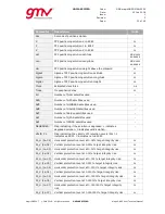
Standard GPGGA NMEA (please see standard NMEA reference for this message):
Timestamp
Latitude
Longitude
Latitude direction
Longitude direction
GPS Quality Indicator
Number of Satellites in Use
Horizontal Dilution of Precision
Antenna altitude above sea level
Units of altitude
Geoidal separation
Units of geoidal separation
Age of DGPS data
DGPS reference station id
Example:
$GPGGA,235942.00,4035.48110204,N,00342.40079690,W,9,11,0.0,753.094,M,51.938,M,,*7F
NMEA PGMVP definition:
Same as GPGGA with extended fields:
Timestamp
Latitude
Longitude
Latitude direction
Longitude direction
GPS Quality Indicator
Number of Satellites in Use
Horizontal Dilution of Precision
Antenna altitude above sea level
Units of altitude
Geoidal separation
Units of geoidal separation
Age of DGPS data
DGPS reference station id.
Kalman Sigma North [m]
Kalman Sigma East [m]
Kalman Sigma Up [m]
Clock Bias [ns]
Tropospheric Zenith Delay [m]
Horizontal Protection Level [m]
Vertical Protection Level [m]
Number of GPS satellites used
Number of GLONASS satellites used
Number of Galileo satellites used
Number of BeiDou satellites used
Number of QZSS satellites used
Example:
$PGMVP,235942.00,4035.48110204,N,00342.40079690,W,9,11,0.0,753.094,M,51.938,M,,,0.0028
90,0.003533,0.006412,8.373966,2.223864,0.152078,0.197840,7,0,4,0,0*5B
NMEA PGMVA definition:
Same as GPGGA with protection levels in meters:
Timestamp
Latitude
Longitude
Latitude direction
Longitude direction
GPS Quality Indicator
Number of Satellites in Use
Horizontal Dilution of Precision
Antenna altitude above sea level
Units of altitude
Geoidal separation
Units of geoidal separation
Age of DGPS data
DGPS reference station id.
Horizontal Protection Level [m]
Vertical Protection Level [m]


