9-1
190-01007-03 Rev. B
Garmin GTN 725/750 Pilot’s Guide
Foreword
Getting
Started
Audio &
Xpdr Ctrl
Com/Nav
FPL
Direct-To
Proc
Charts
Wpt Info
Map
Traffic
Terrain
Weather
Nearest
Music
Utilities
System
Messages
Symbols
Appendix
Index
9
MAP
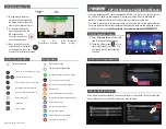
The Map page is used to provide situational awareness in flight. The Map
page can display the following information:
• Airports, NAVAIDs, airspace,
airways, land data (highways,
cities, lakes, rivers, borders, etc.)
with names
•
Wind direction and speed
• Icons for enabled map features
• Aircraft icon (with the nose
representing present position)
• Nav range ring
• Flight plan legs
• Topography scale
• Topography data
• XM NEXRAD Weather (Optional)
• ChartView Overlay
• Terrain Overlay
• Traffic Overlay
Back to
Previous Page
Range Keys
Touch to Zoom
In and Out
Aircraft Symbol
(Present Position)
Active Flight
Plan Leg
CDI
From - To - Next
Waypoints
Map Menu Options
CDI - Select Nav Source
OBS - Select Manual or Auto Sequencing
Nav Range Ring
Touch to View Messages
North Indicator
Touch To Edit FPL
Map Orientation
Figure 9-1 Map Page Description
Содержание GTN 750
Страница 417: ......


