


Page 35
CPV550
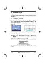
6. USING FIND SERVICES & MORE FUNCTION
With a C-MAP NT
+
/MAX C-CARD installed the GPS Chart Plotter allows you to search for
a Port Service, Port, Tide Stations, Wrecks, Obstructions, POIs, Lakes, User Points, or GPS
Coordinates.
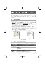
6.0
PORT SERVICES
With a C-MAP NT
+
/MAX C-CARD installed, the GPS Chart Plotter can find Port Services
contained on the map.
1. From the chart page, press
[MENU]
. Move the ShuttlePoint knob to highlight
FIND
SERVICES
and press
[ENT]
or move the ShuttlePoint knob to the right.
2. Move the ShuttlePoint knob to highlight
PORT SERVICES
and press
[ENT]
or move the
ShuttlePoint knob to the right.
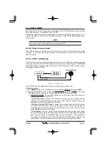
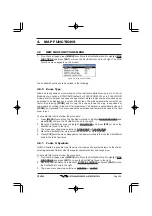
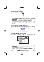
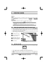
3. A popup window will be shown with the Port Services.
4. Move the ShuttlePoint knob to highlight the desired Service and press
[ENT]
.
5. Another popup window will show the name, distance and position of the Services closest
to your location.
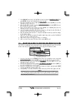
6. Using the ShuttlePoint knob, highlight the desired Service and press
[ENT]
which will
show the name and phone number of the Service.
7. Press
[CLR]
which will show the available Services at the location.
8. Press
[CLR]
to show the actual position of the Services.
Figure 6.0 - Port Services
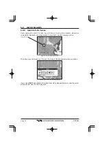
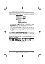
6.1
OTHER AVAILABLE SEARCHES
PORT
:
Shows the closest ports stored on the C-CARD in distance order. Pressing
[MENU]
shows
the list of all ports in alphabetic order; press
[MENU]
again to search the port by name.
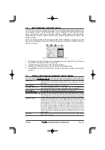
TIDE STATIONS
:
Shows the closest Tide Stations and the relating information of the selected tide station.
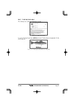
WRECKS
:
Shows the closest Wrecks and the relating information of the selected wreck.
OBSTRUCTIONS
:
Shows the closest Obstructions and the relating information of the selected obstruction.
LAKES INFORMATION :
Shows a list of information about the closest Lakes and the relating information of the
selected lake.
LAKES BY NAME
:
Shows the list of all lakes stored on the C-CARD in alphabetic order. Pressing
[MENU]
to
insert the Lake name.
POINTS OF INTEREST :
Searches and shows for information on the selected Point Of Interest.
USER POINTS
:
Searches and shows on the Chart page for the closest User Points (Marks or Waypoints).
COORDINATES
:
Searches and shows on the Chart page GPS for GPS Coordinates.
INFORMATION
:
Searches and shows for information on the selected point.


