23
Airspace
The AirMap can show the following airspaces: Class B and C airspace,
control zones, control areas (CTA), Terminal Control Areas (TMA), pro-
hibited, restricted, MOA’s (including training, danger, and caution areas),
and alert areas.
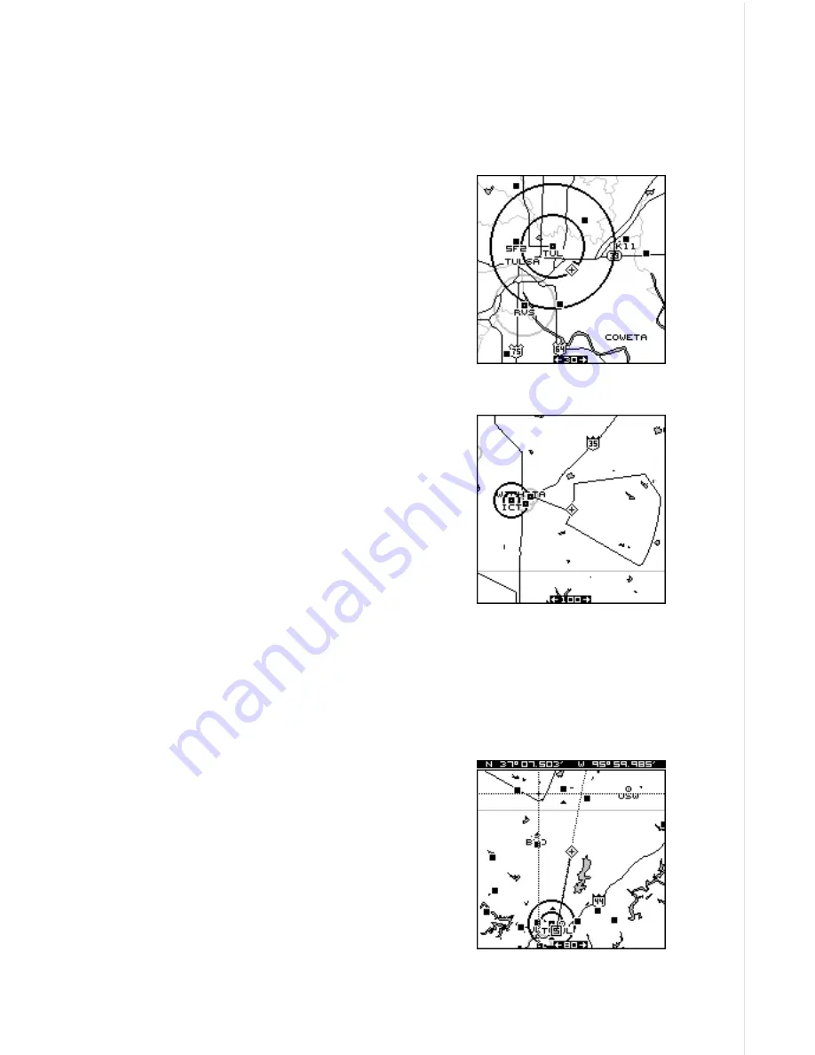
In this example, the Class C airspace surround-
ing Tulsa International airport (TUL) is clearly
visible as two dark circles. The control zone
airspace around Richard Jones (Riverside) air-
port (RVS) is shown in gray.
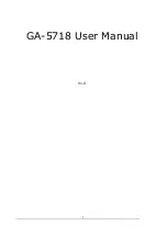
This screen shows the Eureka MOA east of
Wichita, Kansas on the 100 nautical mile range.
The airspace defaults for the AirMap are as
follows: Class B, C, D, Prohibited, Restricted,
and MOA’s are on. All other airspaces default
off. An airspace alarm can be set that will warn
you of any of the above airspaces are within a preset radius of your posi-
tion. Another airspace alarm will “look-ahead” and tell you how soon you
will cross into an airspace. See the alarms section fro more information.
Airspace Information
The AirMap lets you identify an airspace with-
out physically entering it by using the cursor.
To do this, press any arrow key while a map is
showing. In this example, we’re using Map 1.
The cursor appears. Now move the cursor to
the desired airspace as shown at right. (Note:
You may have to zoom-in and/or zoom-out to
view the airspace.)
Summary of Contents for AirMap
Page 1: ...INSTALLATION AND OPERATION INSTRUCTIONS AirMap TM VERSION 3 3...
Page 82: ...78 WINDOW BOXES These boxes are used on Map 3 and Nav 1 only 1 2 3 4 5 6 7 8 9 10 11 12...
Page 83: ...79 13 14 15 16...
Page 84: ...80 WINDOW GROUPS This is a listing of window groups A through O A B C D E F G H I J K L...
Page 85: ...81 M N O...


