


Guidance
Terminology
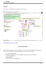
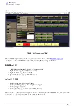
only) calculate altitude above sea-level using a pressure sensor.
navX-sensor (Aero Edition only) altitude has a range of 0 to 25,000 meters.
Important Note: Altitude is calculated based upon barometric pressure. In order to accurately estimate
altitude above the earth, navX-sensor should be configured with the sea-level barometric pressure in the
surrounding area. This setting can be configured via the navX-sensor
.
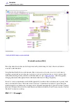
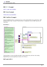
3-D Coordinate System
navX-sensor 3-D Coordinate System
A 3-D Coordinate System uses one or more numbers (coordinates), often used to uniquely determine the
position of a point within a space measured by that system. The origin of a 3-D coordinate system has a
value of (0, 0, 0).
navX-sensors feature gyroscopes, accelerometers and magnetometers which are all aligned with each
other in a 3-D coordinate system. Each sensor type measures values with respect to that coordinate
system, as follows:
Gyroscopes: measure rotation (as shown in the green arrows) about each axis. The coordinate system
origin represents the center of the navX-sensor circuit board.
Accelerometers: measure acceleration, where the origin represents the position in space at which the
previous acceleration sample was acquired.
Magnetometers: measure earth’s magnetic field, where the origin represents the center of the navX-
sensor circuit board.
64


