
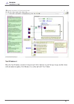


Guidance
Terminology
Y
Forward/Backward
+ Forward / – Backward
Z
Up/Down
+ Up / – Down
Because the gyroscope and accelerometer axes are aligned, a navX-sensor measures linear acceleration in
the same set of 3 axes used to measure Pitch, Roll and Yaw. However unlike Pitch, Roll and Yaw,
acceleration measures linear motion rather than rotation, and is measured in units of G, with a range of +/-
2.0.
Compass Heading
A compass measures the earth’s magnetic field and indicates the current direction (heading) relative to
magnetic north (N). Compass Heading is measured in degrees and is similar to Yaw, but has a few key
differences:
Compass Heading has a range of 0-360 (where magnetic north is 0).
Compass Heading is absolute – it is referenced to magnetic north, and thus Compass Heading
does not drift over time
Important Note 1: Compass Heading relies upon being able to measure the earth’s magnetic field. Since
the earth’s magnetic field is weak, Compass Heading may not be able to measure earth’s magnetic
field when the compass is near a strong magnetic field such as that generated by a motor.
Magnetic North is not exactly the same as True North
. Your robot can calculate True
North given a Magnetic North reading, as long as the current declination is known. Declination is a
measure of the difference in angle between Magnetic North and True North, and changes depending upon
your location on earth, and also changes over time at that same location. An
is provided
allowing one to calculate declination for a given earth location and date.
Altitude
Altitude is a measure of distance in the “up” direction from a reference; navX-sensors (Aero Edition
63


