Revision 6 Feb/2009
B-9
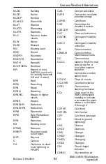
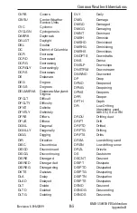
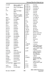
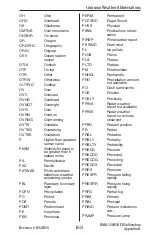
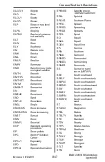
ICGICIP
Icing in clouds and
in precipitation
ICGIP
Icing in precipitation
ID Idaho
IFR Instrument
flight
rules
IL Illinois
IMC
Instrument meteo-
rolgical conditions
IMDT Immediate
IMDTLY Immediately
IMPL Impulse
IMPLS Impulses
IMPT Important
INCL Include
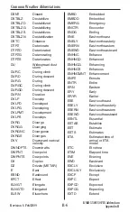
INCLD Included
INCLG Including
INCLS Includes
INCR Increase
INCRD Increased
INCRG Increasing
INCRGLY Increasingly
INCRS Increases
INDC Indicate
INDCD Indicated
INDCG Indicating
INDCS Indicates
INDEF Indefinite
INFO Information
INLD Inland
INSTBY Instability
INTCNTL Intercontinental
INTER
Intermittent
INTL International
INTMD Intermediate
INTMT Intermittent
INTMTLY Intermittently
INTR Interior
INTRMTRGN Intermountain
region
INTS Intense
INTSFCN Intensification
INTSFY Intensify
INTSFYD Intensified
INTSFYG Intensifying
INTSFYS Intensifies
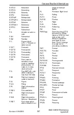
INTSTY
Intensity
INTVL Interval
INVRN Inversion
IOVC In
overcast
INVOF
In vicinity of
IP Ice
pellets
IPV Improve
IPVG Improving
IR
Infrared
ISOL Isolate
ISOLD Isolated
JCTN Junction
JTSTR Jet
stream
KFRST Killing
frost
KLYR
Smoke layer aloft
KOCTY
Smoke over city
KS
Kansas
KT Knots
KY Kentucky
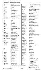
L
Left
LA Louisiana
LABRDR Labrador
LAPS
Local Analysis and
Prediction System
LAMP
Local AWIPS MOS
Program
LAST
Last observation
before a break in
coverage at a
manual station
LAT Latitude
LAWRS Limited
aviation
weather reporting
station
LCL
Local or Lifted
condensation level
LCLY Locally
LCTD Located
LCTN Location
Common Weather Abbreviations
KMD 550/850 FIS Addendum
Appendix B

