A-6
Revision 6 Feb/2009
KMD 550/850 FIS Addendum
Appendix A
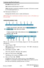
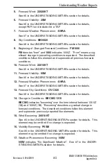
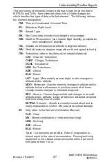
Understanding Weather Reports
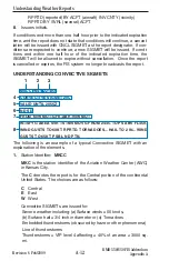
18.
Sky Conditions Becoming:
SKC
See #8 in the UNDERSTANDING METARs section for details. This
element may be omitted if no change is expected.
19.
Change in Conditions:
TEMPO 2022
TEMPO
indicates “temporary” changes expected as described
between 2000Z (
20
)and 2200Z (
22
). “Temporary” indicates a tem-
porary fluctuation in conditions, usually lasting less than one hour.
The described conditions follow this element.
20.
Low Level Windshear:
WS015/30045KT
WS
indicates “windshear” not associated with convective activity.
015
indicates the windshear is expected at 1500 feet. AGL Wind is
expected from 300° (
300
) at 45 knots (
45KT
).
21.
Change in Conditions:
PROB40 0407
PROB40
indicates a 40% “probability” of described conditions
occurring between 0400Z (
04
)and 0700Z (
07
). The described con-
ditions follow this element.
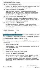
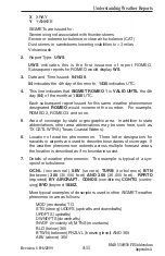
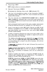
UNDERSTANDING PIREPS
The following is an example of a typical PIREP with an explanation of
the elements.
1.
Station Identifier:
KCRW
This is the station identifier of the nearest weather reporting location
to the reported conditions.
2.
Report Type:
UA
Reports will be routine (UA) or urgent (UUA).
3.
Location:
OV KBKW 360015-KCRW
OV
indicates the report is in relation to a VOR.
KBKW
is the VOR
identifier, in this case Beckley VOR.
360015-KCRW
indicates posi-
tion as related to the VOR. In this case,
15
miles out on the
360
degree radial.
KCRW
indicates this is a leg to the Charleston, West
Virginia VOR.
KCRW UA/OV KBKW 360015-KCRW/TM 1815/FL120/TP BE99/SK IMC/
WX RA/TA M08/WV 290030/TB LGT-MDT/IC LGT RIME/RM MDT MXD
ICG DURGC KROA NWBND FL080-100 1750Z
1
3
2

