Revision 6 Feb/2009
A-11
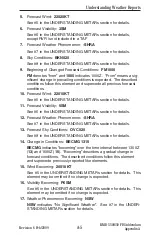
X
XRAY
Y
YANKEE
SIGMETs are issued for:
Severe icing not associated with thunderstorms
Severe or extreme turbulence or clear air turbulence (CAT)
Dust storms or sandstorms lowering visibilities to < 3 miles
Volcanic ash
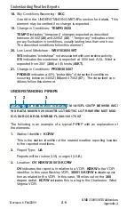
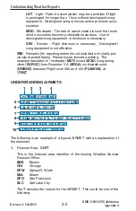
2.
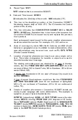
Report Type:
UWS
UWS
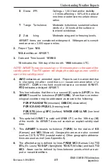
indicates this is the first issuance of report ROMEO.
Subsequent reports for ROMEO would display
WS
.
3.
Date and Time Issued:
041430
.
04
indicates the 4th day of the month.
1430
indicates UTC.
4.
This line indicates that
SIGMET ROMEO 1
is
VALID UNTIL
the 4th
day (
04
) of the month at
1830
UTC.
Each subsequent report issued for this same weather phenomenon
designated
ROMEO
would increment the number. For example,
ROMEO 2, ROMEO 3 and so on.
5
.
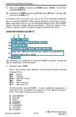
Area of coverage by state or geographic area. In addition to state
abbreviations, other area abbreviations may be seen here, such as,
TX CSTL WTRS (Texas Coastal Waters).
6
.
Location of weather phenomenon. Three letter designators for
navaids or airports are used to describe boundaries of coverage. If
the weather phenomenon extends across multiple forecast areas,
the location is described as if no boundaries exist.
7
.
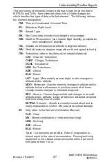
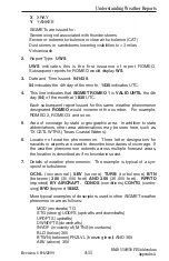
Details of weather phenomenon. The example is typical of a syn-
opsis for turbulence:
OCNL
(occasional)
SEV
(severe)
TURB
(turbulence)
BTN
(between)
300
(30,000 feet)
AND 360
(36,000 feet).
RPRTD
(reported)
BY AIRCRAFT. CONDS
(conditions)
CONTG
(contin-
uing)
BYD
(beyond
1830Z.
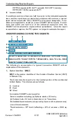
More typical examples of descriptors used in other SIGMET weather
phenomenon are as follows:
MOD (moderate) TO
STG (strong) UDDFS (updrafts and downdrafts)
UPDFTS (updrafts)
DWNDFTS (downdrafts)
INVOF (in vicinity of) MTNS (mountains)
BLO (below) 360
BTWN (between) FRZLVL (freezing level) AND 360
ABV (above) 360
KMD 550/850 FIS Addendum
Appendix A
Understanding Weather Reports

