


Garmin GPSMAP 695/696 Owner’s Manual
190-00919-00 Rev. D
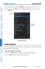
appendix a
137
Overview
GPS Navigation
Flight Planning
Hazar
d
Avoidance
Additional F
eatur
es
Appendices
Index
• Ground Track (TRK)—direction of aircraft movement relative to a ground
position.
• Minimum Safe Altitude (MSA)—uses Grid MORAs to determine a safe altitude
within ten miles of the aircraft’s present position.
• Next Waypoint—the next waypoint in the flight plan or direct-to route.
• Sunrise—the time at which the sun rises on this day.
• Sunset—the time at which the sun sets on this day.
• Time (UTC)—the current time and date in Universal (UTC) time.
• Time (Local)—the current time and date in 12-hour or 24-hours format.
• Vertical Speed (VS)—the rate of climb or descent.
• Vertical Speed Required (VSR)—the vertical speed necessary to descent/climb
from a current position and altitude to the previously selected VNAV position and
altitude, based upon current groundspeed.
• Weather (Altimeter) (WX ALTIM)—the altimeter setting at the nearest METAR
reporting station.
• Weather (Dew Point) (WX DEW PT)—the dew point at the nearest weather
reporting station.
• Weather (Pressure) (WX PRESS)—the surface pressure at the nearest weather
reporting station.
• Weather (Rel. Humidity) (WX HUMIDITY)—the relative humidity at the nearest
weather reporting station.
• Weather (Temperature) (WX TEMP)—the temperature at the nearest weather
reporting station.
• Weather (Wind) (WX WIND)—the wind speed and direction at the nearest weather
reporting station.
Summary of Contents for GPSMAP 695
Page 1: ...GPSMAP 695 696 Owner s Manual Portable Aviation Receiver...
Page 2: ......
Page 3: ...Overview GPS Navigation Flight Planning Hazard Avoidance Additional Features Appendices Index...
Page 4: ......
Page 10: ...Garmin GPSMAP 695 696 Owner s Manual 190 00919 00 Rev D Warnings Cautions Notes Blank Page...
Page 209: ......