SonTek, a Xylem brand
102
RiverSurveyor S5/M9 System Manual (February 2013)
k)
No depth-lock for either the Bottom Track or Vertical Beam. Some environ-
mental conditions (such as bed conditions or grass/weeds) may also result in inva-
lid depth detection.
l)
Bottom Track not available or not installed.
m)
Battery level in the system is at 10%. Finish data collection immediately or
risk losing data. Communications will have to be re-established after installing a re-
charged battery pack.
n)
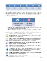
The data collection device (PC or Mobile device) is not receiving data. This
does not mean that the system is not collecting data. The system will continue to
collect data even if the communications link is lost. If using a wireless link such as
Bluetooth (range is 60 m) or Spread Spectrum radios (range is 2 km), the system
may be out of range or there may be obstacles preventing communication. Aim to
maintain direct line of sight between the system and communications device at all
times. For direct connection, most likely the cable has been disconnected.
4. Multiple discharge calculations across the same transect do not match
a. Flow conditions may have changed since you completed the last transect. This may be
the case in areas of high tidal variation or when the measurement section is downstream
of a man-made structure that regularly alters the flow conditions. Constant stage or wa-
ter level is not a clear indication the flow conditions have been maintained.
b. Be sure to keep a written record of water level at the site during the discharge meas-
urement. The water level can be referenced to a stream gauge that is permanently in-
stalled or to a staff that can be temporarily installed on the water’s edge.
c. Make sure the site depth and location that you measured for the first transect match the
measured values for the second transect in the data collected. You may have moved up
or downstream since the last transect.
d. Visible landmarks are always a good guide when making a measurement. Check the
positional and depth measurements for both transects.
e. Make sure the distance made good (DMG) is consistent between transects.
f. The acceptable error between two to four measurements is typically less than 2 to 5%,
but may be potentially higher depending on your application and the conditions.
g. The edge positions should be the same or very close. Therefore the edge distances
should be the same or similar for all transects.
5. Mobile Device
a. Be sure that the
RiverSurveyor Live for Mobile
software is installed correctly on the Mo-
bile device prior to field data collection.
b. Please use the clear plastic lanyard with the Mobile device to prevent any water damage
in the field. The Mobile device is not water resistant. Water damage is not covered by
the warranty.
c. The operational range can be affected by inclement weather.
d. The
RiverSurveyor Live for Mobile
software will automatically activate the Bluetooth
even if it is manually turned off.
It can also be activated manually with these steps:
a) Select Start on the Mobile device to open a list of Programs
Содержание SonTek River Surveyor M9
Страница 10: ......
Страница 118: ......
Страница 150: ...SonTek a Xylem brand 140 RiverSurveyor S5 M9 System Manual February 2013 Figure 126 Island Edge...


