Page 78
CP500
R
12.0 CHART PAGE
The Chart page is the main page of the GPS Chart Plotter. From this page the user can zoom
in/out, pan around the chart, show information about cartographic objects, see the exact
vessel position with the COG and SOG, place points, GOTO a destination point, show Track
history etc. The GPS Chart Plotter is provided with a Worldwide background showing C-MAP
B
Y
J
EPPESEN
NT
+
/MAX detail up to 2.0 NM. For more detail, optional C-MAP B
Y
J
EPPESEN
NT
+
/
MAX C-CARDs are used.
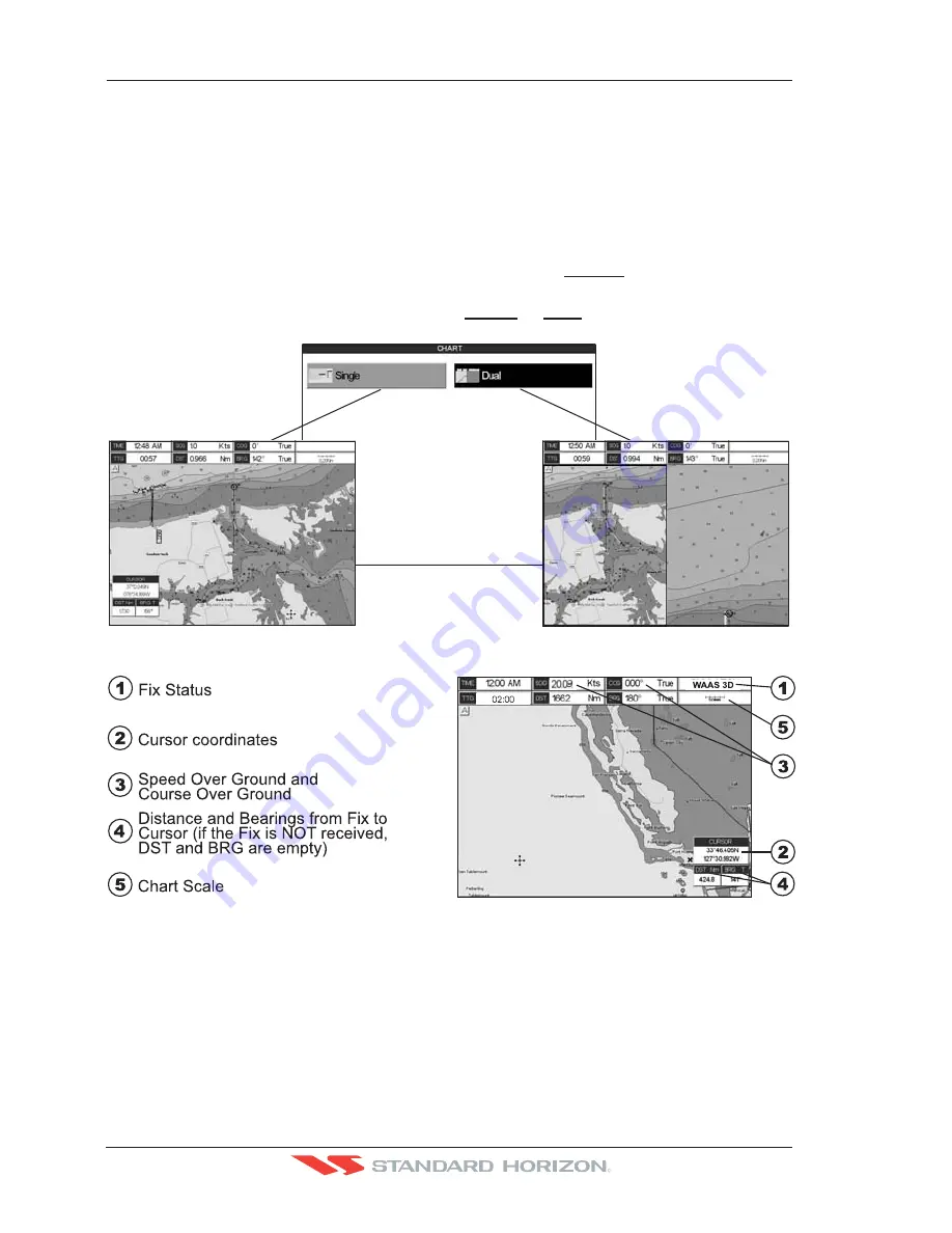
It is possible to set the chart as a single or two charts side by side.
1. Press
[MENU]
. Move the ShuttlePoint knob to highlight
CHART
and press
[ENT]
.Two
Chart page types are available: Single and Dual.
2. Move the ShuttlePoint knob to highlight
Single
or
Dual
and press
[ENT]
.
WAAS 3D
WAAS 3D
Figure 12.0 - Chart selection menu
Figure 12.0a - Example of Charts and general text area
12.0.0 Window Selections
The window on the right side of the Chart Page is called the General Window and it may
be edited, customized or even changed to show a highway or compass tape.
Содержание CP500
Страница 1: ......
Страница 2: ...CP500 12 WAAS GPS Chart Plotter Owner s Manual GPS Chart Plotters R ...
Страница 5: ...Page 6 CP500 R ...
Страница 31: ...Page 32 CP500 R ...
Страница 41: ...Page 42 CP500 R ...
Страница 53: ...Page 54 CP500 R ...
Страница 61: ...Page 62 CP500 R ...
Страница 69: ...Page 70 CP500 R ...
Страница 73: ...Page 74 CP500 R ...
Страница 99: ...Page 100 CP500 R ...
Страница 109: ...Page 110 CP500 R ...
Страница 115: ...Page 116 CP500 R ...
Страница 119: ...Page 120 CP500 R ...
Страница 126: ......


