CP500
Page 43
R
5. MAX CARTOGRAPHY OVERVIEW
5.0
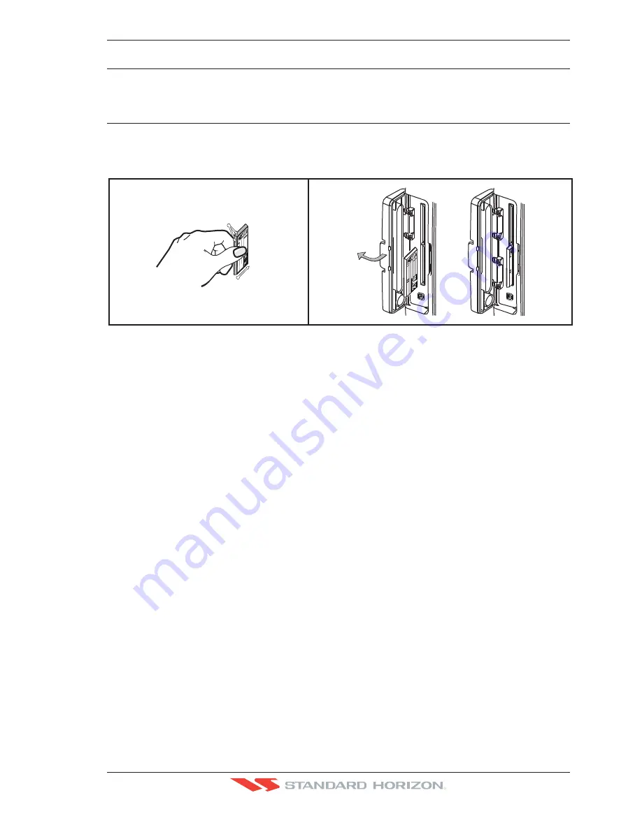
INSERTING THE C-CARD
Hold the C-CARD by the long inclined side so that you can see the C-MAP B
Y
J
EPPESEN
label.
Open the door, gently push the C-CARD into the slot: push the C-CARD in as far as it will
go, then close the door.
code
code
datedate
ser.n
ser.n
class
class
cod
e
code
dat
e
date
ser.n
ser.
n
class
date
code
ser.n
.
class
INCLINED
SIDES
INSERTION
DIRECTION
cod
e
dat
e
ser.
n
clas
s
A
Figure 5.0 - Inserting C-CARD
C-MAP B
Y
J
EPPESEN
MAX is a major evolution of the product technology. Key points are:
Data Features
· ISO Certification
(electronic chart production process with quality certification)
· Extra Large Coverage
(all the C-Map electronic chart detail and a huge coverage
without having to change cartridge)
· Official data source (data based on use of official data sources Hydrographic Offices
Release)
· Detailed World Background
(worldwide background chart with details)
· Depths & Land Elevation (color shading of sea depth and land altitude for improved
chart appearance)
· Bathymetric & Spot Soundings
(Data Base with depth and bathy information for an
extraordinary view of the seabed depth)
· Detailed Port Plan to information
(complete port and marina charts with detail)
· Search & Find
(quickly locates chart contents and objects)
· Tides Preview
(allows viewing of current, future and past tide cycles of specific NOAA
Tide Stations)
· Dynamic Currents
(current arrows showing speed and direction of current, future and
past currents)
· Dynamic Nav-Aids
(selection to enable the Nav-Aids to blink to their specifications
and appear on the chart in color)
· Port Info
(searchable data base of service in ports)
· Enhanced Port Info & Roads
(searchable data base of detailed information that
include facilities and services in ports and surrounding areas)
· Object Info (moving cursor over object to show restricted area details and related
information)
· Quick Info (moving cursor over wrecks, shoals, Nav-Aids to show restricted area
details and related information and object to show details)
Содержание CP500
Страница 1: ......
Страница 2: ...CP500 12 WAAS GPS Chart Plotter Owner s Manual GPS Chart Plotters R ...
Страница 5: ...Page 6 CP500 R ...
Страница 31: ...Page 32 CP500 R ...
Страница 41: ...Page 42 CP500 R ...
Страница 53: ...Page 54 CP500 R ...
Страница 61: ...Page 62 CP500 R ...
Страница 69: ...Page 70 CP500 R ...
Страница 73: ...Page 74 CP500 R ...
Страница 99: ...Page 100 CP500 R ...
Страница 109: ...Page 110 CP500 R ...
Страница 115: ...Page 116 CP500 R ...
Страница 119: ...Page 120 CP500 R ...
Страница 126: ......


