124 |
Maps |
Argus Radar Operator Manual
Appearance of the highlighting (Focusing)
of a line of the map.
4.
To delete the line, just press the right SK (corresponding to “Cancel Line”) when the line is
highlighted.
5.
To move the line, when it is highlighted, press the left SK (corresponding to “Hook Line”); note
that only the extremity of the selected side will be hooked and the other end of the segment
will remain in its position. During the movement, the line is drawn with a different style.
When the extremity of the line is hooked to the
trackball (during the movement) the Help line will
show “Place Line”, “Unused” and “Close”, giving the
possibility to place the point of the segment where
desired with the left SK and to close the segment
on another point of the map (for example to close
a polygon) with the right SK.
In case the operator choose to press the right SK
to close the line to another point of the map, the
other point must be reasonably near (50 pixels),
otherwise the system will show: “WRONG: No Point
Near Enough”.
6.
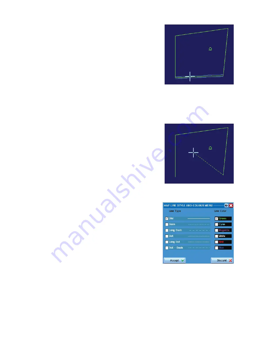
To modify the highlighted line, press the centre SK and the following window will appear:
The buttons of the left column allow changing
the line style and the ones of the right column
allow changing the line color. The “Accept” but-
ton must be pressed t
o apply the modifications,
otherwise press “Discard” to return to the previous
settings.
The same operation can be performed also for the other types of objects by pressing “Select
Text” or “Select Symbol”. The procedure is the same, the string “Line” is replaced by “Text” or
“Sym”. In case of text changing, it is also possible to correct a wrong text by pressing the
“Change Text” button. The menus used to implement the modifications are shown on the
next page in the text color menu example.
¼
Note:
It is possible to open the ”Line Type”, “Text Color” and “Symbol Type” menus also
without selecting any object, just by clicking on the corresponding black label. This is now
the preset and will be applied for the next object of the actual type that will be inserted. For
example, having a map with 4 green standard lines, clicking in the black label related to the
lines formatting and changing the color to red and the line style to dashed, the next line that
the operator will insert in the map (the 5th) will be red and dashed.
Содержание ARGUS FMCW 3G
Страница 1: ...ENGLISH ARGUSRADAR SYSTEM User Manual navico commercial com...
Страница 2: ......
Страница 149: ......
Страница 150: ...988 10185 004...


