120 |
Maps |
Argus Radar Operator Manual
•
“Map List” opens the Video Maps Menu
•
“Hide Map” hides the map temporarily from the screen, the Help lines middle suggestion
changes to “Show Map” and on the Map Name a “(Hidden)” text is added. Press the trackball’s
middle pushbutton again to show the map again
•
“Clear Map” is a shortcut to the “Undisplay Map” command. Used to delete the map perma-
nently.
Create a new map
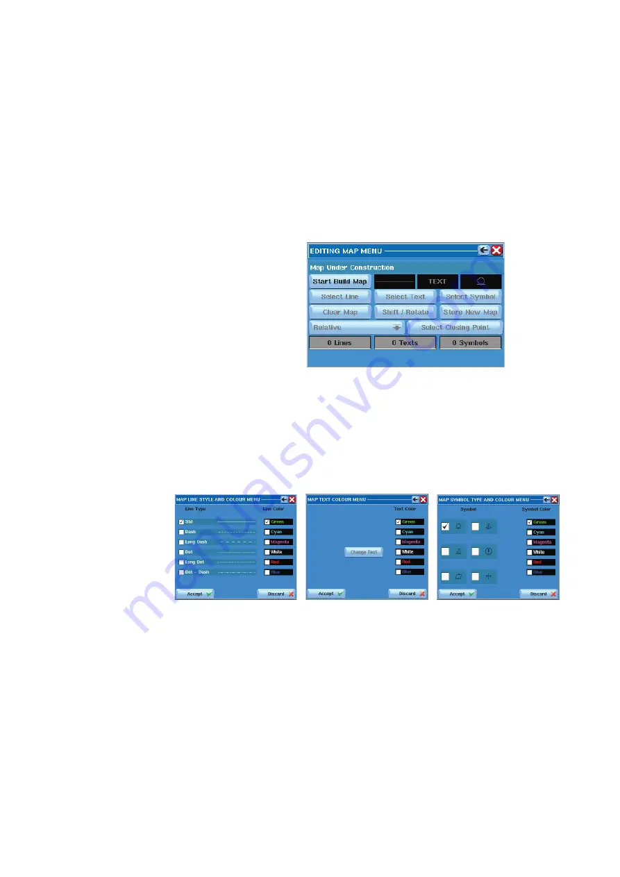
Pressing the “Create New” button, the “Edit Map Menu” will open. This menu provides all the
facilities to manage the Video Maps and this is the same menu used to edit a stored map.
To start creating a map
, the first step is to press “Start Build Map”. At the beginning, this is also
the only button enabled, the other buttons and labels will be insensitive, as shown below.
After “Start Build Map” has been pressed for the first time, its text changes to “Start New Line”
and its function changes. The labels with black background, next to the right of this button,
will also turn sensitive (Their background changes to white, when moving the cursor over
them (as a kind of focusing). The purpose of these labels is to give the operator the possibility
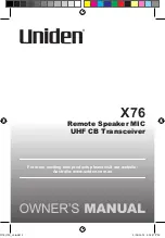
to choose the type and color of the next lines he is going to draw, the color of the next text
he is going to write and the type and color of the next symbol he is going to place. Clicking
inside each of them, the following windows will appear to make the choices.
Map color menu
When the trackball cursor is inside the PPI, the Help line will change to “Ins Line”, “Ins Text” and
“Ins Symbol” (“Ins” stands for Insert).
Inserting line:
Now, pressing the left SK on the PPI, the first point of the first segment will be placed and a
line will connect that point from the trackball cursor. Pressing it again at another location, a
segment will be drawn with the style and the color previously defined for the lines. Another
line will follow the trackball pointer from that point, so that the next point of the map will be
automatically connected to the previous one. In case a multi-line segment has to be inter-
rupted (the following point shall not be connected to the previous one), the operator has to
press “Start New Line” and place the point where desired, starting the new line. At the first
line inserted, the “Select Line” button will be enabled, because it is now possible to select and
modify a line.
When drawing the map, it is possible to automatically close the areas. For example, drawing
a square, after the 3rd line segment is drawn, it is possible to close the square with very high
Содержание ARGUS FMCW 3G
Страница 1: ...ENGLISH ARGUSRADAR SYSTEM User Manual navico commercial com...
Страница 2: ......
Страница 149: ......
Страница 150: ...988 10185 004...


