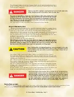
Operator’s Responsibilities
•
Ensure the boat is in top operating condition and there are no hazards that impede your moving about
the boat.
•
Ensure the bilge is clean prior to starting.
•
File a float plan, as described below, with a relative or friend.
•
Have a complete knowledge of the operation and handling characteristics of your boat.
•
Ensure that the boat is not loaded above the maximum capacity and that the load is properly distrib-
uted.
•
Have familiarity with your starting location and your goal, and the waterways between.
•
Maintain a safe speed at all times to avoid collisions.
•
Keep an eye out for changing weather conditions and respond accordingly.
•
Know and practice the navigational rules. Know and obey all federal and state regulations and operate
the boat properly around all waterway markers.
•
Maintain a clear, unobstructed view at all times, especially forward. Scan the water and avoid tunnel vi-
sion. Many boating collisions are caused by inattention.
Float Plan
A “float plan” is a written record indicating the planned destination and approximate length of time for the
outing. Sample forms are available at the Coast Guard’s website. One should be completed and left with a rela-
tive or friend prior to each trip. In case of an emergency or failure to return within a reasonable period of time,
pertinent information will be available to assist local marine police or the Coast Guard in determining whether
a search should be performed. Be sure to notify the float plan holder upon return.
Nautical Charts
Nautical charts are especially important to boaters planning trips, particularly on open waters. These
charts show the nature and shape of the coast, depths of water, general configuration and character of the
bottom. Other markings on the nautical charts include prominent landmarks, port facilities, aids to naviga-
tion, and marine hazards. Changes brought about by people and nature require that nautical charts be con-
stantly maintained and updated to aid safe navigation.
National Ocean Service (NOS) charts may be purchased either directly by mail from the NOS Distribution
Branch or through an authorized agent. There are more than 1,700 nautical chart agents who sell them.
FAA/National Aeronautical Charting Office
Distribution Division, AVN-530
6303 Ivy Lane, Suite 400
Greenbelt, MD 20770
Telephone: (301) 436-8301
Email: [email protected]
Website: http://naco.faa.gov/
Weather
Never leave the dock without first checking the local
weather forecast. Weather information is available from
television, radio, local newspaper, online or from a weather
channel on a VHF radio.
At certain times of the year, weather can change rap-
idly and boaters should always keep an eye out for weather
conditions. While boating, pay attention to the following:
•
Weather changes generally come from the west.
•
Watch for cloud build-up, especially rapid, vertically
rising clouds.
•
Sudden drop in temperature.
•
Sudden change in wind direction and/or speed.
•
On-board barometers should be checked every two-
to-three hours. A rising barometer indicates fair
weather and a rise in wind velocity; a falling barom-
eter indicates stormy or rainy weather.
What to do in severe weather:
•
Reduce speed, keeping enough power to maintain
headway.
2011 Owners Manual...Safety Knowledge...Page 1-8
Содержание prostar 190 2011
Страница 26: ...Guide to Individual Models 2011 Owners Manual Guide to Individual Models Page 4 1...
Страница 81: ......
Страница 93: ......
Страница 105: ......


