68
iGage
iG8 User Manual
State Plane Coordinate System
Localized Coordinate System
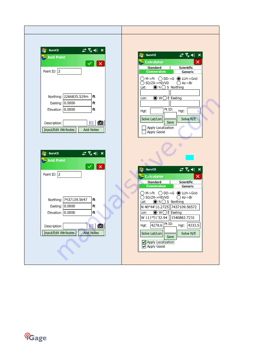
Enter a new pointe ‘2’ from ‘File: Points’ by pressing
‘Add’:
Enter the Northing from the OPUS result with a ‘m’ after
the number, when you click to the Easting the
coordinate will automatically change to Feet:
Do the same for the Easting and Orthometric elevation,
don’t forget to enter a ‘m’ after each metric value:
Go to the ‘COGO’ tab and click on the ‘8 Calculator’
button, then select the ‘Conversion’ tab and click the
‘LLH->Grid’ button:
Click the ‘Apply Localization’ and ‘Apply Geoid’
checkboxes.
Enter the NAD83 Latitude, Longitude, and Ellipsoid
Height on the left side (highlighted in Cyan above). Be
sure to put an ‘m’ after the metric ellipsoid height:
Click the ‘Solve N/E’ button on the right, then enter 2 in
the ‘Pt ID:’ box:’


