


iQue
™
3600
GPS Applications
2
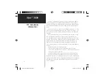
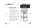
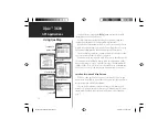
GPS Antenna in the On Position
Initializing the GPS Receiver
Pull out and
rotate up to the
On Position
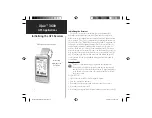
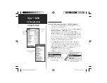
Using QueGPS
QueGPS is an information type application that displays the
current status of satellite reception by showing the location and
numbers of the satellites in the sky overhead. A signal strength bar
at the bottom of the page shows the signal strength of each satel-
lite being received.
Use QueGPS to:
• Observe the status of GPS satellite signal reception.
• View the current date and time.
• Determine your current location coordinates and their accuracy.
• Determine your current speed.
• Determine your approximate elevation (altitude above mean sea level).
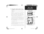
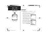
Initializing the Receiver
The GPS Receiver must be initialized (given an opportunity to
determine its location) before you can begin using it for navigation.
Before it can receive signals from GPS satellites overhead, you must turn
the receiver on. This can be accomplished by deploying the antenna on
the back of the iQue
™
handheld by rotating it up to the On position. In
order to receive satellite signals, you must have a clear view of the sky.
Satellite signals cannot pass through solid materials (except glass) or
dense overhead tree cover. When the unit initializes for the first time it
may take as long as 15 minutes. This time can be shortened by using the
map to point to the general area in which you are currently located (see
page 6). Anytime you have traveled more than 600 miles with the GPS
receiver turned off, the iQue handheld must again find its location by
re-initializing.
QueApplicationsGuideFinal.indd 12
6/23/2003, 3:17:47 PM