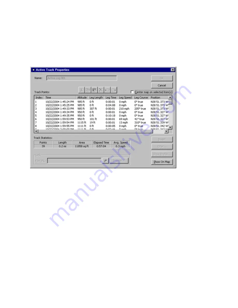
Viewing Active Track Properties
You can view (but not edit or change) the properties of a track as it is being recorded.
To view active track properties:
1. Click
the
Tracks
Tab.
2. Click
the
Display Active Track Properties
button on the right-hand side of the Tracks Tab while a track is
being recorded. The Track Properties window appears for the active track.
The Track Properties window contains the following information about each point along the track:
Index
—the sequential number of the track point.
Time
—the time at which the track point was recorded.
Altitude
—the altitude of the track point.
Leg Length
—the distance to the next track point.
Leg Time
—the time elapsed until the next track point was reached.
Leg Speed
—the average speed of the vehicle while travelling to the next point.
Leg Course
—the course the vehicle took to the next point.
Position
—the position of the track point.
Track Statistics
—the total points, length, area, elapsed time, and average speed of the track.
3. To show the active track on the map, click the
Show on Map
button.
4. To center the Graphic Map on a particular track point, check the
Center map on selected item(s)
box and
select the desired point.
5. Click
Cancel
to close the Track Properties window.
87
Содержание GPS 18 - Deluxe USB Sensor
Страница 1: ...nRoute GPS navigation software help contents ...
Страница 32: ...Legend of Map Symbols Legend Businesses and Attractions 30 ...
Страница 33: ...Legend Points of Interest 31 ...
Страница 34: ...Legend Map Lines 32 ...
Страница 35: ...Legend Map Areas 33 ...
Страница 41: ...39 ...
Страница 43: ...41 ...
Страница 82: ...7 Click Close to exit the Vertical Profile window 80 ...
Страница 129: ......


