


Garmin GI 275 Pilot's Guide
190-02246-01 Rev. A
95
Navigation
System Overview
Flight Instruments
EIS
Navigation
Hazar
d A
voidance
Autopilot
Additional F
eatur
es
Appendices
Index
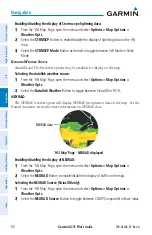
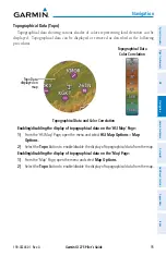
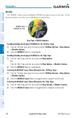
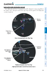
Topographical Data (Topo)
Topographical data showing various shades of colors representing land elevation can be
displayed. Topographical data can be displayed or removed as described in the following
procedures.
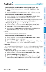
Topographical Data
Color Correlation
Topographical Data and Color Correlation
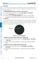
Topo Data
displayed on
map
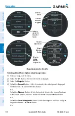
Enabling/disabling the display of topographical data on the 'HSI Map' Page:
1)
From the 'HSI Map' Page, open the menu and select
HSI Map Options
>
Map
Options
.
2)
Select the
Topo
Button to enable/disable the display of topographical data from the map.
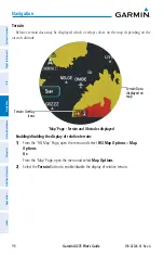
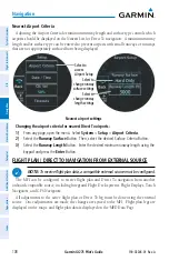
Enabling/disabling the display of topographical data on the 'Map' Page:
1)
From the 'Map' Page, open the menu and select
Map Options
.
2)
Select the
Topo
Button to enable/disable the display of topographical data from the map.
Содержание GI 275
Страница 1: ...GI 275 Pilot s Guide ...
Страница 2: ......
Страница 4: ......
Страница 12: ...Garmin GI 275 Pilot s Guide 190 02246 01 Rev A Warnings Cautions Notes Blank Page ...
Страница 14: ...Garmin GI 275 Pilot s Guide 190 02246 01 Rev A Software License Agreement Blank Page ...
Страница 16: ...Garmin GI 275 Pilot s Guide 190 02246 01 Rev A Record of Revisions Blank Page ...
Страница 22: ...Garmin GI 275 Pilot s Guide 190 02246 01 Rev A vi Table of Contents Blank Page ...
Страница 249: ......


