6-1
6.
NAV DATA DISPLAY
6.1
Nav Data Displays
6.1.1
Full nav data display
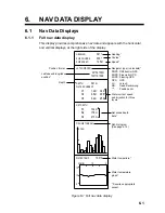
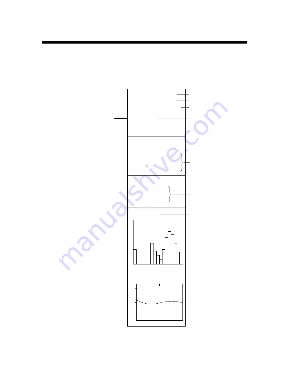
This display provides comprehensive nav data and appears with the horizontal
and vertical displays, at the right side of the display.
HEADING
321
°
SHIP COURSE
335
°
SHIP SPEED
12.5kt
LAT/LON[DGPS]
DEPTH
321m
WATER CURRENT
C1
1.2kt
342
°
C2
0.8kt
298
°
C3
0.4kt
256
°
NET DEPTH
S1
134m
S2
178m
S3
213m
FISH HISTOGRAM
1 SCAN
10.3
°
C
WATER TEMP
8
12
10
0
10
20MIN
Heading*
Course*
Speed*
Navigator type (in brackets)*
DGPS: Differrential GPS
KGPS: Kinematic GPS
FGPS: Floating GPS
GPS:
GPS
LC:
Loran C
DR:
Dead Reckoniong
***:
Position error
Depth
Water current speed
and direction for three
layers*
Net sonde depth
data*
Fish histogram
(See page 4-14.)
Water temperture*,
Water temperature
graph*
* Requires appropriate
sensor.
Latitude and longitude
position*
Position format
32
°
52.150N
132
°
12.150E
Figure 6-1 Full nav data display
Содержание FSV-24
Страница 1: ...COLOR SCANNING SONAR FSV 24 ...
Страница 12: ...This page is intentionally left blank ...
Страница 112: ...This page is intentionally left blank ...
Страница 126: ...This page is intentionally left blank ...
Страница 144: ...This page is intentionally left blank ...
Страница 162: ...This page is intentionally left blank ...
Страница 170: ...This page is intentionally left blank ...

