


IFD500 Series Pilot Guide
Map Subsystem 4-21
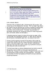
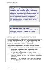
NOTE
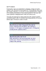
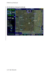
Datalink Data Intended to Aid Decision Making
Weather Datalink information is meant to aid pilot
planning and near-term decisions focused on avoiding
areas of inclement weather that are beyond visual range
or where poor visibility precludes visual acquisition of
inclement weather. The system is not designed for use
for weather penetration and storm cell circumvention.
The system lacks sufficient resolution and updating
necessary for tactical maneuvering.
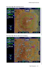
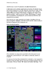
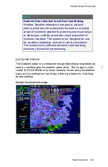
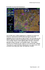
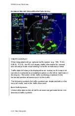
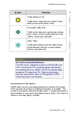
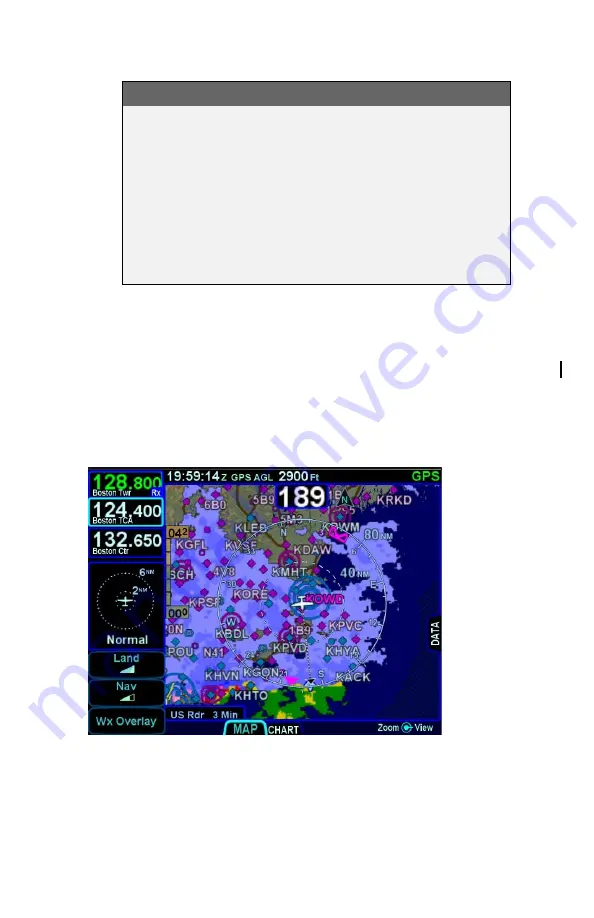
DATALINK RADAR
The Datalink radar is a composite image depicting precipitation as
seen by multiple ground weather radar sites. The image is color-
coded to FAA definitions to show intensity levels and precipitation
types and is overlaid on top of any other map features, including
terrain alerting.
Datalink Precipitation Example
Содержание IFD510
Страница 1: ......
Страница 75: ...IFD500 Series Pilot Guide SVS Subsystem 2 9 Yellow Obstacle Threat Bubble Red Obstacle Threat Bubble ...
Страница 140: ...IFD500 Series Pilot Guide 3 50 FMS Subsystem Weather Data on Info Tab Info Tab Nearby Navaids ...
Страница 150: ...IFD500 Series Pilot Guide 3 60 FMS Subsystem User Waypoint Airfield Naming Example ...
Страница 156: ......
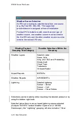
Страница 180: ...IFD500 Series Pilot Guide 4 24 Map Subsystem ADS B Lightning Coverage Area Shadow ...
Страница 217: ...IFD500 Series Pilot Guide Map Subsystem 4 61 Map SVS Fly By Waypoint Depiction Map SVS Missed Approach Not Activated ...
Страница 218: ...IFD500 Series Pilot Guide 4 62 Map Subsystem Map SVS Close in of Landing Runway Map SVS Missed Approach Enabled ...
Страница 252: ...IFD500 Series Pilot Guide 5 16 Aux Subsystem Trip Statistics Calculator ...
Страница 369: ...IFD500 Series Pilot Guide Navigation 6 33 Enable Missed LSK Enabled Missed Approach in Flight Plan ...
Страница 459: ...IFD500 Series Pilot Guide General 7 81 Bluetooth pairing keyboard discovered Bluetooth pairing Pair Device LSK ...
Страница 460: ...IFD500 Series Pilot Guide 7 82 General Bluetooth pairing pairing code ...