


IFD500 Series Pilot Guide
4-2
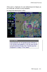
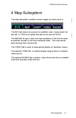
Map Subsystem
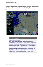
MAP TAB
The map has several formats and views. There is both a full map
depiction as well as a datablock map depiction. In both cases, you
have the ability to control the map feature density as well as the
various overlays, all via the LSKs along the left edge of the display.
The active FMS flight plan is always overlaid on the map as are any
traffic depictions.
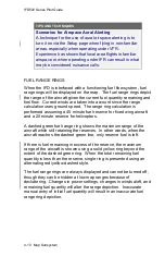
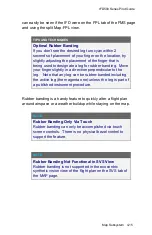
COOL FEATURE
Next Leg Depiction on Map
While the current leg of the active flight plan is always
depicted in magenta on all moving maps, we’ve added
an indication of the next leg using alternating magenta
and white stripes. This “candy cane” indication can
come in handy during such circumstances as teardrop
entries into a hold pattern. It gives you a clear
indication of what the system will do next. All future legs
beyond the next leg will be depicted in white.
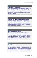
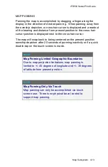
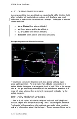
MAP CONTROLS
Turning the bottom right knob
or using “pinch zoom” touch gestures
will result in a map range change.
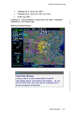
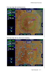
Map range choices extend from 2 nm up to 1000 nm. Current map
range is indicated on the outer map range ring at approximately the
1:30 position and as noted above, the map range can be adjusted by
either turning the bottom right knob or by using a two-fingered
pinching gesture on the touch screen. The depicted current range
numeric is replaced by “Min” and “Max” for two seconds before timing
back out to the actual range number when at the two range
extremes.
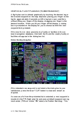
Pressing the knob cycles through the various map views. The map
view selected is indicated at the top of the map next to the heading
box. No indication means Heading Up. All other options are labeled
next to that heading box. Depending on the installation, map view
options can be:
Содержание IFD510
Страница 1: ......
Страница 75: ...IFD500 Series Pilot Guide SVS Subsystem 2 9 Yellow Obstacle Threat Bubble Red Obstacle Threat Bubble ...
Страница 140: ...IFD500 Series Pilot Guide 3 50 FMS Subsystem Weather Data on Info Tab Info Tab Nearby Navaids ...
Страница 150: ...IFD500 Series Pilot Guide 3 60 FMS Subsystem User Waypoint Airfield Naming Example ...
Страница 156: ......
Страница 180: ...IFD500 Series Pilot Guide 4 24 Map Subsystem ADS B Lightning Coverage Area Shadow ...
Страница 217: ...IFD500 Series Pilot Guide Map Subsystem 4 61 Map SVS Fly By Waypoint Depiction Map SVS Missed Approach Not Activated ...
Страница 218: ...IFD500 Series Pilot Guide 4 62 Map Subsystem Map SVS Close in of Landing Runway Map SVS Missed Approach Enabled ...
Страница 252: ...IFD500 Series Pilot Guide 5 16 Aux Subsystem Trip Statistics Calculator ...
Страница 369: ...IFD500 Series Pilot Guide Navigation 6 33 Enable Missed LSK Enabled Missed Approach in Flight Plan ...
Страница 459: ...IFD500 Series Pilot Guide General 7 81 Bluetooth pairing keyboard discovered Bluetooth pairing Pair Device LSK ...
Страница 460: ...IFD500 Series Pilot Guide 7 82 General Bluetooth pairing pairing code ...