ATLAS North America Proprietary
Sea Scan ARC Scout MKII Operations Manual
1 of 1
Page: 37
Issue: 1.2.4
SCTM2-OPS
Operations Manual
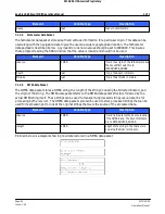
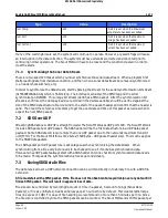
Name
Example
Units
Description
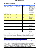
Start Of String
$
$ indicates start of string
Message ID
GPGGA
GGA string identifier
UTC Time
161229.487
hhmmss.ss (h = hour, m =
minutes, s = seconds)
Latitude
3723.2475
ddmm.mmmm (d =
degrees, m = minutes)
N/S Indicator
N
N = North or S =South
Longitude
12158.3416
dddmm.mmmm (d =
degrees, m = minutes)
E/W Indicator
W
E = East or W = West
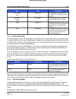
Position Fix Indicator
1
0 = Invalid, 1 = GPS Mode
Valid, 2 = DGPS Mode
Valid, 6 = Dead Reckoning
Valid
Satellites Used
07
HDOP
1.0
Horizontal Dilution Of
Precision
MSL Altitude
meters
not used
Units
M
Meters
Geoid Separation
meters
not used
Units
M
Meters
Age of Differential
Correction
seconds
not used
Differential Reference
Station ID
not used
Checksum Delimeter
*
The checksum comes after
this character.
18
2 Digit Hexadecimal
Sentence Terminator
<CR><LF>
Indicates end of sentence.
6.3.1.3
HDT
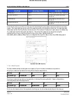
This string contains True Heading.
Example:
$GPHDT,132.8,T*3D
Format Description:

