Adding and Using User Bitmap Charts
MicronNav System
0656-SOM-00001-07
89
© Tritech International Ltd.
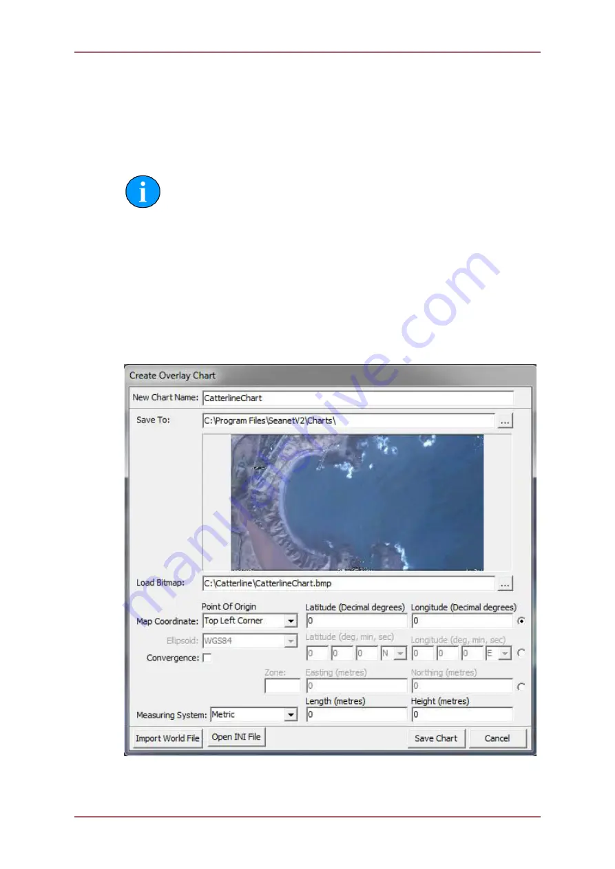
In the Chart Editor, a chart/map image can be loaded which can be any of several file formats;
.jpeg, .jpg, .bmp, .tiff or .tif, .png.
Once the chart/map image is loaded, geographical information (location and size) for the
loaded image must then be typed in on this page. Alternatively, for backwards compatibility
with earlier versions of Seanet Pro, all this information can be entered into an .INI file and
this file Opened to load up all the values and populate the Chart Editor.
Note
All loaded values should be reviewed before proceeding to Save the Chart.
It is also possible to import a chart/map image which has a World File associated, e.g. which
includes geographical information for georeferencing the image. The World File must have
the same filename as the image file and its extension should follow standard conventions
(e.g. image file = “Chart.tif”, World File = “Chart.tfw”). The Dialog page used to Import the
World Files has a filter that gives full information of the file extension types that are used
for this.
Once all information has been entered, click on the ‘Save Chart’ button to save the chart
information to the registry and the image file to the selected “Save To” folder. If the bitmap is
stored in a different place a copy will be created in the “Save To” folder.
Once the Chart is Saved, it will be added to the Chart Selection drop-down list on the main
page.

