MicronNav System
0656-SOM-00001-07
7
© Tritech International Ltd.
1. Introduction
The Tritech MicronNav system is an innovative Ultra Short Base Line (USBL) acoustic
tracking system designed for tracking or marking the position of underwater vehicles or
objects. The design of the system provides 180° hemispherical coverage from the surface
unit and 360° omni-directional coverage from the subsea unit enabling continuous reliable
tracking even in very shallow water. The size of the subsea unit is small enough to be fitted
to the smallest of observation class vehicles.
The system can be used stand-alone in Transponder mode in which case the subsea unit
only requires power, or it can be used with Tritech's range of imaging Sonars (Micron MKII
or MKIII, Super SeaKing and Gemini) in responder mode in which case the subsea unit is
powered by and communicated with through the Sonar Aux port. It is synchronised with the
Sonar to reduce the effect of acoustic interference on the sonar display. For compatibility
with other
Tritech International Ltd
Sonars see Chapter 8,
Using with Other Tritech Sonars
The MicronNav system consists of a Seanet Pro application software package for installation
onto a suitable PC or laptop computer, a small surface MicronNav100 Interface Hub, a
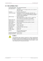
lightweight surface USBL ‘Dunking’ Transducer (with integral magnetic compass and pitch/
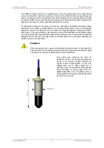
roll sensor) and one or more small subsea MicronNav Modem heads.
Note
The Tritech SeaHub Surface Interface Module cannot be used in place of the
MicronNav100 Hub.
The Seanet Pro application software running on a PC or Laptop commands the subsea
MicronNav Modem head to transmit an acoustic ranging signal to the Surface USBL
Dunking Transducer. When operating in stand-alone Transponder mode this command is
sent acoustically via the USBL Dunking Transducer, and when combined with the Tritech
sonar and operating in Responder mode this command is sent electronically via the sonar
communications link.
The MicronNav acoustic ranging signal is detected by the USBL Dunking Transducer and
MicronNav100 Hub Interface module and the received signal information sent to the host
Seanet computer for calculation of range and bearing of the subsea head. USBL Dunking
Transducer pitch/roll and heading data from the integral pitch/roll sensors and magnetic
compass are also captured and sent to Seanet Pro for calculation of corrected position to
world axis.
If GPS positional data is available the range and bearing of the subsea head is synchronised
and the Seanet display updated with ships position and ROV position to true world position.
Provision is made to allow position information to be overlaid onto a user supplied bitmap
chart display of the local area if required.
The position fixing cycle is repeated dependent upon the selected update rate (0.5 – 10s).


