xi
190-01150-02 Rev. J
Garmin G500H Pilot’s Guide
For
ewor
d
Sec 1
System
Sec 2
PFD
Sec 3
MFD
Sec 4
Hazar
d
Avoidance
Sec 5
Additional
Featur
es
Sec 6
Annun.
& Alerts
Sec 7
Symbols
Sec 8
Glossary
Appendix A
Appendix B
Index
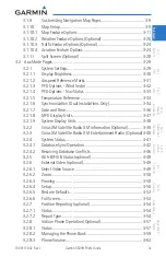
4.6.1.3 Range Ring ......................................................................... 4-23
4.6.1.4 Altitude Display ................................................................... 4-23
4.6.1.5 TAS/TCAS Symbology........................................................... 4-24
4.6.1.6 Traffic System Status ............................................................ 4-25
4.6.1.7 Traffic Pop-Up...................................................................... 4-27
4.6.2
TIS Traffic (Optional) ............................................................ 4-28
4.6.2.1 Traffic Map Page.................................................................. 4-28
4.6.2.2 TIS Symbology ..................................................................... 4-30
4.6.2.3 TIS Limitations ..................................................................... 4-31
4.6.2.4
TIS Alerts ............................................................................. 4-33
4.6.2.5 Traffic Pop-Up...................................................................... 4-34
4.6.2.6 TIS System Status ................................................................ 4-35
4.6.3
ADS-B Traffic (Optional) ....................................................... 4-37
4.6.3.1 Target Selection ................................................................... 4-38
4.6.3.2 Status ................................................................................. 4-39
4.6.3.3
Motion Vector ..................................................................... 4-40
4.7 XM WX Satellite Weather (Optional) .................................................... 4-42
Using XM WX Satellite Weather Products ............................. 4-42
Customizing the XM WX Satellite Weather Map ......................4-43
Weather Symbols and Product Age ................................ 4-45
XM WX Weather Symbols and Product Age ........................................... 4-45
4.7.4
XM Weather Legends .......................................................... 4-47
XM NEXRAD ....................................................................... 4-49
4.7.5.1 Reflectivity .......................................................................... 4-51
4.7.5.2 NEXRAD Limitations ............................................................ 4-51
4.7.6
XM Weather Page Map Orientation ...................................... 4-52
NEXRAD Data Viewing Range .............................................. 4-52
NEXRAD Legend.................................................................. 4-53
NEXRAD Source .................................................................. 4-54
XM Echo Tops ..................................................................... 4-55
XM Cloud Tops .................................................................... 4-57
XM WX Satellite Lightning ................................................... 4-59
XM SIGMETs and AIRMETs .................................................. 4-60
XM PIREPs .......................................................................... 4-62
XM METARs ........................................................................ 4-63
XM Winds Aloft ................................................................... 4-65
XM Surface Analysis and City Forecast ................................. 4-67
Summary of Contents for G500H
Page 1: ...G500H Pilot s Guide ...
Page 365: ......


