3-22
Garmin G500H Pilot’s Guide
190-01150-02 Rev. J
For
ewor
d
Sec 1 System
Sec 2
PFD
Sec 3
MFD
Sec 4
Hazar
d
Avoidance
Sec 5
Additional Featur
es
Sec 6
Annun. & Alerts
Sec 7
Symbols
Sec 8
Glossary
Appendix A
Appendix B
Index
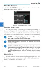
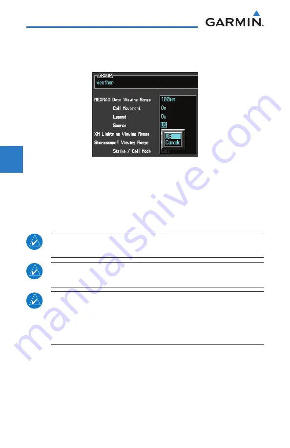
XM/FIS-B NEXRAD Source
The XM or FIS-B NEXRAD Source selection allows the choice of the available
sources for NEXRAD weather products.
Figure 3-29 NEXRAD Weather Source Selection
Stormscope
®
Viewing Range
The Stormscope Viewing Range option selects Stormscope cells or strikes are
shown on the Navigation Map. Products will be shown at and below the selected
map range. When Off is selected, cells or strikes will not be shown. Where
100 NM is selected, symbols will be shown at map ranges of 100 NM and lower.
NOTE:
The selected lightning display type, cell or strike, will be shown the
same on both the StormScope and the Map pages.
NOTE:
StormScope data is displayed on the Map Page only if aircraft
heading is available.
NOTE:
The G500/600 will display StormScope data with or without a
heading source. If no heading source is available, the display will indicate
this by placing “HDG N/A” in the upper right portion of the display. If no
heading is available, the pilot must clear the strikes after each heading
change.
Strike/Cell Mode
When the Stormscope Viewing Range option has a range greater than zero,
the Stormscope cells or strikes option is made available and can determine
which type are shown on the Navigation Map.
Summary of Contents for G500H
Page 1: ...G500H Pilot s Guide ...
Page 365: ......

