
3-13
190-01150-02 Rev. J
Garmin G500H Pilot’s Guide
For
ewor
d
Sec 1
System
Sec 2
PFD
Sec 3
MFD
Sec 4
Hazar
d
Avoidance
Sec 5
Additional
Featur
es
Sec 6
Annun.
& Alerts
Sec 7
Symbols
Sec 8
Glossary
Appendix A
Appendix B
Index
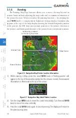
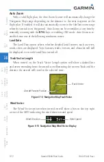
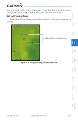
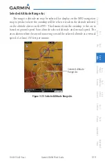
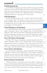
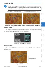
Nav Range Ring
When turned on, the Nav Range Ring option will show a ring with a compass
rose oriented to magnetic north around your present position on the Map page.
When selected ON, the Enhanced Range Ring function provides a second ring
at 1/2 the distance of the primary ring to allow the pilot to acccurately judge
distance to objects depicted on the map.
Range Ring Radius
Range Ring with Compass Rose
Figure 3-16 Navigation Map Range Ring
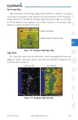
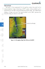
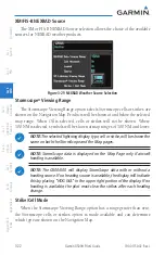
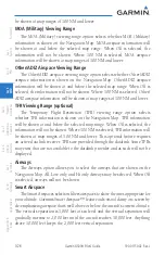
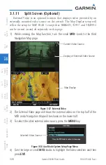
Topo Data
The Topo Data option selects whether the colored topographical features are
displayed. Traffic, Land Data, Terrain, and Obstacles will still be displayed even
with Topo Data turned off.
Topo Data Off
Topo Data On
Figure 3-17 Navigation Map Topo Data
Summary of Contents for G500H
Page 1: ...G500H Pilot s Guide ...
Page 365: ......