Garmin G1000 Pilot’s Guide for the Diamond DA62
190-01895-00 Rev. A
252
FLIGHT MANAGEMENT
SY
STEM
O
VER
VIEW
FLIGHT
INSTRUMENTS
EIS
AUDIO P
ANEL
& CNS
FLIGHT
MANA
GEMENT
HAZARD
AV
OID
ANCE
AFCS
ADDITIONAL FEA
TURES
APPENDICES
INDEX
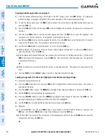
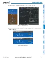
Predicting RAIM availability at a selected waypoint:
1)
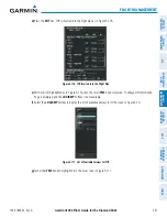
Select the AUX-GPS Status Page.
2)
Press the
FMS
Knob. The RAIM Prediction ‘WAYPOINT’ field is highlighted.
3)
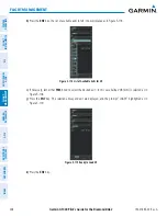
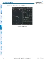
Turn the small
FMS
Knob to display the Waypoint Information Window. (Turning it clockwise displays a blank
Waypoint Information Window, turning it counter-clockwise displays the Waypoint Information Window with a
waypoint selection submenu allowing selection of active flight plan, nearest, recent, user, or airway waypoints).
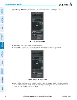
4)
Enter the identifier, facility, or city name of the departure waypoint; or select a waypoint from the submenu of
waypoints and press the
ENT
Key to accept the waypoint entry.
5)
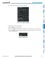
Turn the FMS Knobs to enter an arrival time and press the
ENT
Key.
6)
Turn the FMS Knobs to enter an arrival date and press the
ENT
Key.
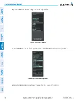
7)
Press the
ENT
Key with ‘COMPUTE RAIM?’ highlighted to begin the computation.
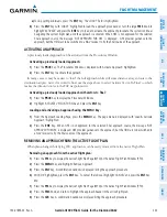
Predicting RAIM availability at the aircraft present position:
1)
Select the AUX-GPS Status Page.
2)
Press the
FMS
Knob. The RAIM Prediction ‘WAYPOINT’ field is highlighted.
3)
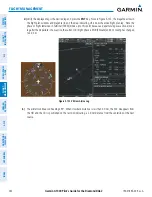
Press the
MENU
Key, highlight ‘Set WPT to Present Position’, and press the
ENT
Key.
4)
Press the
ENT
Key to accept the waypoint entry.
5)
Turn the FMS Knobs to enter an arrival time and press the
ENT
Key.
6)
Turn the FMS Knobs to enter an arrival date and press the
ENT
Key.
7)
Press the
ENT
Key with ‘COMPUTE RAIM?’ highlighted to begin the computation.
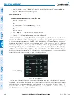
Status of the RAIM computation for the selected waypoint, time, and date is displayed at the bottom of the
RAIM PREDICTION Box as follows:
• ‘COMPUTE RAIM?’ - RAIM has not been computed.
• ‘COMPUTING AVAILABILITY’ - RAIM calculation is in progress.
• ‘RAIM AVAILABLE’ - RAIM is predicted to be available.
• ‘RAIM NOT AVAILABLE’ - RAIM is predicted to be unavailable.
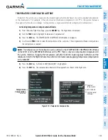
The Satellite Based Augmentation System (SBAS) provides increased navigation accuracy when available. SBAS
can be enabled or disabled manually on the GPS Status Page.

