background image

Astro 320 and DC40 Owner’s Manual 

55

Customizing Your Device

 ◦

Fishing

—(requires marine 

maps) displays a detailed view 

of bottom contours and depth 

soundings. Simplifies map 

presentation for optimal use 

while fishing.

• 

Appearance

—allows you to set the 

appearance of marine navigation 

aids on the map.

• 

Marine Alarm Setup 

 ◦

Anchor Drag Alarm

—alarm 

sounds when you exceed a 

specified drift distance while 

anchored.

 ◦

Off Course Alarm

—alarm 

sounds when you are off course 

by a specified distance.

 ◦

Deep Water/Shallow Water

— 

alarm sounds when you enter 

water of a specific depth.

Setting up Marine Alarms

1.  From the main menu, select 

Setup


Marine

 > 

Marine Alarm Setup

.

2.  Select an alarm type.
3.  Select 

On

.

4.  Enter a distance.

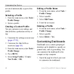
Fitness Settings

For more information on optional 

fitness accessories, see 

page 66

.

Summary of Contents for Astro 320

Page 1: ...Astro 320 owner s manual GPS enabled dog tracking system...

Page 2: ...and supplemental information concerning the use of this product Garmin the Garmin logo Astro City Navigator BlueChart and TracBack registered in the USA and other countries DC 40 ANT ANT BaseCamp chi...

Page 3: ...0 13 Navigating to Your Dog 13 Editing Dog Information 15 Tracking Your Dog on the Map 16 Adding Dogs 16 Collar Lock 18 Astro and DC 40 Tips 18 Waypoints Routes and Tracks 21 Waypoints 21 Routes 24 Tr...

Page 4: ...cks Settings 50 Changing the Units of Measure 50 Time Settings 50 Position Format 51 Heading Settings 51 Altimeter Settings 52 Geocache Settings 53 Routing Settings 53 Marine Settings 54 Fitness Setti...

Page 5: ...tteries in the Astro page 5 2 Charge the DC 40 page 6 3 Register your device page 65 4 Turn on the devices page 6 5 Acquire satellites page 7 6 Calibrate the compass page 36 7 Attach the DC 40 to your...

Page 6: ...4 hours 1 Connect the power cable to an appropriate electrical source 2 Slide the charging clip onto the DC 40 3 Charge the DC 40 completely The blue LED flashes when the DC 40 is charging The blue LE...

Page 7: ...ng satellite signals can take a few minutes 1 Go outdoors to an open area away from tall buildings and trees 2 Press and quickly release The status page appears The bars indicate satellite strength 3...

Page 8: ...using a high powered radio greater than 5 watts in close proximity to the Astro It may cause irreversible damage to the Astro GPS antenna VHF antenna Power key Display Keypad USB port under weather c...

Page 9: ...oduction DC 40 VHF antenna Collar GPS antenna Power key Keypad DOG Press to view the Dog Tracker page MARK Press to mark your current location BACK Press to cancel data entry or return to the previous...

Page 10: ...the Keypad 1 Press and quickly release 2 Press OUT Adjusting the Backlight 1 Press and quickly release 2 Use the Rocker to adjust the brightness levels TIP You can also press and quickly release to c...

Page 11: ...that you should select a series of items in order for example Select Delete Yes Status Information Status information is provided on the main menu and when you press and quickly release Indicates the...

Page 12: ...On Screen Keyboard A keyboard appears when you enter text Use the Rocker to select a character and press ENTER Select to backspace Select to shift Press IN or OUT to change the character mode of the k...

Page 13: ...your Astro was linked with the Astro at the factory If you are using a DC 40 that you purchased separately follow the instructions for adding a new dog on page 16 to establish communications with the...

Page 14: ...s 3 Press ENTER to view the dog information About the Dog Tracker Page The dog you are tracking is identified and the dog pointer indicates its direction from you The dog pointer is most accurate when...

Page 15: ...with the Astro Changing the Dog Name 1 From the main menu press DOG ENTER The dog information appears 2 Select the name field The on screen keyboard appears 3 Enter the name of the dog Changing the D...

Page 16: ...line About the Map When the map orientation is Track Up objects on the map appear to rotate around your position As you move the entire map reorients in the direction you are facing To stabilize the...

Page 17: ...o a dog Assigning a Dog ID Manually This requires wireless communication with the DC 40 You must turn on the DC 40 and bring it within range of the Astro 1 From the main menu press DOG twice 2 Select...

Page 18: ...a unique PIN Note If you forget the PIN the Collar Lock feature can be overridden by physically touching the Astro to the DC 40 Astro and DC 40 Tips Turn on the DC 40 and allow it to acquire satellite...

Page 19: ...ices During a Hunt If you are moving the dogs during a hunt and you do not want to record the transportation of the dogs you can pause the tracking of all dogs 1 From the main menu press DOG MENU 2 Se...

Page 20: ...path of radio signals degrade the quality of the signals Keeping an unobstructed line of sight between your Astro and your dog s DC 40 produces the best communication signal Obstructed radio waves res...

Page 21: ...e Marking Your Current Location 1 Press MARK 2 Select New or choose a default location name such as Truck or Camp 3 Select Done Marking a Covey You can mark a covey location and enter the estimated nu...

Page 22: ...int 2 Press MENU 3 Select Spell Search 4 Enter the name of the waypoint Matches appear as you select characters in the name 5 Select the waypoint from the list Finding a Waypoint Near Another Waypoint...

Page 23: ...ect Tools Waypoint Mgr 2 Select a waypoint 3 Press MENU 4 Select Reposition Here The position changes to your current location Averaging Your Location You can refine a waypoint location for more accur...

Page 24: ...of points or saved locations that leads you to your final destination To customize your route settings see page 53 Creating a Route 1 From the main menu select Tools Route Planner Create Route 2 Sele...

Page 25: ...te select Remove Viewing the Active Route 1 From the main menu select Tools Active Route 2 Select a point in the route to view additional details Reversing a Route 1 From the main menu select Tools Ro...

Page 26: ...terval of frequency NOTE Using the Most Often interval provides the most track detail but fills up the device memory quicker As you move with the device turned on a track log is created Viewing a Trac...

Page 27: ...u select Tools Track Manager 2 Select a track 3 Select Save Track You are prompted to enter a name for the track 4 Follow the on screen instructions Saving Part of the Track Log 1 From the main menu s...

Page 28: ...age 30 or compass page 34 Archiving Your Track Logs You can archive saved tracks to save memory space Archiving a Track Manually 1 From the main menu select Tools Track Manager 2 Select a track 3 Sele...

Page 29: ...d or Receive 3 Follow the on screen instructions Sharing Dog Information Before you can share dog information with another Astro user the user must enable their Astro to receive wirelessly and bring i...

Page 30: ...d leaves a track log trail Waypoint names and symbols also appear on the map Map orientation arrow Route instructions Route to destination page 31 Your current location Map scale Scaling the Map Press...

Page 31: ...he main menu select Setup Map Data Fields 2 Select the number of data fields 3 Press MAP MENU 4 Select Change Data Fields 5 Select a field A list of data field options appears page 69 6 Select an opti...

Page 32: ...Waypoints Tracks Routes or Cities 1 From the main menu select Find 2 Select Waypoints Tracks Routes or Cities A list of items near your current location appears 3 Select an item from the list Finding...

Page 33: ...com us maps Finding an Address 1 From the main menu select Find Addresses 2 Enter the state or province city street number and street name Matches appear as you select characters in the name 3 Select...

Page 34: ...9 Satellite page 40 Compass The Astro has a 3 axis electronic compass Navigating with the Compass 1 From the main menu select Tools Compass 2 Turn toward the direction of the bearing pointer until the...

Page 35: ...r obstacles in your path It also helps you avoid hazards to either side of the course such as shoals or submerged rocks 1 From the main menu select Setup Heading Go To Line Pointer Course CDI The cour...

Page 36: ...r changing the batteries 1 From the main menu press DOG MENU 2 Select Calibrate Compass Start 3 Follow the on screen instructions Showing Dog Pointers on the Compass You can show pointers on the compa...

Page 37: ...lect an option Select Big Numbers to change the size of the numbers shown on the trip computer page Select Change Data Fields page 69 Select Change Dashboard to change the theme and information displa...

Page 38: ...evation plot or a pressure plot to view the elevation or pressure reading the time of day and the date when the point was recorded Navigating to a Point on the Plot 1 From the main menu select Tools E...

Page 39: ...rms Proximity alarms alert you when you are within a specified range of a particular location A tone sounds when you enter the designated radius Setting a Proximity Alarm 1 From the main menu select T...

Page 40: ...If necessary select Track Up to change the view of the satellites to be oriented with your current track toward the top of the screen 4 If necessary select Multicolor to assign a specific color to th...

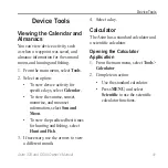
Page 41: ...select Calendar To view the sunrise sunset moonrise and moonset information select Sun and Moon To view the predicted best times for hunting and fishing select Hunt and Fish 3 If necessary use the arr...

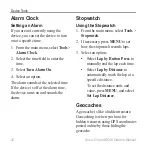
Page 42: ...time the device turns on and sounds the alarm Stopwatch Using the Stopwatch 1 From the main menu select Tools Stopwatch 2 If necessary press MENU to set how the stopwatch records laps 3 Select an opti...

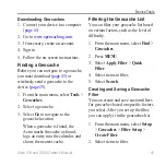
Page 43: ...tion When a geocache is found the Astro marks the cache as found logs an entry into the calendar and shows the nearest cache Filtering the Geocache List You can filter your geocache list based on cert...

Page 44: ...n program and leave in a geocache Only the owner of the chirp can program a chirp but anyone can find a chirp in a geocache For more information about programming a chirp see the chirp Owner s Manual...

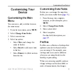
Page 45: ...t Customizing Data Fields Before you can change the map data fields you must enable them page 31 1 From the map trip computer compass or elevation plot press menu 2 Select Change Data Fields 3 Select...

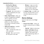
Page 46: ...From the main menu select Tools Profile Change 4 Press MENU 5 Select Setup Profiles Create New Profile OK Editing a Profile Name 1 From the main menu select Tools Profile Change 2 Select a profile 3...

Page 47: ...s not change the language of user entered data or map data such as street names Battery Type allows you to select the type of AA battery you are using page 57 Dog Settings From main menu select Setup...

Page 48: ...st Select Remove to delete a dog from the list Display Settings From main menu select Setup Display Backlight Timeout adjusts the length of time before the backlight turns off Note To adjust the backl...

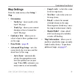
Page 49: ...and the detail level of the map Auto Zoom automatically selects the appropriate zoom level for optimal use on your map When Off is selected you must zoom in or out manually Zoom Levels selects the zoo...

Page 50: ...matic archive method to organize your tracks Tracks are saved and cleared automatically based on the user setting Color changes the color of the track line on the map Changing the Units of Measure You...

Page 51: ...device is using The default coordinate system is WGS 84 Heading Settings You can customize the compass settings You can specify the type of heading display and the type of North reference used to cal...

Page 52: ...iable Elevation allows the barometer to measure changes in elevation while you are moving Fixed Elevation assumes the device is stationary at a fixed elevation Therefore the barometric pressure should...

Page 53: ...play the geocache list by names or codes Found Geocaches allows you to edit the number of geocaches found This number automatically increases as you log a find page 43 Filter Setup page 43 chirp Searc...

Page 54: ...s available only for some activities Auto automatically routes you to the next point Manual allows you to select the next point on the route Distance routes you to the next point on the route when you...

Page 55: ...map Marine Alarm Setup Anchor Drag Alarm alarm sounds when you exceed a specified drift distance while anchored Off Course Alarm alarm sounds when you are off course by a specified distance Deep Water...

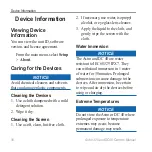
Page 56: ...1 Use a soft clean lint free cloth 2 If necessary use water isopropyl alcohol or eyeglass lens cleaner 3 Apply the liquid to the cloth and gently wipe the screen with the cloth Water Immersion notice...

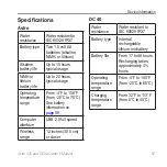
Page 57: ...sage Operating temperature range From 4 F to 158 F from 20 C to 70 C See battery information on page 58 Computer interface USB 2 0 full speed Wireless range 12 inches 30 5 cm or closer DC 40 Water res...

Page 58: ...onditions Replacing the Batteries See page 5 Selecting the Battery Type 1 From the main menu select Setup System Battery Type 2 Select Alkaline Lithium or Rechargeable NiMH Long Term Storage When you...

Page 59: ...f screen backlighting can significantly reduce battery life You can adjust the backlight brightness and decrease the backlight timeout to maximize battery power 1 Quickly press 2 Adjust the brightness...

Page 60: ...min POI Loader Go to www garmin com products poiloader JPEG photo files GPX geocache files Installing a microSD Card You can purchase microSD memory cards from an electronics supplier or purchase prel...

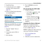
Page 61: ...r Connecting the USB Cable notice To prevent corrosion thoroughly dry the mini USB port the weather cap and the surrounding area before charging or connecting to a computer 1 Connect the USB cable to...

Page 62: ...es in the Garmin GPX folder 5 Select Edit Paste Transferring Detailed Tracks The dog tracks saved on your Astro are detailed enough for most users to view the movements of their dog The DC 40 stores m...

Page 63: ...en the Garmin drive or volume 2 If necessary open a folder or volume 3 Select the files 4 Press the Delete key on your keyboard Disconnecting the USB Cable 1 Complete an action For Windows computers c...

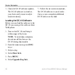
Page 64: ...e DC 40 you must get the software from WebUpdater 1 Turn on the DC 40 and bring it within range of the Astro Note To avoid data corruption do not turn off the Astro or the DC 40 during data transfer 2...

Page 65: ...completing our online registration today Go to http my garmin com Keep the original sales receipt or a photocopy in a safe place Using myGarmin Go to http my garmin com to access the latest services...

Page 66: ...u select Setup Fitness 3 Select an option Select Heart Rate Monitor On Select Bike Cadence Sensor On 4 Wait until the device displays Connected 5 Customize your data fields to view the heart rate or c...

Page 67: ...vigator maps Go to www garmin com us maps Replacement Parts Replacing the DC 40 Collar You must provide your own Phillips screwdriver to replace the DC 40 collar 1 Carefully cut the zip tie that secur...

Page 68: ...lar Trim the zip tie and any sharp edges Changing the Fuse in the Vehicle Power Cable NOTICE When replacing the fuse do not lose any of the small pieces and make sure they are put back in the proper p...

Page 69: ...ded Battery Level The remaining battery power Barometer The calibrated current pressure Data Field Description Bearing The direction from your current location to a destination Cadence cadence accesso...

Page 70: ...Glide Ratio The ratio of horizontal distance traveled to the change in vertical distance Data Field Description Glide Ratio to Dest The glide ratio required to descend from your current position and...

Page 71: ...ached since last reset Speed Moving Avg The average speed of the device while moving since last reset Data Field Description Speed Overall Avg Your average speed since last reset Sunrise The time of s...

Page 72: ...the last reset Turn The angle of difference in degrees between the bearing to your destination and your current course L means turn left R means turn right Velocity Made Good The speed at which you a...

Page 73: ...et Reset All Settings My device does not acquire satellite signals 1 Take your device out of buildings and parking garages and away from tall buildings and trees 2 Turn on the device 3 Remain stationa...

Page 74: ...nds or until the device goes into mass storage mode I cannot see any new removable drives in my list of drives If you have several network drives mapped on your computer Windows may have trouble assig...

Page 75: ...bearing pointer 34 BirdsEye satellite imagery 67 BlueChart g2 maps 67 C calculator 41 calendar 41 calibrating altimeter 39 52 compass 36 caring for the devices 56 chirp 44 53 City Navigator 33 cleanin...

Page 76: ...armin Product Support 65 geocaches 42 settings 53 sharing 29 GPS settings 47 signals 11 40 69 H heading settings 51 K keyboard 12 keypad 9 L language 47 line of sight radio communication 20 M main men...

Page 77: ...s 11 13 18 69 Sight N Go 36 software version 56 specifications 57 stopwatch 42 storage 56 58 system settings 47 T time settings 50 data fields 71 sunrise and sunset 71 tones 47 48 topographical maps 2...

Page 78: ......

Page 79: ......
Page 80: ...011 Garmin Ltd or its subsidiaries Garmin International Inc 1200 East 151st Street Olathe Kansas 66062 USA Garmin Europe Ltd Liberty House Hounsdown Business Park Southampton Hampshire SO40 9LR UK Gar...

Reviews: