2-2
2.2 Showing/Hiding Chart
Features
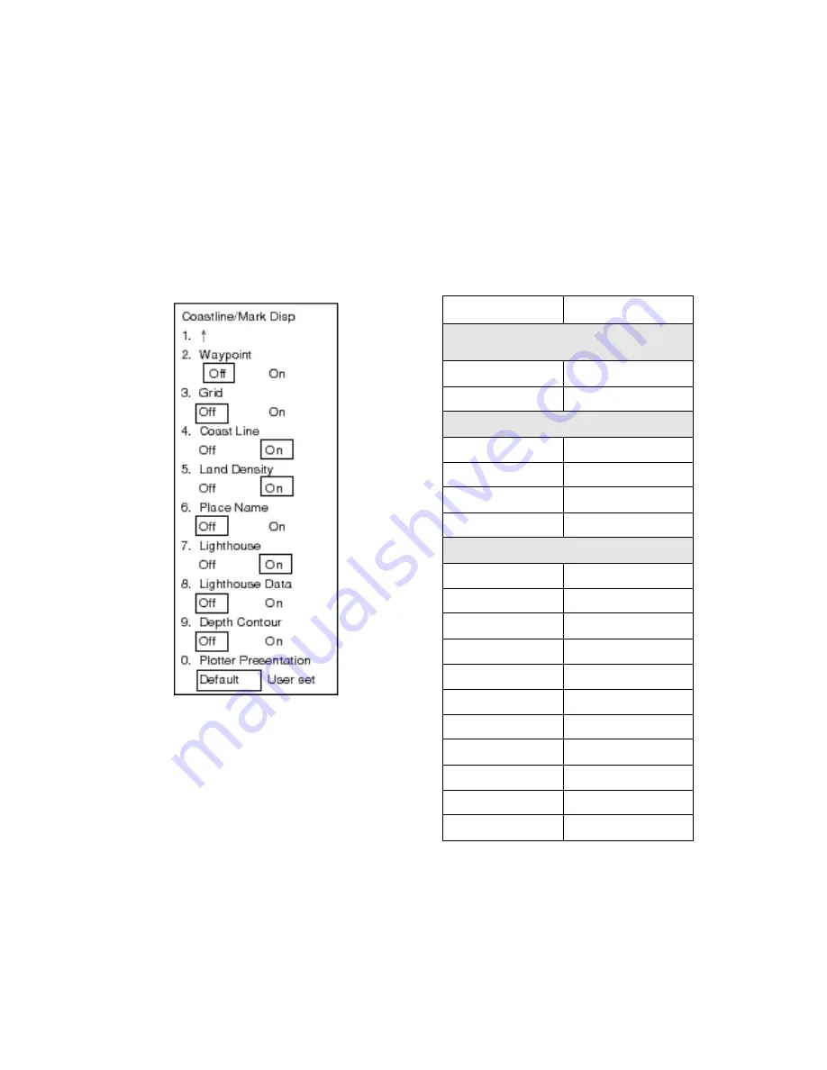
Chart features may be turned on/off as fol-
lows:
1. Press the [MENU] key to display the main
menu.
2. Press the [1] key twice to select Video
Plot.
3. Press the [9] key twice to select Coast-
line/Mark Disp.
Figure 2-2 Coastline/Mark Disp menu
4. Press appropriate numeric key to select
both item and option.
Waypoint: Turns waypoint display on/off.
Grid: Turns grid on/off.
Coastline: Turns coastline on/off.
Land Density: Fills in (On) or hollows
(Off) land.
Place Name: Turns geographic names
on/off.
Lighthouse: Turns lighthouse icons on/
off.
Lighthouse Data: Turns lighthouse
viewing angle on/off. Viewing angle is
shown as an arc extending from
lighthouse position. Arc color, white or
green, is the color of the lighthouse’s
beam. This feature is available on
selected charts.
Depth Contour: Turns depth contour
lines on/off.
Plotter Presentation: Selects plotter
screen settings; default or user setting.
Default settings are as below.
Item
Setting
Radar colors, brilliance and
background
Background color
Black
Echo color
Yellow
Color of chart elements
Land
green
Grid
green
Marks
green
Contour
green
Chart information
Waypoints
ON
Grid
OFF
Coastline
ON
Land density
ON
Place name
OFF
Lighthouse
ON
Lighthouse data
ON
Depth contour
OFF
Target track
OFF
OS track
OFF
Marks
OFF
5. Press the [ENTER/SELECT] key to reg-
ister your selection.
6. Press the [MENU] key to escape.
Summary of Contents for RP-17
Page 1: ...VIDEO PLOTTER RP 17...
Page 3: ...i i i i i i i i i i i i i i SAFETY INSTRUCTIONS...
Page 39: ...A 1 CHART ICONS The figure below shows all the icons which appear on the radar display...
Page 40: ...A 2 MENU TREE...
Page 41: ...A 3...
Page 43: ...A 5 DATA SENTENCES...
Page 44: ...A 6...
Page 48: ......


