Findclouds Manual 2
2 Findclouds Software
The Findclouds software evaluates images of the sky and calculates the cloudiness. Especially it
was designed for the Total Sky Camera J1006 using a fisheye lens for whole-sky images.
Evaluations of the total sky images by the analysis software may be done online on automatic
mode or afterwards for campaign based data sets. This new software allows classifying the clear
sky, the total hemispheric cloud cover, optically thick and thin clouds, the cloud cover of the free
horizon or the cloud cover above an artificial horizon. In addition the presence of the direct sun is
detected. If the natural horizon is not yet known, the software calculates it by drag-and-drop. All
analysed data are stored as ASCII data including pictures for additional investigations.
The cloudiness tells, how much the sky is covered with clouds, using a number from 0.00 for
cloudless sky to 1.00 for completely clouded sky. Normally the cloudiness is estimated by a
meteorologist - the Findclouds software reduces the necessary individual manpower for analysis of
the cloudiness.
The camera can operate in a high dynamic intensity range to be able to analyse the sky area near
the sun.
Using a high dynamic intensity range out of the combination from a normal exposed and an
underexposed image, the software is able to analyse the area near the sun and to tell, whether
there was the sun visible or not. Nevertheless also when analysing a single image the software
provides algorithms to tell about cloudiness and sun visibility.
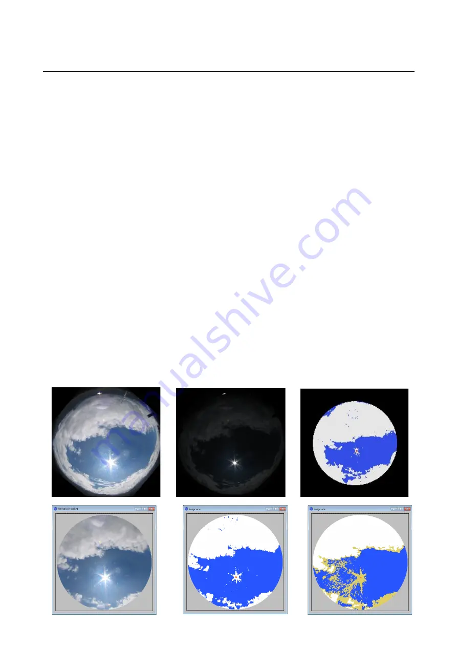
In example these are pictures of normal and underexposed sky. The final evaluation with equalised
range shows thin clouds, thick clouds and red marker on sun position.


