


36
4 NAvIGAtIoN & LoCAtIoN
The Navigation and Location screen displays a full page of navigation information with location
coordinates. To access from the Main Menu:
> ‘MENU’ 1 sec. + “NAV/LOCATION” + ‘ENT’
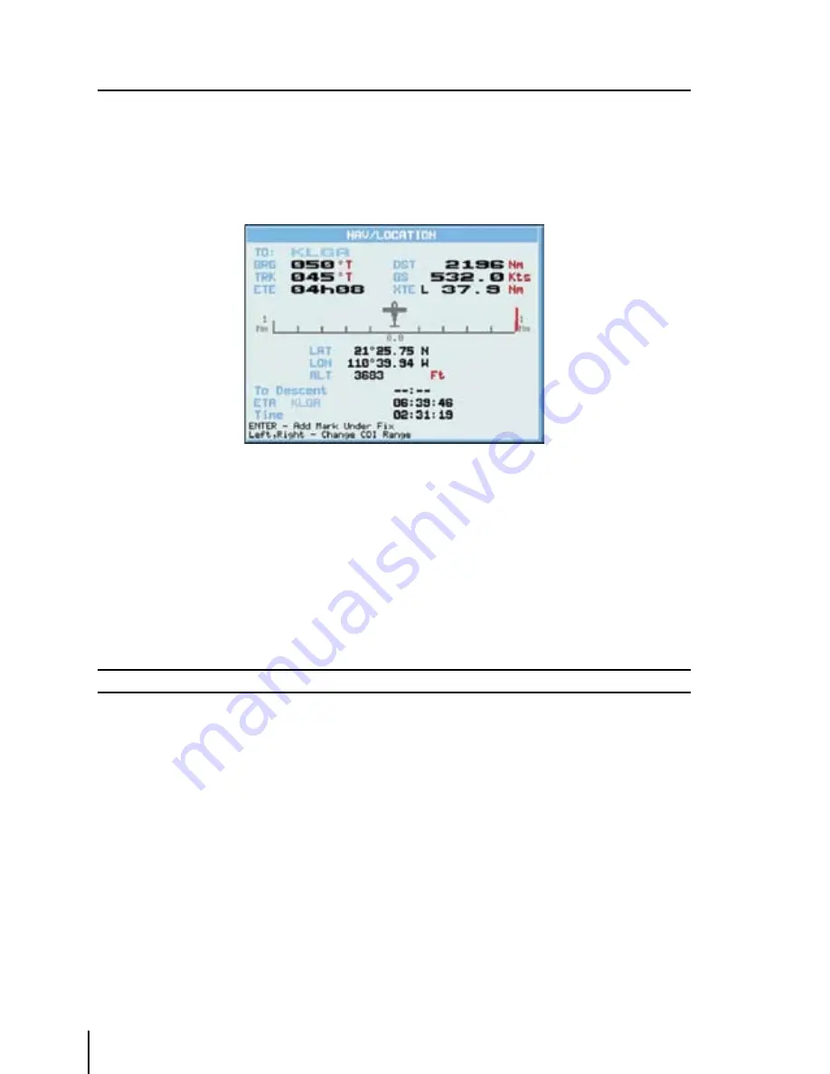
Fig. 4 - Nav/Location screen
4.1 NAvIGAtIoN & LoCAtIoN DAtA
The Navigation data displayed in this window is based on the current Flight Plan leg or active
Waypoint. If no Flight Plan is active, only Ground Speed and Track can be displayed. The CDI is
a graphic display of Cross Track Error (XTE). The airplane remains at the center, with the course
line needle moving right and left in relation to the airplane icon. When the line is to the left of the
airplane, you are right off course and must turn left (fly to the line) to close on the course.
Note
Distances are measured horizontally.
If the icon rotates 180° and points toward the bottom of the display, you are moving away from the
destination. The numbers on either side of the CDI represent a full-scale deflection.
To change the CDI scale press the left/right cursor key.
The GEOPILOT references navigation information to the next Waypoint in the active Flight Plan.
When you reach the destination of one leg, the GEOPILOT automatically switches to the next leg.
This leg switching occurs when the airplane crosses the bisector of the legs, as shown in
the diagram. The pilot may choose a different leg (forward of the present location) by using the
Flight Plan menu and activating the leg destination.
> ‘MENU’ 1 sec. + “FLIGHT PLAN” + ‘ENT’
Highlight the destination Waypoint of the desired leg and press ‘GOTO’ to activate that leg of the
Flight Plan.
Summary of Contents for GeoPilot plus
Page 1: ...USER MANUAL Via Caboto 9 54036 Marina di Carrara MS ITALIA E mail info avmap it ...
Page 4: ... ...
Page 59: ...59 Fig 10 6a Sample Calculation ...
Page 80: ...80 ...


