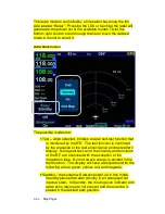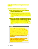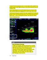
Map Pages
3-57
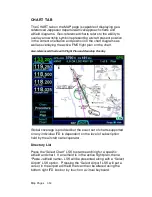
in/out as desired by using the right-hand knob on the IFD or via a
pinch-zoom touch method.
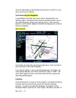
Taxi Charts/Airport Diagrams
If a published procedure was used via the Charts tab for the
landing airport, the display chart will automatically switch over to
the airfield diagram during post-landing roll out. Your ownship
position on the airfield diagram chart will be displayed as an aid in
surface navigation.
Airport Diagram
The charts can be pinch-zoomed and panned or knob zoomed to
see close ups of the airfield diagram.
If you did not select or use a published approach via Charts, the
local airfield diagram can still be accessed. Select “CHART” tab
of the MAP page and then use the left-hand LSKs to select the
desired airfield diagram.
Lighting
Some pilots prefer to use the Charts pages in the daytime lighting
scheme at all times and some prefer the nighttime lighting
scheme. In order to provide that flexibility, a separate “Chart
Day/Night Mode” option (Auto, Day, Night) has been provided on
Summary of Contents for IFD540
Page 1: ......
Page 2: ......
Page 8: ......
Page 82: ...2 28 FMS Pages Approaches Dropdown Box Procedures Brackets ...
Page 91: ...2 37 FMS Pages Four Additional Rows of Weather Data on Info Tab Info Tab Nearby Navaids ...
Page 101: ...2 47 FMS Pages User Waypoint Airfield Depiction on Map ...
Page 154: ...3 50 Map Pages Curved Flight Path with Next Leg Depiction Fly By Waypoint Depiction 1 ...
Page 156: ...3 52 Map Pages Missed Approach Enabled in Map SVS View ...
Page 260: ......
Page 332: ......


