background image


13 


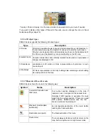
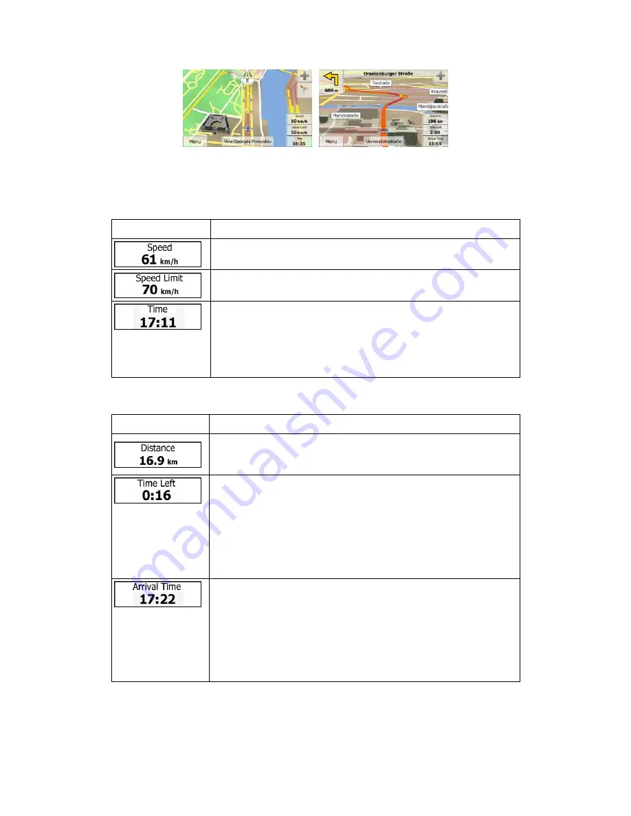
Tap  any  of  the  data  fields  to  suppress  others  and  display  only  the  selected  one.  The  data 
fields are different when you are navigating an active route and when you have no specified 
destination (the orange line is not displayed). 
Default  data  fields  when  cruising  without  a  destination  (tap  and  hold  any  of  the  fields  to 
change its value): 

Field 

Description 

Shows your current speed given by the GPS receiver. 

Shows the speed limit of the current road if the map contains it. 


Shows the current time corrected with time zone offset. The accurate 
time  comes  from  the  GPS  satellites,  and  the  time  zone  information 
comes from the map or it can be set manually in Regional settings. 
(The  current  time  is  always  displayed  in  the  top  left  corner  of  menu 
screens.) 

  
Default data fields when navigating a route (tap and hold any of the fields to change its value): 

Field 

Description 


Shows the distance you need to travel on the route before reaching 
your final destination. 


Shows  the  time  needed  to  reach  the  final  destination  of  the  route
based  on  information  available  for  the  remaining  segments  of  the 
route. 
If  ZENEC 

device

  is  capable  of  receiving  live  traffic  information,  the 

calculation takes into account traffic delays affecting your route if they 
are received. However, this calculation is rarely accurate. 
Historical traffic data can also be taken into account if data is available.


Shows  the  estimated  arrival  time  at  the  final  destination  of  the  route
based  on  information  available  for  the  remaining  segments  of  the 
route. 
If  ZENEC 

device

  is  capable  of  receiving  live  traffic  information,  the 

calculation takes into account traffic delays affecting your route if they 
are received. However, this calculation is rarely accurate. 
Historical traffic data can also be taken into account if data is available.

Содержание ZENEC GPS NAVIGATION SYSTEM

Страница 1: ...GPS NAVIGATION SYSTEM MAIN USER MANUAL ENGLISH...

Страница 2: ...using your ZENEC device right away This document is the detailed description of the navigation software You can easily discover ZENEC navigation while you are using it however we still recommend that...

Страница 3: ...ng the details of the current position Where Am I 22 3 On road navigation 24 3 1 Selecting the destination of a route 24 3 1 1 Entering an address or a part of the address 24 3 1 1 1 Entering an addre...

Страница 4: ...ute 53 3 4 7 Changing the vehicle used in route planning 54 3 4 8 Changing the road types used in route planning 55 3 5 Saving a location as a Favourite destination 56 3 6 Saving a location as an aler...

Страница 5: ...5 5 3 7 Display settings 75 5 3 8 Regional settings 75 6 Glossary 76 7 Copyright note 78...

Страница 6: ...important that you look at the display only when it is safe to do so If you are the driver of the vehicle we recommend that you operate ZENEC navigation before you start your journey Plan the route b...

Страница 7: ...ment Tap to continue 3 The Configuration wizard starts Tap to continue 4 Select the language and speaker used for voice guidance messages Later you can change it in Sound and Warnings settings page 75...

Страница 8: ...he navigation software works to simulate demo routes or to run some additional applications x Tap to start navigating on the map The button itself is a miniature live map that shows your current posit...

Страница 9: ...bit or till the end Alternatively move between pages with the and buttons and tap the value that you want Radio button When there are only a few choices radio buttons may be used instead of lists Onl...

Страница 10: ...the new keyboard layout from the list Correcting your entry on the keyboard Tap to remove the unneeded character s Tap and hold the button to delete several characters or the entire input string Enter...

Страница 11: ...buttons on the Map screen you can rotate tilt or scale the map continuously x Tap and hold on keyboard screens you can delete several characters quickly x Tap and hold or in long lists you can scroll...

Страница 12: ...e is no GPS position the Vehimarker is transparent It shows your last known position You see coloured dots circling around a satellite symbol in the top left corner The more green dots you see the clo...

Страница 13: ...ap and hold any of the fields to change its value Field Description Shows the distance you need to travel on the route before reaching your final destination Shows the time needed to reach the final d...

Страница 14: ...ge 1 When a map location is selected the Cursor appears at the selected point on the map The Cursor is displayed with a radiating red dot to make it visible at all zoom levels The location of the Curs...

Страница 15: ...y the next manoeuvre is displayed Most of these icons are very intuitive The following table lists some of the frequently shown route events The same symbols are used in both fields Icon Description T...

Страница 16: ...nded route When navigating a route only the signpost that points to the lane s to be taken is displayed in vivid colours all others are darker If you want to hide the currently displayed signposts tap...

Страница 17: ...3D landmarks Landmarks are 3D artistic or block representations of prominent or well known objects 3D buildings 3D block representation of full city building data containing actual building size and p...

Страница 18: ...ate colour and small symbols displayed along the route show the type of the traffic event 2 3 3 8 Traffic events Road segments affected by traffic events are displayed with an alternate colour on the...

Страница 19: ...ever upside down and you only see the streets and objects that you need Map scaling has a limit in 3D map view mode If you zoom out further the map switches to 2D view mode Tap the button once to modi...

Страница 20: ...the Cursor as a new destination The route is automatically calculated 2 3 5 Quick menu The Quick menu is a selection of controls and functions that are frequently needed during navigation It can be o...

Страница 21: ...earch for nearby emergency or roadside assistance For details see the next chapter Tap the Current Street field on the Map screen This button cancels the route and stops navigation The button is repla...

Страница 22: ...reen and starts simulating the active route My Route More Simulate Navigation page 1 This button opens the GPS Information screen with satellite position and signal strength information Tap the top of...

Страница 23: ...dated x Address details when available of the current position are also displayed at the bottom You can also perform some actions on this screen Tap to save the current position as a Favourite destina...

Страница 24: ...e destination of a route ZENEC device offers you several ways of choosing your destination x Enter a full address or a part of an address for example a street name without a house number or the names...

Страница 25: ...try from the list of results 4 If needed select a new city town a Tap b Start entering the name of the city town on the keyboard c Find the city town you need x The most likely city town name is alway...

Страница 26: ...er letters tap c Tap to finish entering the address If the entered house number cannot be found the midpoint of the street is selected as the destination 7 A full screen map appears with the selected...

Страница 27: ...ber is not available 1 If you are on the Map screen tap to return to the Navigation menu 2 In the Navigation menu tap the following buttons 3 If necessary modify the country and city town as described...

Страница 28: ...howing the entire route The route is automatically calculated Tap to modify route parameters or tap and start your journey 3 1 1 3 Selecting an intersection as the destination To enter an address as t...

Страница 29: ...name of the intersecting street on the keyboard As soon as the street names that match the entered string can be shown on one screen their list appears automatically Select from the list 6 A full scre...

Страница 30: ...name of the city town on the keyboard c Find the city town you need x The most likely city town name is always shown in the input field To accept it tap x If the desired name does not show up the name...

Страница 31: ...mple with a full address 1 If you are on the Map screen tap to return to the Navigation menu 2 In the Navigation menu tap the following buttons 3 If necessary modify the country as described earlier p...

Страница 32: ...he house number on the keyboard To enter letters tap c Tap to finish entering the address If the entered house number cannot be found the midpoint of the street is selected as the destination 7 A full...

Страница 33: ...word appears in several names for example in the name of streets roads and avenues you can obtain the result faster if you enter the first letter of the street type For example enter PI A to obtain P...

Страница 34: ...name of the Place 3 After entering a few letters tap to open the list of Places with names containing the entered character sequence 4 optional The Places in the list are ordered by the length of the...

Страница 35: ...most frequently selected types of Places 1 If you are on the Map screen tap to return to the Navigation menu 2 In the Navigation menu tap the following buttons 3 The preset search categories appear x...

Страница 36: ...Tap any of the quick search buttons to get an instant list of Places 5 optional The Places in the list are ordered by their distance from the current or last known position from the destination or by...

Страница 37: ...ance from this position x Tap to search for a place within a selected city town The result list will be ordered by the distance from the centre of the selected city town x Tap to search for a place ar...

Страница 38: ...or along the route 8 Sometimes the list of brands in the selected Place subcategory appears Select one brand or tap to list all Places in the selected subcategory around the selected location or along...

Страница 39: ...o modify route parameters or tap and start your journey 3 1 2 4 Searching for a Place of Interest by name You can search for Places of Interest by their names You can search around different locations...

Страница 40: ...that results in a minimal detour only such as searching for upcoming petrol stations or restaurants The result list will be ordered by the length of the necessary detour 5 optional If you have selecte...

Страница 41: ...Browse the list if necessary and tap one of the list items A full screen map appears with the selected point in the middle The name and address of the Place is displayed at the top of the screen 13 o...

Страница 42: ...nu 2 Tap and then 3 Preset search categories appear all for searching around the current position or around the last known position if the current position is not available x Car repair and roadside a...

Страница 43: ...to the map 8 If necessary tap the map somewhere else to modify the destination The Cursor appears at the new location Tap to confirm the destination or tap to select a different destination 9 After a...

Страница 44: ...s is described on page 56 1 Access the list of Favourites x If you are on the Map screen tap and then tap x If you are in the Navigation menu tap and then tap 2 The list of Favourite destinations is d...

Страница 45: ...f day the day of week and the current location The more you use the navigation software the better it can guess your desired destination 1 If you are on the Map screen tap to return to the Navigation...

Страница 46: ...s The rest of the destinations are ordered by time they were last selected If necessary scroll the list to see earlier destinations 3 Select a destination from the list 4 A full screen map appears wit...

Страница 47: ...ngitude values in any of the following formats decimal degrees degrees and decimal minutes or degrees minutes and decimal seconds 5 optional If necessary tap then and enter the coordinate in UTM forma...

Страница 48: ...u can also build your route destination by destination from the My Route menu 1 If you are on the Map screen tap to return to the Navigation menu 2 In the Navigation menu tap 3 Tap 4 There is only one...

Страница 49: ...urn to the Navigation menu 2 In the Navigation menu tap 3 Tap The active route is displayed in its full length on the map together with additional information and controls 3 3 Checking route parameter...

Страница 50: ...e route The following sections show some of those options 3 4 1 Selecting a new destination when already having a route New Route Waypoint or Final Destination If you already have a recommended route...

Страница 51: ...it the route by modifying the list of destinations 1 If you are on the Map screen tap to return to the Navigation menu 2 In the Navigation menu tap 3 Tap 4 You have the following options x Tap to add...

Страница 52: ...ve route is deleted with all its waypoints 3 4 5 Checking route alternatives when planning the route You can select from different route alternatives or change the route planning method after you have...

Страница 53: ...ves for an existing route To recalculate the active route with a different route planning method you can modify the Route settings page 70 There is another way to do this and to compare different rout...

Страница 54: ...onds to return to the Map screen ZENEC device recalculates the route The orange line now shows the new recommended route 3 4 7 Changing the vehicle used in route planning To recalculate the active rou...

Страница 55: ...her vehicle x Charge roads are pay roads where you can purchase a pass or vignette to use the road for a longer period of time They can be enabled or disabled separately from toll roads x ZENEC device...

Страница 56: ...a coordinate or a location where a photo was taken 2 When the full screen map appears with the selected location in the middle tap 3 Tap 4 optional Using the keyboard you can change the name offered f...

Страница 57: ...can edit a previously saved or uploaded alert point for example a speed camera or a railway crossing 1 Browse the map and select the alert point to edit The red circle appears around the alert point...

Страница 58: ...nation is the same as described at on road navigation The only difference is that route points are linked to form a route with straight lines regardless of the road network and traffic regulations 4 2...

Страница 59: ...ens x Daytime colours are similar to paper road maps and the menus are bright x The night colour themes use dark colours for large objects to keep the average brightness of the screen low ZENEC device...

Страница 60: ...ickest or shortest route For some of the vehicle types you can also check the fuel consumption and CO2 emission when planning a route and you can create cost effective routes with less effect on the e...

Страница 61: ...reas like school zones or railroad crossings You can set up the different alert types individually in Sound and Warning settings page 67 The following alert types are available x Audio warning beeps o...

Страница 62: ...limit sign on the map all the time 5 1 7 Battery and GPS position quality indicators You can find useful information in the top corners of menu screens In the top right corner the GPS reception quali...

Страница 63: ...data is broadcast at your location ZENEC device automatically takes into account the traffic events received You do not need to set anything in the program The receiver will automatically search the F...

Страница 64: ...ore menu or it can also be switched off in Traffic Settings When automatic tuning is turned off you can use the left and right arrows on the Traffic Summary screen for manual tuning The arrows are loc...

Страница 65: ...of the consumption of your car even if you do not use navigation for all your journeys Set the initial odometer value and then record the distance taken and fuel filled in whenever you fill your car...

Страница 66: ...lculated Select the type of vehicle you are driving the road types used in route planning and the route planning method You can fine tune the appearance of the Map screen Adjust the map view to your n...

Страница 67: ...the information about the country you have just entered x All system messages can also be announced Tap this button to set the verbosity of the voice instructions how much they tell and how often the...

Страница 68: ...the community database x Give Feedback you can give feedback about an alert point to the community You can set the different alert point categories individually The following alert types are available...

Страница 69: ...e in to receive them If you would like to determine which station to use turn off automatic tuning and use the left and right arrows on the Traffic Summary screen for manual tuning If automatic tuning...

Страница 70: ...ypes are to be considered for or to be excluded from the route if possible Excluding a road type is a preference It does not necessarily mean total prohibition If your destination can only be accessed...

Страница 71: ...Description Tap this button to rename the profile for something meaningful Enter the average consumption of your vehicle when used in built up areas The unit for consumption can be set in Regional Set...

Страница 72: ...eed limit on all roads Usually the best selection for fast and normal cars Gives a short route to minimise the distance to travel It can be practical for slow vehicles Searching for a short route rega...

Страница 73: ...en daytime and night colour modes or let the software switch between the two modes automatically a few minutes before sunrise and a few minutes after sunset Select the colour scheme used in daytime mo...

Страница 74: ...ent speed or the altitude or route data related to your final destination or the next waypoint on your route You may need a petrol station or a restaurant during your journey This feature displays a n...

Страница 75: ...ocal language measurement units time and date settings and formats as well as to choose the time zone Button Description You can set the distance units to be used by the program ZENEC device may not s...

Страница 76: ...re custom graphic settings and they can have different colours for streets blocks or surface waters in 2D and 3D modes and they display shades or shadows in different ways in 3D mode One daytime schem...

Страница 77: ...y crossings are also available Route A sequence of route events i e manoeuvres for example turns and roundabouts to reach the destination The route contains one start point and one or more destination...

Страница 78: ...without the express written consent of ZENEC 2012 ZENEC Data Source 2006 2010 Tele Atlas All rights reserved This material is proprietary and the subject of copyright protection database right protec...

Страница 79: ...ZENEC by ACR AG Bohrturmweg 1 Bad Zurzach Switzerland www zenec com Rev B...

Отзывы: