88
Using the GPS Function
Positioning Using GPS
About GPS positioning
Positioning refers to the calculation of one’s own position from the satellites orbit information and the
transmission time of the radio waves. Positioning requires that three or more satellites be acquired.
When positioning cannot be carried out properly, move to an open space as far away from buildings
as possible and where there are fewer obstructions.
●About the error
Depending on the surrounding environment of the receiver location, an error of several hundred
meters may occur. Although positioning is possible using only three satellites, depending on the
positioning conditions, the positioning accuracy may become worse, or may no longer be possible
under the following conditions:
• Between high rise buildings, narrow roads between buildings, indoors and under the shade of
buildings, below high voltage lines and underneath overhead structures, between trees and shrubs
such as in forests and woods, inside tunnels and underground, when used behind a solar-energy
reflecting glass, locations where a strong magnetic field occurs
●When not using the radio for a long period of time
When using the GPS function for the first time after purchasing the FTM-400XDR/DE transceiver,
and when turning it on after It has not been used for a long period time, positioning may take several
minutes in order to search for the satellites. Also, when using the device again several hours after
switching off the power, positioning may take several minutes in order to search for the satellites.
Positioning using an external GPS device
Commercial GPS receive devices can also be connected to the [EXT GPS] jack on the
side of the controller.
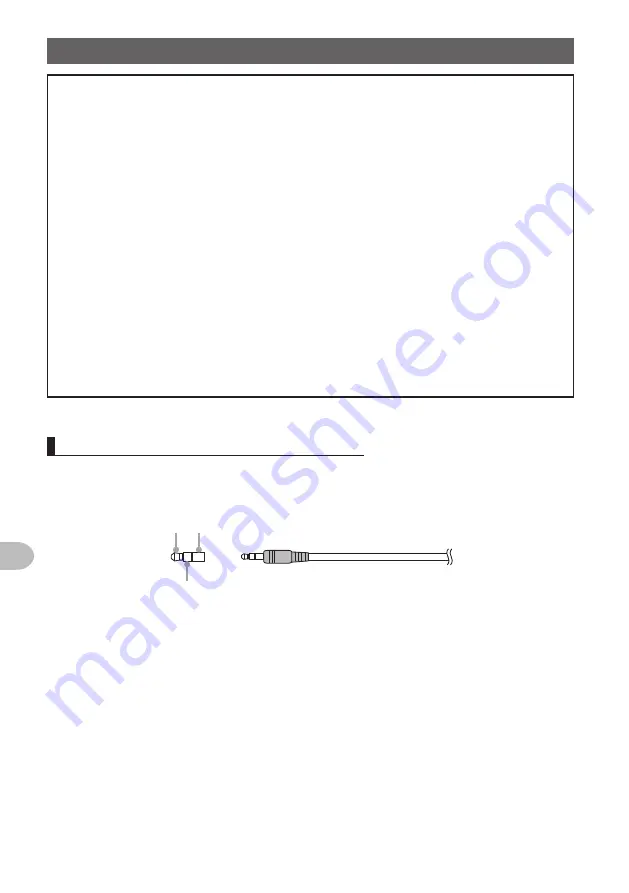
The [EXT GPS] plug connector is illustrated below.
➀ ➂
➁
➀
TXD (serial data output [transceiver → external device])
➁
RXD (serial data input [transceiver ← external device])
➂
GND
Содержание FTM-400XDR/DE
Страница 218: ...218 Appendix Note...


