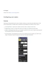
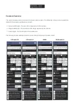
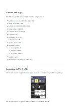
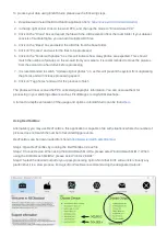


Set focus to Automatic Continuous (AF-C)
Set AF on Shutter to OFF
Set camera to single shooting mode
Set Auto Review to OFF
Set Focus Area to Wide
Set Quality to Extra fine(for JPEG only)
Set mode dial to Shutter Priority
Set DRO to OFF
Set Steady shot to OFF
Set Release w/o Lens to Enable
Set Release w/o Card to Disable
Set Airplane mode to ON
Set Pwr Save Start Time to 30min
Set White balance to Auto
Set shutter time to 1/1000 – 1/3200
Set ISO to auto
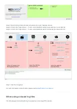
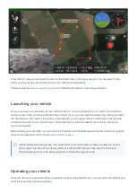
Geo-referencing
If your DeltaQuad is equipped with a mapping payload you will need to post-process the images to add the
geographic coordinates. This is called geo-referencing (or geotagging). Some camera systems have a built-
in GPS solution, these include the Micasense, Flir, and Workswell sensors. Other systems such as the Sony
or Agrowing cameras require post-processing for geo-referencing.
Post-processing can be performed on 2 methods:
1. Using the onboard flight logs. For this step please skip to the section "When using onboard log files".
This provides an easy, but relatively low accuracy method of georeferencing pictures.
2. If your DeltaQuad was equipped with an Emlid Reach PPK/RTK solution you can georeference using
the Emlid Reach method. This provides highly accurate georeferencing of your images.
Once your images have been geo-referenced, you can import them into stitching software to reconstruct a
2D and/or 3D model of the surveyed area. Examples of stitching software are Pix4D and Agisoft.
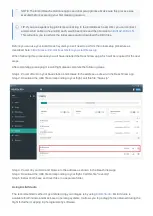
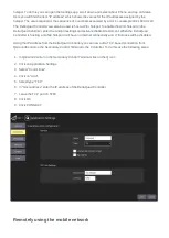
When using the Emlid Reach system


