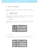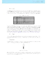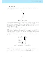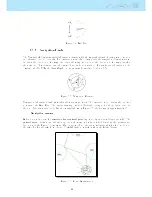
Table 3.4 continued from previous page
Field ID
Description
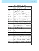
Dist.CTR
Distance to controlled airspace. When more than one airspace
area is in range the closest will be shown. When inside an airspace
area the distance shown is to the closest edge.
Dist.Cone
Horizontal distance from the pilot position to the cone.
Dist.ConeA
Horizontal distance from the pilot to the cone arrival point.
Dist.Edge
Distance to Edge. Shortest distance to the optimal point of the
next waypoint using route optimisation.
Dist.Goal
Distance to goal is the total distance from the current position to
the goal. The distance is calculated considering that the optimal
route is made through all pending turnpoints.
Dist.Line
Distance to Line. Shortest distance to the waypoint line circle.
Distance line corresponds to the Distance Next minus the way-
point radius.
Dist.Next
Distance to Next. Shortest distance to the waypoint center. Dis-
tance next corresponds to the Distance Line plus the waypoint
radius.
Dist.Start
Distance to start. Shortest distance to the start cylinder.
Dist.Thermal
Shortest distance to last thermal core (thermal dot).
Dist.To
Distance to take o is the distance between the current point and
the ight starting point.
Dur.
Flight Duration. Duration of the current ight.
Flight Level
Current altitude in hundreds of feet, based on a xed QNH of
1013.25hPa.
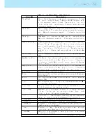
Floor
Shows the lower altitude of the airspace causing the warning, i.e.
airspace that you are violating or close to violating.
Fuel
Fuel level in liters (available when connected with Flymaster M1).
G-Force
Current G-Force being experienced by the pilot when using the
Heart-G sensor.
Goal Close
Remaining time to goal close.
GPS Alti
Altitude reported by the GPS.
G.R.Goal
Glide ratio to goal. Necessary glide ratio to reach the Goal consid-
ering that the optimal route trough remainng waypoints is made.
G.R.M.G.
Glide ratio made good. The actual glide ratio towards the active
turn point. It is calculated using the integrated vario, and the
VMG.
G.R.Next
Glide Ratio to Next. Necessary glide ratio to reach the next turn
point.
G.R.To
Glide ratio to takeo. Necessary glide ratio to reach the take o.
Heading
Heading in degrees returned by GPS.
Int.Temperature
Temperature inside the instrument.
Land In
During competition tasks it is common, usually due to safety rea-
sons, to have a land by time. The land by time is dened by
adding a waypoint typically the goal to the already dened task,
setting it as Landing and dening the time. Land in shows the
amount of time remaining before having to be on the ground.
Latitude
Current position latitude according to the format dened in the
settings menu.
Longitude
Current position longitude according to the format dened in the
settings menu.
Max.Alti
Maximum altitude reached during current ight. This is based on
barometric altitude.
Continued on next page
18
Содержание Flymaster NAV SD
Страница 1: ...User manual Version 3 0...
Страница 54: ...Figure 4 42 GPS Reset 53...
Страница 66: ...Figure 9 2 Firmware Update Done 65...

